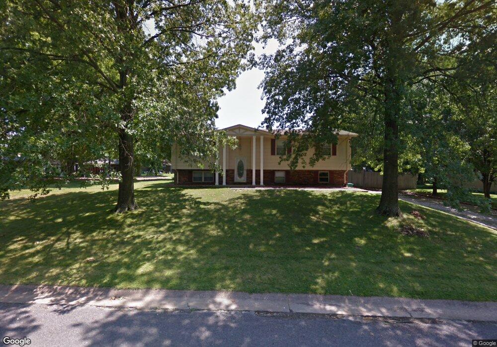
217 Weinel Dr Smithton, IL 62285
Estimated Value: $173,000 - $264,000
3
Beds
2
Baths
1,248
Sq Ft
$184/Sq Ft
Est. Value
About This Home
This home is located at 217 Weinel Dr, Smithton, IL 62285 and is currently estimated at $229,240, approximately $183 per square foot. 217 Weinel Dr is a home located in St. Clair County with nearby schools including Smithton Elementary, Freeburg Community High School, and St John the Baptist Catholic School.
Ownership History
Date
Name
Owned For
Owner Type
Purchase Details
Closed on
Aug 5, 2011
Sold by
Mitchell William
Bought by
Mcpherson Keith A and Mcpherson Emily H
Current Estimated Value
Home Financials for this Owner
Home Financials are based on the most recent Mortgage that was taken out on this home.
Original Mortgage
$122,580
Outstanding Balance
$84,714
Interest Rate
4.53%
Mortgage Type
VA
Estimated Equity
$144,526
Create a Home Valuation Report for This Property
The Home Valuation Report is an in-depth analysis detailing your home's value as well as a comparison with similar homes in the area
Home Values in the Area
Average Home Value in this Area
Purchase History
| Date | Buyer | Sale Price | Title Company |
|---|---|---|---|
| Mcpherson Keith A | $120,000 | Fatic |
Source: Public Records
Mortgage History
| Date | Status | Borrower | Loan Amount |
|---|---|---|---|
| Open | Mcpherson Keith A | $122,580 |
Source: Public Records
Tax History
| Year | Tax Paid | Tax Assessment Tax Assessment Total Assessment is a certain percentage of the fair market value that is determined by local assessors to be the total taxable value of land and additions on the property. | Land | Improvement |
|---|---|---|---|---|
| 2024 | $5,234 | $63,568 | $6,262 | $57,306 |
| 2023 | $4,991 | $59,083 | $5,820 | $53,263 |
| 2022 | $4,707 | $54,224 | $5,341 | $48,883 |
| 2021 | $4,525 | $51,058 | $5,029 | $46,029 |
| 2020 | $4,383 | $47,301 | $4,853 | $42,448 |
| 2019 | $4,239 | $47,301 | $4,853 | $42,448 |
| 2018 | $4,058 | $45,644 | $4,683 | $40,961 |
| 2017 | $4,013 | $43,529 | $4,466 | $39,063 |
| 2016 | $4,073 | $43,516 | $7,676 | $35,840 |
| 2014 | $3,598 | $42,823 | $7,554 | $35,269 |
| 2013 | $3,336 | $43,755 | $7,718 | $36,037 |
Source: Public Records
Map
Nearby Homes
- 14 N High St
- 753 Fieldview Dr
- 227 Suburban Place
- 4507 Elk Meadows Ln
- 4805 Lone Rock Ln
- 4525 Boardwalk
- 3402 Arbor View Ct
- 5248 Cherry Oak Ln
- 0 Unknown Unit 22065045
- 4200 Laurel Oak Ln
- 4057 Bur Oak Dr
- 4132 Summer Oak Dr
- 4122 Knab Rd
- 4017 Autumn Oak Dr
- 4016 Autumn Oak Dr
- 4112 Summer Oak Dr
- 222 Alamosa Dr
- 416 Telluride Dr
- 359 Sleeping Indian Dr
- 363 Sleeping Indian Dr
Your Personal Tour Guide
Ask me questions while you tour the home.