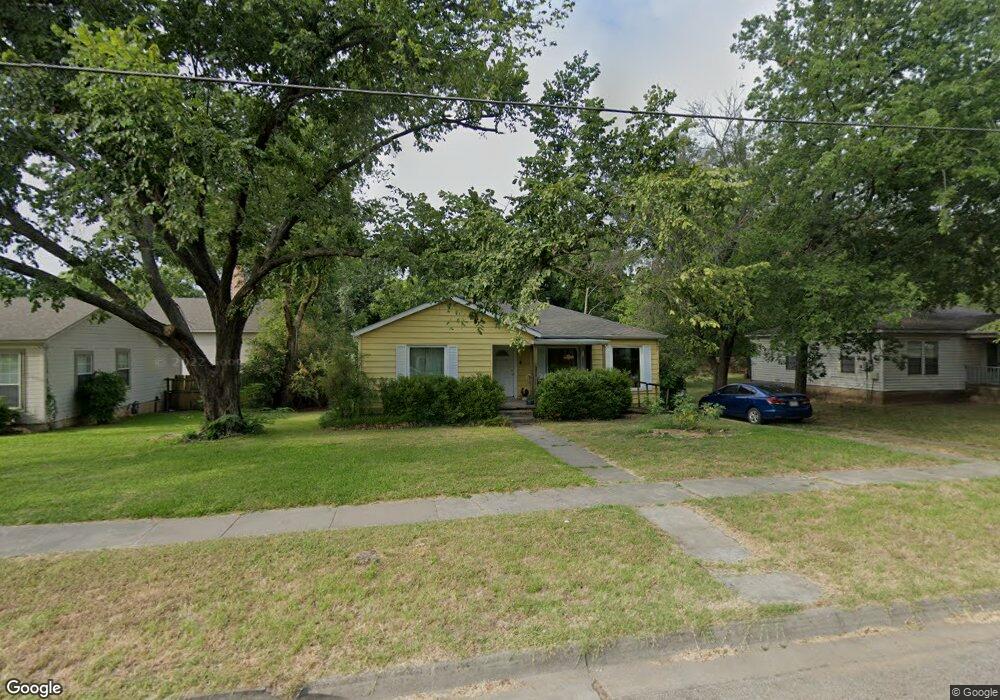
218 Forest St Denton, TX 76209
Downtown Denton NeighborhoodEstimated Value: $209,000 - $298,000
Studio
1
Bath
1,107
Sq Ft
$228/Sq Ft
Est. Value
About This Home
This home is located at 218 Forest St, Denton, TX 76209 and is currently estimated at $252,891, approximately $228 per square foot. 218 Forest St is a home located in Denton County with nearby schools including Evers Park Elementary School, Calhoun Middle School, and Denton High School.
Ownership History
Date
Name
Owned For
Owner Type
Purchase Details
Closed on
Jun 1, 2019
Sold by
Newton Glen and Newton Lynda Kay
Bought by
Newton Amanda Leann and Schafidi Crump Justin
Current Estimated Value
Purchase Details
Closed on
May 10, 2006
Sold by
Newton Amanda Leann
Bought by
Newton Glen and Newton Lynda
Purchase Details
Closed on
May 4, 2005
Sold by
Stuckey Adonna Sheryce and Wright Sherlene A
Bought by
Newton Amanda Leann
Home Financials for this Owner
Home Financials are based on the most recent Mortgage that was taken out on this home.
Original Mortgage
$90,000
Interest Rate
5.92%
Mortgage Type
Purchase Money Mortgage
Create a Home Valuation Report for This Property
The Home Valuation Report is an in-depth analysis detailing your home's value as well as a comparison with similar homes in the area
Home Values in the Area
Average Home Value in this Area
Purchase History
| Date | Buyer | Sale Price | Title Company |
|---|---|---|---|
| Newton Amanda Leann | $90,000 | None Available | |
| Newton Glen | -- | None Available | |
| Newton Amanda Leann | -- | Ctic |
Source: Public Records
Mortgage History
| Date | Status | Borrower | Loan Amount |
|---|---|---|---|
| Previous Owner | Newton Amanda Leann | $90,000 |
Source: Public Records
Tax History
| Year | Tax Paid | Tax Assessment Tax Assessment Total Assessment is a certain percentage of the fair market value that is determined by local assessors to be the total taxable value of land and additions on the property. | Land | Improvement |
|---|---|---|---|---|
| 2025 | $2,844 | $222,265 | $81,508 | $140,757 |
| 2024 | $4,040 | $209,298 | $0 | $0 |
| 2023 | $2,436 | $190,271 | $81,508 | $151,938 |
| 2022 | $3,672 | $172,974 | $81,508 | $103,651 |
| 2021 | $3,496 | $157,500 | $58,220 | $99,280 |
| 2020 | $3,268 | $142,954 | $40,754 | $102,200 |
| 2019 | $3,454 | $144,738 | $40,754 | $103,984 |
| 2018 | $3,253 | $134,658 | $40,754 | $93,904 |
| 2017 | $3,060 | $123,814 | $29,110 | $94,704 |
| 2016 | $2,733 | $110,573 | $29,110 | $81,463 |
| 2015 | $2,564 | $104,571 | $29,110 | $75,461 |
| 2014 | $2,564 | $102,490 | $40,689 | $61,801 |
| 2013 | -- | $100,368 | $40,689 | $59,679 |
Source: Public Records
Map
Nearby Homes
- 211 E Sherman Dr
- 2010 N Locust St
- 2012 N Locust St
- 110 Peach St
- 2207 N Elm St
- 2107 Preston Place
- 2621 N Locust St
- 2411 Denison St
- 2712 N Bell Ave
- 2821 N Bell Ave
- 1309 N Austin St
- 425 Oakhill Dr
- 1401 Bolivar St
- 314 Northridge St
- 1111 N Austin St
- 3008 N Bell Ave Unit 30
- 3016 N Bell Ave Unit 30
- 2210 Robinwood Ln
- 3024 N Bell Ave Unit 30
- 613 Cordell St
- 214 Forest St
- 222 Forest St
- 210 Forest St
- 219 E Sherman Dr
- 2203 Palmer Dr
- 2202 Fowler Dr
- 206 Forest St
- 215 E Sherman Dr
- 2207 Palmer Dr
- 2206 Fowler Dr
- 419 E Sherman Dr
- 400 E Sherman Dr
- 320 E Sherman Dr
- 202 Forest St
- 2200 Palmer Dr
- 420 E Sherman Dr
- 2211 Palmer Dr
- 2210 Fowler Dr
- 2204 Palmer Dr
- 205 E Sherman Dr
Your Personal Tour Guide
Ask me questions while you tour the home.