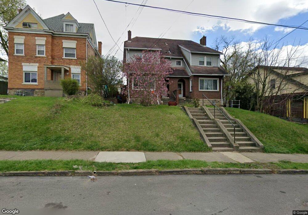
219 Grant Ave Bellevue, PA 15202
Estimated Value: $221,000 - $281,000
3
Beds
1
Bath
3,016
Sq Ft
$82/Sq Ft
Est. Value
About This Home
This home is located at 219 Grant Ave, Bellevue, PA 15202 and is currently estimated at $247,769, approximately $82 per square foot. 219 Grant Ave is a home located in Allegheny County with nearby schools including Northgate Middle School/High School, Northside Catholic School, and Abundant Life Academy.
Ownership History
Date
Name
Owned For
Owner Type
Purchase Details
Closed on
Apr 20, 2009
Sold by
Cipresse Jarrod
Bought by
Largent Gary
Current Estimated Value
Home Financials for this Owner
Home Financials are based on the most recent Mortgage that was taken out on this home.
Original Mortgage
$83,200
Outstanding Balance
$52,369
Interest Rate
4.86%
Mortgage Type
New Conventional
Estimated Equity
$195,400
Purchase Details
Closed on
Nov 12, 1998
Sold by
Dugan Frances L
Bought by
Schaffold Charles Paul and Schaffold Denise Marie
Purchase Details
Closed on
Jan 1, 1900
Create a Home Valuation Report for This Property
The Home Valuation Report is an in-depth analysis detailing your home's value as well as a comparison with similar homes in the area
Home Values in the Area
Average Home Value in this Area
Purchase History
| Date | Buyer | Sale Price | Title Company |
|---|---|---|---|
| Largent Gary | $104,000 | -- | |
| Schaffold Charles Paul | $80,000 | -- | |
| -- | -- | -- |
Source: Public Records
Mortgage History
| Date | Status | Borrower | Loan Amount |
|---|---|---|---|
| Open | Largent Gary | $83,200 |
Source: Public Records
Tax History
| Year | Tax Paid | Tax Assessment Tax Assessment Total Assessment is a certain percentage of the fair market value that is determined by local assessors to be the total taxable value of land and additions on the property. | Land | Improvement |
|---|---|---|---|---|
| 2025 | $4,461 | $115,900 | $23,100 | $92,800 |
| 2024 | $4,461 | $115,900 | $23,100 | $92,800 |
| 2023 | $4,281 | $115,900 | $23,100 | $92,800 |
| 2022 | $4,165 | $115,900 | $23,100 | $92,800 |
| 2021 | $4,165 | $115,900 | $23,100 | $92,800 |
| 2020 | $4,070 | $115,900 | $23,100 | $92,800 |
| 2019 | $3,988 | $115,900 | $23,100 | $92,800 |
| 2017 | $3,988 | $115,900 | $23,100 | $92,800 |
Source: Public Records
Map
Nearby Homes
- 138 Kendall Ave
- 109 S Harrison Ave
- 73 S Fremont Ave
- 29 S Bryant Ave
- 499 Roosevelt Ave
- 301 Lincoln Ave
- 10 N Bryant Ave
- 17-19 N Bryant Ave
- 30 Ohio St
- 4022 Oswald St
- 471 Lincoln Ave
- 69 Orchard St
- 206 Brighton Rd
- 78 N Bryant Ave
- 3718 Millerton Ave
- 634 Madison Ave
- 116 Orchard St
- 1905 Termon Ave
- 513 John St
- 1813 Termon Ave
- 215 Grant Ave
- 225 Grant Ave
- 213 Grant Ave
- 231 Grant Ave
- 118 Cedar Ave
- 235 Grant Ave
- 235 Grant Avenue Extension
- 222 Grant Ave
- 114 Cedar Ave
- 218 Grant Ave
- 170 Kendall Ave
- 237 Grant Ave
- 214 Grant Ave
- 166 Kendall Ave
- 226 Grant Ave
- 203 Grant Ave
- 162 Kendall Ave
- 230 Grant Ave
- 210 Grant Ave
- 176 Kendall Ave
Your Personal Tour Guide
Ask me questions while you tour the home.