Estimated Value: $235,000 - $255,216
4
Beds
1
Bath
3,760
Sq Ft
$65/Sq Ft
Est. Value
About This Home
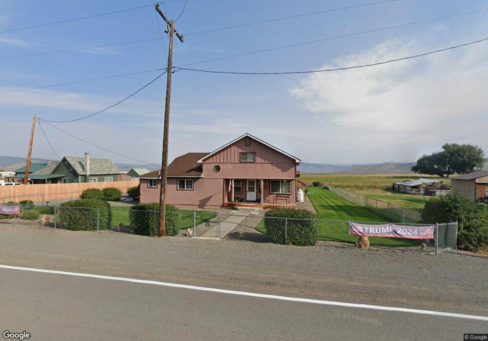
This home is located at 219 Main St, Unity, OR 97884 and is currently estimated at $245,108, approximately $65 per square foot. 219 Main St is a home with nearby schools including Burnt River School.
Create a Home Valuation Report for This Property
The Home Valuation Report is an in-depth analysis detailing your home's value as well as a comparison with similar homes in the area
Tax History
| Year | Tax Paid | Tax Assessment Tax Assessment Total Assessment is a certain percentage of the fair market value that is determined by local assessors to be the total taxable value of land and additions on the property. | Land | Improvement |
|---|---|---|---|---|
| 2025 | $747 | $96,501 | $22,267 | $74,234 |
| 2024 | $725 | $93,691 | $12,511 | $81,180 |
| 2023 | $707 | $90,963 | $8,992 | $81,971 |
| 2022 | $687 | $88,314 | $9,554 | $78,760 |
| 2021 | $655 | $85,742 | $9,275 | $76,467 |
| 2020 | $622 | $83,245 | $9,005 | $74,240 |
| 2019 | $622 | $80,821 | $8,743 | $72,078 |
Source: Public Records
Map
Nearby Homes
- 0 1680 Nfs Rd
- 31841 Rice Rd
- TBD Rattlesnake Ln
- 32290 Rice Rd
- 31849 Rice Rd
- 14556 Hereford Loop Rd
- 0 0 Nfs 1680 Rd Unit 24159006
- 6154 John Day Hwy
- 17925 Old Trestle Ln
- 38470 Elkhorn Estates Rd
- 39612 Sumpter Valley Hwy
- 78930 Middle Fork Ln
- 39151 Last Chance Ln
- 39798 Bear Gulch Rd
- 602 S Mill St
- 382 Ash St
- 379 Mill St
- 129 E Austin St
- 206 Austin St
- 455 E Auburn St
Your Personal Tour Guide
Ask me questions while you tour the home.