Estimated Value: $252,000 - $262,819
4
Beds
1
Bath
3,760
Sq Ft
$68/Sq Ft
Est. Value
About This Home
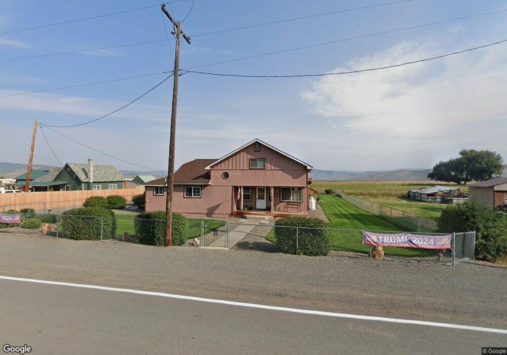
This home is located at 219 Main St, Unity, OR 97884 and is currently estimated at $257,410, approximately $68 per square foot. 219 Main St is a home with nearby schools including Burnt River School.
Create a Home Valuation Report for This Property
The Home Valuation Report is an in-depth analysis detailing your home's value as well as a comparison with similar homes in the area
Tax History
We collect this data history from publicly available records. To have your information removed, we recommend requesting removal directly through your county’s website.
| Year | Tax Paid | Tax Assessment Tax Assessment Total Assessment is a certain percentage of the fair market value that is determined by local assessors to be the total taxable value of land and additions on the property. | Land | Improvement |
|---|---|---|---|---|
| 2025 | $747 | $96,501 | $22,267 | $74,234 |
| 2024 | $725 | $93,691 | $12,511 | $81,180 |
| 2023 | $707 | $90,963 | $8,992 | $81,971 |
| 2022 | $687 | $88,314 | $9,554 | $78,760 |
| 2021 | $655 | $85,742 | $9,275 | $76,467 |
| 2020 | $622 | $83,245 | $9,005 | $74,240 |
| 2019 | $622 | $80,821 | $8,743 | $72,078 |
| 2018 | $604 | $78,467 | $9,151 | $69,316 |
| 2017 | $509 | $69,360 | $7,900 | $61,460 |
| 2016 | $563 | $73,520 | $8,400 | $65,120 |
| 2015 | $570 | $73,060 | $8,400 | $64,660 |
| 2014 | $613 | $76,182 | $8,885 | $67,297 |
| 2013 | -- | $73,964 | $8,626 | $65,338 |
Source: Public Records
Map
Nearby Homes
- 0 1680 Nfs Rd
- 31841 Rice Rd
- TBD Rattlesnake Ln
- 32290 Rice Rd
- 14556 Hereford Loop Rd
- Unnamed Rd
- 0 Skyline Rd Unit 553429590
- 37780 Hudspeth Rd
- 38470 Elkhorn Estates Rd
- 38987 Deer Creek Rd
- 78930 Middle Fork Ln
- 39151 Last Chance Ln
- 39612 Sumpter Valley Hwy
- 40327 Bear Gulch Rd
- 0 Bear Gulch Rd Unit 124050595
- 602 Mill St
- 379 Mill St
- 206 Austin St
- 0 Sumter Unit 4500
- 0 Ibex St Unit 296745102
Your Personal Tour Guide
Ask me questions while you tour the home.