2191 William T Cir Lancaster, OH 43130
Lancaster AreaEstimated Value: $299,589 - $356,000
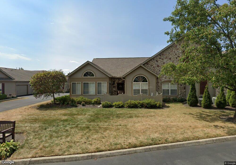
About This Home
This home is located at 2191 William T Cir, Lancaster, OH 43130 and is currently estimated at $321,147, approximately $206 per square foot. 2191 William T Cir is a home located in Fairfield County with nearby schools including Medill Elementary School, Thomas Ewing Junior High School, and Lancaster High School.
Ownership History
We collect this data history from publicly available records. To have your information removed, we recommend requesting removal directly through your county’s website.
Purchase Details
Purchase Details
Home Financials for this Owner
Home Financials are based on the most recent Mortgage that was taken out on this home.Home Values in the Area
Average Home Value in this Area
Purchase History
We collect this data history from publicly available records. To have your information removed, we recommend requesting removal directly through your county’s website.
| Date | Buyer | Sale Price | Title Company |
|---|---|---|---|
| $160,000 | Sas Title Ag Ltd | ||
| $171,900 | Hocking Valley Title Agency |
Mortgage History
We collect this data history from publicly available records. To have your information removed, we recommend requesting removal directly through your county’s website.
| Date | Status | Borrower | Loan Amount |
|---|---|---|---|
| Previous Owner | $70,000 |
Tax History
We collect this data history from publicly available records. To have your information removed, we recommend requesting removal directly through your county’s website.
| Year | Tax Paid | Tax Assessment Tax Assessment Total Assessment is a certain percentage of the fair market value that is determined by local assessors to be the total taxable value of land and additions on the property. | Land | Improvement |
|---|---|---|---|---|
| 2025 | $6,795 | $87,770 | $17,500 | $70,270 |
| 2024 | $6,795 | $75,580 | $11,760 | $63,820 |
| 2023 | $2,749 | $75,580 | $11,760 | $63,820 |
| 2022 | $2,760 | $75,580 | $11,760 | $63,820 |
| 2021 | $2,276 | $58,390 | $11,760 | $46,630 |
| 2020 | $2,181 | $58,390 | $11,760 | $46,630 |
| 2019 | $2,073 | $58,390 | $11,760 | $46,630 |
| 2018 | $1,959 | $50,020 | $11,760 | $38,260 |
| 2017 | $1,960 | $52,410 | $11,760 | $40,650 |
| 2016 | $1,909 | $52,410 | $11,760 | $40,650 |
| 2015 | $1,899 | $50,610 | $11,760 | $38,850 |
| 2014 | $1,809 | $50,610 | $11,760 | $38,850 |
| 2013 | $1,809 | $50,610 | $11,760 | $38,850 |
Map
- 2110 Lancaster Newark Rd NE
- 1882 Rosewood Dr NE
- 1030 Rhoda Ln NE
- 1499 Stringtown Rd NE
- 1080 Beechwood Dr NE
- 1129 Royal Ct NE
- 0 Stringtown Rd NW
- 1130 Longwood Dr NE
- 920 Towe Dr NE
- 1659 Rainbow Dr NE
- 1401 Beverly Hills Dr
- 0 Old Millersport Rd NE Unit Tract 11
- 0 Old Millersport Rd NE Unit Tract 10
- 0 Old Millersport Rd NE Unit 225010386
- 0 Old Millersport Rd NE Unit Tract 8
- 1751 Declaration Dr W
- 0 Tschopp Rd NE Unit Lot 17 225027320
- 0 Tschopp Rd NE Unit Lot 33 225027324
- 1540 N High St
- 0 Tiki Ln
- 2181 William T Cir
- 2183 William T Cir
- 2185 William T Cir
- 2187 William T Cir
- 2193 William T Cir
- 2197 William T Cir
- 2171 William T Cir
- 2182 William T Cir
- 2184 William T Cir
- 2175 William T Cir
- 2173 William T Cir
- 2108 William T Cir
- 2106 William T Cir
- 2177 William T Cir
- 2172 William T Cir
- 2088 William T Cir
- 2194 William T Cir
- 2186 William T Cir
- 2188 William T Cir
- 2174 William T Cir
Ask me questions while you tour the home.