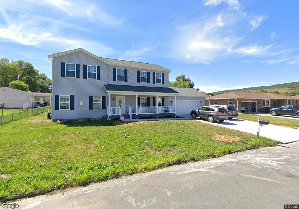
22 Barbara Ln Taylor, PA 18517
Estimated Value: $215,023 - $378,000
3
Beds
2
Baths
2,259
Sq Ft
$130/Sq Ft
Est. Value
About This Home
This home is located at 22 Barbara Ln, Taylor, PA 18517 and is currently estimated at $293,006, approximately $129 per square foot. 22 Barbara Ln is a home located in Lackawanna County with nearby schools including Riverside Junior/Senior High School, All Saints Academy, and Triboro Christian Academy.
Ownership History
Date
Name
Owned For
Owner Type
Purchase Details
Closed on
Sep 27, 2008
Sold by
Zang Otto J
Bought by
Walsh Ii Carl P and Walsh Lori A
Current Estimated Value
Home Financials for this Owner
Home Financials are based on the most recent Mortgage that was taken out on this home.
Original Mortgage
$110,000
Outstanding Balance
$71,523
Interest Rate
6.57%
Mortgage Type
New Conventional
Estimated Equity
$221,483
Create a Home Valuation Report for This Property
The Home Valuation Report is an in-depth analysis detailing your home's value as well as a comparison with similar homes in the area
Home Values in the Area
Average Home Value in this Area
Purchase History
| Date | Buyer | Sale Price | Title Company |
|---|---|---|---|
| Walsh Ii Carl P | $160,500 | Abstract Enterprises |
Source: Public Records
Mortgage History
| Date | Status | Borrower | Loan Amount |
|---|---|---|---|
| Open | Walsh Ii Carl P | $110,000 |
Source: Public Records
Tax History
| Year | Tax Paid | Tax Assessment Tax Assessment Total Assessment is a certain percentage of the fair market value that is determined by local assessors to be the total taxable value of land and additions on the property. | Land | Improvement |
|---|---|---|---|---|
| 2025 | $8,194 | $34,000 | $3,000 | $31,000 |
| 2024 | $7,308 | $34,000 | $3,000 | $31,000 |
| 2023 | $7,308 | $34,000 | $3,000 | $31,000 |
| 2022 | $645 | $3,000 | $3,000 | $0 |
| 2021 | $3,762 | $17,500 | $3,000 | $14,500 |
| 2020 | $3,688 | $17,500 | $3,000 | $14,500 |
| 2019 | $3,513 | $17,500 | $3,000 | $14,500 |
| 2018 | $3,451 | $17,500 | $3,000 | $14,500 |
| 2017 | $3,352 | $17,500 | $3,000 | $14,500 |
| 2016 | $1,839 | $17,500 | $3,000 | $14,500 |
| 2015 | -- | $17,500 | $3,000 | $14,500 |
| 2014 | -- | $17,500 | $3,000 | $14,500 |
Source: Public Records
Map
Nearby Homes
- 0 William St Unit GSBSC253642
- 107 Donny Dr
- 343 Haverford Dr
- 736 Oak St
- 531 Oak St
- 6 Bald Mountain Rd Unit C
- 30 Glinko St
- 0 Oak St Unit GSBSC255768
- 0 Way
- 0 Roanoke Ln Unit GSBSC254856
- 1335 Sloan St
- 1301 Sloan St
- 0 R Luzerne St
- LOT#16 Reynolds Ave
- Lot# 7 Reynolds Ave
- 1227 Rundle St
- 310 Dale Ave
- 224 Dale Ave
- 408 17th Ave Unit 410
- 405 17th Ave
Your Personal Tour Guide
Ask me questions while you tour the home.