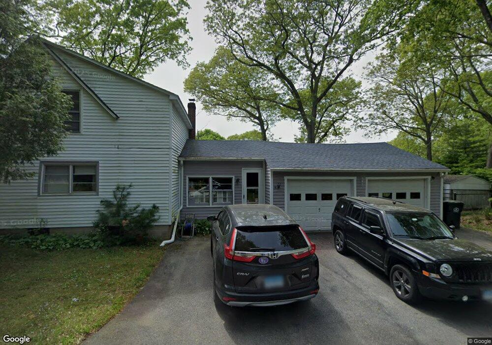
22 Bluff Rd Gales Ferry, CT 06335
Gales Ferry NeighborhoodEstimated Value: $335,049 - $481,000
2
Beds
2
Baths
1,536
Sq Ft
$257/Sq Ft
Est. Value
About This Home
This home is located at 22 Bluff Rd, Gales Ferry, CT 06335 and is currently estimated at $395,262, approximately $257 per square foot. 22 Bluff Rd is a home located in New London County with nearby schools including Ledyard Middle School, Ledyard High School, and Academy Of St Therese.
Ownership History
Date
Name
Owned For
Owner Type
Purchase Details
Closed on
Nov 2, 2001
Sold by
Wheeler Charles B and Wheeler Sandra
Bought by
Shontell Susan and Rumery Elizabeth
Current Estimated Value
Home Financials for this Owner
Home Financials are based on the most recent Mortgage that was taken out on this home.
Original Mortgage
$104,000
Interest Rate
6.82%
Create a Home Valuation Report for This Property
The Home Valuation Report is an in-depth analysis detailing your home's value as well as a comparison with similar homes in the area
Home Values in the Area
Average Home Value in this Area
Purchase History
| Date | Buyer | Sale Price | Title Company |
|---|---|---|---|
| Shontell Susan | $130,000 | -- |
Source: Public Records
Mortgage History
| Date | Status | Borrower | Loan Amount |
|---|---|---|---|
| Closed | Shontell Susan | $145,000 | |
| Closed | Shontell Susan | $50,000 | |
| Closed | Shontell Susan | $104,000 |
Source: Public Records
Tax History
| Year | Tax Paid | Tax Assessment Tax Assessment Total Assessment is a certain percentage of the fair market value that is determined by local assessors to be the total taxable value of land and additions on the property. | Land | Improvement |
|---|---|---|---|---|
| 2025 | $4,791 | $129,010 | $48,230 | $80,780 |
| 2024 | $4,542 | $129,010 | $48,230 | $80,780 |
| 2023 | $4,459 | $129,010 | $48,230 | $80,780 |
| 2022 | $4,363 | $129,010 | $48,230 | $80,780 |
| 2021 | $4,335 | $129,010 | $48,230 | $80,780 |
| 2020 | $4,516 | $129,150 | $51,660 | $77,490 |
| 2019 | $4,528 | $129,150 | $51,660 | $77,490 |
| 2018 | $4,429 | $129,150 | $51,660 | $77,490 |
| 2017 | $4,203 | $129,150 | $51,660 | $77,490 |
| 2016 | $4,120 | $129,150 | $51,660 | $77,490 |
| 2015 | $3,926 | $129,150 | $51,660 | $77,490 |
| 2014 | $3,981 | $133,140 | $51,660 | $81,480 |
Source: Public Records
Map
Nearby Homes
- 59 Kings Hwy Unit 5
- 17 Comstock Ave
- 1581 Route 12
- 14 Anderson Dr
- 4 Brewer St
- 197 Norwich-New London Turnpike
- 82 Christy Hill Rd
- 17 Patricia Ct
- 11 Blumenthal Dr
- 932 Long Cove Rd Unit LOT 4
- 20 Inchcliffe Dr
- 168 Kitemaug Rd
- 593 Mohegan Avenue Pkwy
- 1637 Connecticut 12
- 1513 Connecticut 12
- 19 Moxley Rd
- 1010 Long Cove Rd Unit LOT 17
- 9 Oakridge Dr
- 153 Old Norwich Rd
- 183 Whalehead Rd
Your Personal Tour Guide
Ask me questions while you tour the home.