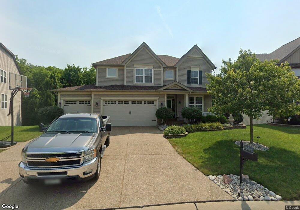
22 Burnside Ct Saint Charles, MO 63303
Heritage NeighborhoodEstimated Value: $600,000 - $672,000
4
Beds
4
Baths
3,293
Sq Ft
$192/Sq Ft
Est. Value
About This Home
This home is located at 22 Burnside Ct, Saint Charles, MO 63303 and is currently estimated at $631,639, approximately $191 per square foot. 22 Burnside Ct is a home located in St. Charles County with nearby schools including Becky-David Elementary School, Barnwell Middle School, and Francis Howell North High School.
Ownership History
Date
Name
Owned For
Owner Type
Purchase Details
Closed on
Dec 30, 2010
Sold by
Payne Family Homes At The Enclave Llc
Bought by
Brenner John P and Brenner Susan E
Current Estimated Value
Home Financials for this Owner
Home Financials are based on the most recent Mortgage that was taken out on this home.
Original Mortgage
$243,800
Outstanding Balance
$163,247
Interest Rate
4.41%
Mortgage Type
New Conventional
Estimated Equity
$468,392
Create a Home Valuation Report for This Property
The Home Valuation Report is an in-depth analysis detailing your home's value as well as a comparison with similar homes in the area
Home Values in the Area
Average Home Value in this Area
Purchase History
We collect this data history from publicly available records. To have your information removed, we recommend requesting removal directly through your county’s website.
| Date | Buyer | Sale Price | Title Company |
|---|---|---|---|
| Brenner John P | $304,756 | Integrity Land Title Co Inc |
Source: Public Records
Mortgage History
We collect this data history from publicly available records. To have your information removed, we recommend requesting removal directly through your county’s website.
| Date | Status | Borrower | Loan Amount |
|---|---|---|---|
| Open | Brenner John P | $243,800 |
Source: Public Records
Tax History
| Year | Tax Paid | Tax Assessment Tax Assessment Total Assessment is a certain percentage of the fair market value that is determined by local assessors to be the total taxable value of land and additions on the property. | Land | Improvement |
|---|---|---|---|---|
| 2025 | $6,636 | $113,333 | -- | -- |
| 2023 | $6,627 | $107,592 | $0 | $0 |
| 2022 | $5,717 | $85,945 | $0 | $0 |
| 2021 | $5,705 | $85,945 | $0 | $0 |
| 2020 | $4,990 | $73,229 | $0 | $0 |
| 2019 | $4,972 | $73,229 | $0 | $0 |
| 2018 | $4,801 | $67,509 | $0 | $0 |
| 2017 | $4,776 | $67,509 | $0 | $0 |
| 2016 | $4,204 | $59,564 | $0 | $0 |
| 2015 | $4,167 | $59,564 | $0 | $0 |
| 2014 | $4,032 | $55,864 | $0 | $0 |
Source: Public Records
Map
Nearby Homes
- 52 Bunker Hill
- 1513 Hudson Landing
- 2497 Annapolis Way
- 408 Monitor Way
- 1311 Musket Hollow Unit F
- 1343 Hampton Rd Unit B
- 405 Meramec Way Unit 10
- 1387 Hampton Rd Unit C
- 2621 Plantation Point Unit C
- 147 Foxtail Dr
- 634 River Bend Estates Dr
- 2613 Hampton Rd
- 2 Saw Mill Way
- 1465 Heritage Landing Unit 35
- 1465 Heritage Landing Unit 306
- 1465 Heritage Landing Unit 403
- 1465 Heritage Landing Unit 102
- 1380 Heritage Landing Unit 206
- 27 Ridge Mount Ct
- 3118 Woodbridge Dr
- 16 Burnside Ct
- 14 Burnside Ct
- 17 Confederate Way
- 12 Burnside-Uc Ct
- 20 Burnside Ct
- 1588 Burnside Ln
- 18 Confederate Way
- 1593 Burnside Ln
- 10 Burnside Ct
- 1590 Burnside Ln
- 16 Confederate Way
- 19 Confederate Way
- 1592 Burnside Ln
- 1595Lot # 1 Burnside Ln
- 1595 Burnside Ln
- 1595 Burnside Ln
- 24 Burnside Ct
- 15 Confederate Way
- 38 Burnside Ct
- 38Lot # 21 Burnside Ct
Your Personal Tour Guide
Ask me questions while you tour the home.