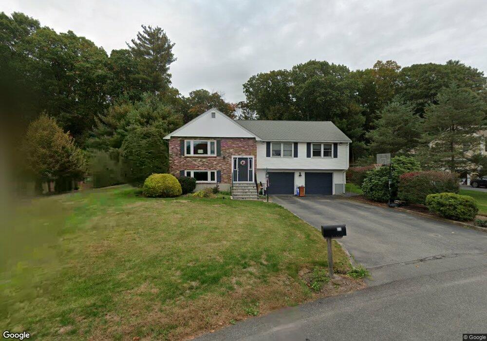
22 Estey Way Canton, MA 02021
Estimated Value: $801,000 - $1,038,000
About This Home
This home is located at 22 Estey Way, Canton, MA 02021 and is currently estimated at $908,627, approximately $337 per square foot. 22 Estey Way is a home located in Norfolk County with nearby schools including Canton High School and St. John the Evangelist School.
Ownership History
We collect this data history from publicly available records. To have your information removed, we recommend requesting removal directly through your county’s website.
Purchase Details
Home Financials for this Owner
Home Financials are based on the most recent Mortgage that was taken out on this home.Purchase Details
Home Financials for this Owner
Home Financials are based on the most recent Mortgage that was taken out on this home.Purchase Details
Home Financials for this Owner
Home Financials are based on the most recent Mortgage that was taken out on this home.Home Values in the Area
Average Home Value in this Area
Purchase History
We collect this data history from publicly available records. To have your information removed, we recommend requesting removal directly through your county’s website.
| Date | Buyer | Sale Price | Title Company |
|---|---|---|---|
| $463,150 | -- | ||
| $326,000 | -- | ||
| $252,900 | -- |
Mortgage History
We collect this data history from publicly available records. To have your information removed, we recommend requesting removal directly through your county’s website.
| Date | Status | Borrower | Loan Amount |
|---|---|---|---|
| Open | $250,000 | ||
| Closed | $333,700 | ||
| Previous Owner | $293,400 | ||
| Previous Owner | $200,000 |
Tax History
We collect this data history from publicly available records. To have your information removed, we recommend requesting removal directly through your county’s website.
| Year | Tax Paid | Tax Assessment Tax Assessment Total Assessment is a certain percentage of the fair market value that is determined by local assessors to be the total taxable value of land and additions on the property. | Land | Improvement |
|---|---|---|---|---|
| 2025 | $8,442 | $853,600 | $297,400 | $556,200 |
| 2024 | $8,186 | $821,100 | $286,000 | $535,100 |
| 2023 | $7,887 | $746,200 | $286,000 | $460,200 |
| 2022 | $7,294 | $642,600 | $272,400 | $370,200 |
| 2021 | $7,098 | $581,800 | $247,600 | $334,200 |
| 2020 | $6,828 | $558,300 | $235,800 | $322,500 |
| 2019 | $6,758 | $545,000 | $214,300 | $330,700 |
| 2018 | $6,513 | $524,400 | $206,100 | $318,300 |
| 2017 | $6,579 | $514,400 | $202,100 | $312,300 |
| 2016 | $6,469 | $505,800 | $197,100 | $308,700 |
| 2015 | $6,078 | $474,100 | $191,400 | $282,700 |
Map
- 14 Estey Way
- 44 Will Dr Unit 58
- 54 Will Dr Unit 87
- 6 Janice Rd
- 2 Forbes Rd
- 38 Sentinel St
- 1355 Central St
- 29 Station St
- 17 Indian Woods Way Unit 17
- 1388 Central St
- 862 Pleasant St
- 319 Cushing St
- 65 Mccormick Terrace Unit 10
- 888 Turnpike St
- 34 Rosewood Dr Unit 34
- 91 Rosewood Dr Unit 91
- 64 Laurelwood Dr
- 206 Greenbrook Dr
- 52 Rosewood Dr
- 153 Greenbrook Dr Unit 153
Ask me questions while you tour the home.