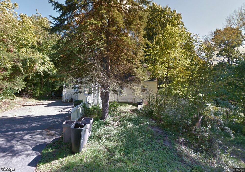
22 Hillside Rd Harwinton, CT 06791
Estimated Value: $394,000 - $455,000
3
Beds
2
Baths
1,912
Sq Ft
$224/Sq Ft
Est. Value
About This Home
This home is located at 22 Hillside Rd, Harwinton, CT 06791 and is currently estimated at $429,069, approximately $224 per square foot. 22 Hillside Rd is a home located in Litchfield County with nearby schools including Harwinton Consolidated School, Har-Bur Middle School, and Lewis S. Mills High School.
Ownership History
Date
Name
Owned For
Owner Type
Purchase Details
Closed on
Apr 10, 1974
Bought by
Aeschlimann Ronald F and Aeschlimann Judith A
Current Estimated Value
Create a Home Valuation Report for This Property
The Home Valuation Report is an in-depth analysis detailing your home's value as well as a comparison with similar homes in the area
Home Values in the Area
Average Home Value in this Area
Purchase History
| Date | Buyer | Sale Price | Title Company |
|---|---|---|---|
| Aeschlimann Ronald F | -- | -- |
Source: Public Records
Mortgage History
| Date | Status | Borrower | Loan Amount |
|---|---|---|---|
| Open | Aeschlimann Ronald F | $50,000 | |
| Closed | Aeschlimann Ronald F | $45,000 | |
| Closed | Aeschlimann Ronald F | $45,000 |
Source: Public Records
Tax History
| Year | Tax Paid | Tax Assessment Tax Assessment Total Assessment is a certain percentage of the fair market value that is determined by local assessors to be the total taxable value of land and additions on the property. | Land | Improvement |
|---|---|---|---|---|
| 2025 | $5,843 | $254,030 | $68,770 | $185,260 |
| 2024 | $5,817 | $254,030 | $68,770 | $185,260 |
| 2023 | $5,385 | $184,420 | $49,120 | $135,300 |
| 2022 | $5,256 | $184,420 | $49,120 | $135,300 |
| 2021 | $5,293 | $184,420 | $49,120 | $135,300 |
| 2020 | $5,164 | $184,420 | $49,120 | $135,300 |
| 2019 | $5,164 | $184,420 | $49,120 | $135,300 |
| 2018 | $5,419 | $193,520 | $60,420 | $133,100 |
| 2017 | $5,380 | $193,520 | $60,420 | $133,100 |
| 2016 | $5,380 | $193,520 | $60,420 | $133,100 |
| 2015 | $5,283 | $193,520 | $60,420 | $133,100 |
| 2014 | $5,206 | $193,520 | $60,420 | $133,100 |
Source: Public Records
Map
Nearby Homes
- 184 Campville Hill Rd
- Lot 2 Birch Hill Rd
- 399 Hill Rd
- 0 Decker Dr Unit 24148478
- 604 Wildcat Hill Rd
- 0 Reder Rd Unit 24133780
- 0 Clearview Ave Unit 24158105
- 67 E Litchfield Rd S
- 111 Whetstone Rd
- Lot 3A William Way
- 68 Thomaston Rd
- 152 Davis Rd
- 73 Mcbride Rd
- 115 Mcbride Rd
- 151 Highview Dr
- 164 Birge Park Rd
- 3 Break Maiden Ln
- 3 & 5 Break Maiden Ln
- 35 Quail Run
- 31 Main St
- 30 Hillside Rd
- 29 Hillside Rd
- 171 Mansfield Rd
- 175 Mansfield Rd
- 179 Mansfield Rd
- 31 Hillside Rd
- 182 Mansfield Rd
- 161 Mansfield Rd
- 155 Mansfield Rd
- 144 Mansfield Rd
- 187 Mansfield Rd
- 57 Mansfield Rd
- 145 Mansfield Rd
- 180 Mansfield Rd
- 188 Mansfield Rd
- 195 Mansfield Rd
- 196 Mansfield Rd
- 129 Mansfield Rd
- 215 Mansfield Rd
- 208 Mansfield Rd
Your Personal Tour Guide
Ask me questions while you tour the home.