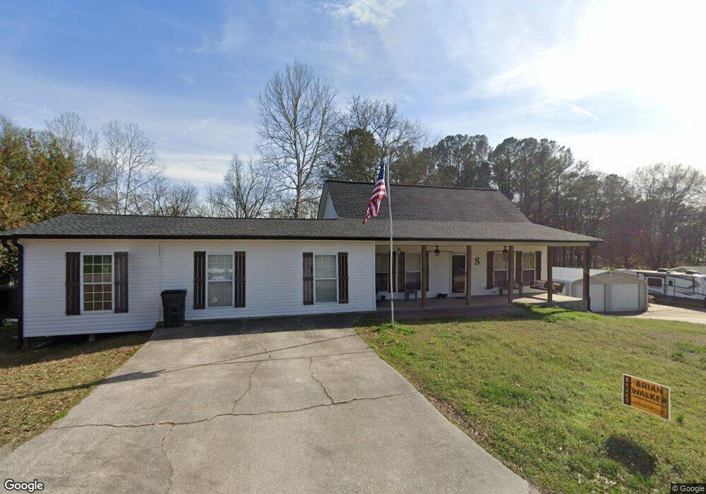
22 Main Dr Tallapoosa, GA 30176
Estimated Value: $305,000 - $339,000
3
Beds
2
Baths
2,648
Sq Ft
$119/Sq Ft
Est. Value
About This Home
This home is located at 22 Main Dr, Tallapoosa, GA 30176 and is currently estimated at $315,514, approximately $119 per square foot. 22 Main Dr is a home located in Haralson County with nearby schools including Haralson County High School.
Ownership History
Date
Name
Owned For
Owner Type
Purchase Details
Closed on
May 3, 2021
Sold by
Williams Ronald
Bought by
Silva Kevin and Silva Brandie
Current Estimated Value
Home Financials for this Owner
Home Financials are based on the most recent Mortgage that was taken out on this home.
Original Mortgage
$230,743
Outstanding Balance
$207,772
Interest Rate
3.1%
Mortgage Type
FHA
Estimated Equity
$107,742
Purchase Details
Closed on
Apr 2, 1999
Sold by
Mcburnett Derl
Bought by
Williams Ronald and Williams Rita R
Purchase Details
Closed on
Jul 30, 1993
Sold by
Cook Grady
Bought by
Mcburnett Derl
Purchase Details
Closed on
Jan 7, 1984
Sold by
Howell Angela Gale
Bought by
Cook Grady
Purchase Details
Closed on
Apr 22, 1975
Sold by
Windom J J
Bought by
Howell Angela Gale
Create a Home Valuation Report for This Property
The Home Valuation Report is an in-depth analysis detailing your home's value as well as a comparison with similar homes in the area
Home Values in the Area
Average Home Value in this Area
Purchase History
| Date | Buyer | Sale Price | Title Company |
|---|---|---|---|
| Silva Kevin | $235,000 | -- | |
| Williams Ronald | $90,000 | -- | |
| Mcburnett Derl | $2,000 | -- | |
| Cook Grady | -- | -- | |
| Howell Angela Gale | -- | -- |
Source: Public Records
Mortgage History
| Date | Status | Borrower | Loan Amount |
|---|---|---|---|
| Open | Silva Kevin | $230,743 |
Source: Public Records
Tax History
| Year | Tax Paid | Tax Assessment Tax Assessment Total Assessment is a certain percentage of the fair market value that is determined by local assessors to be the total taxable value of land and additions on the property. | Land | Improvement |
|---|---|---|---|---|
| 2025 | $2,566 | $109,149 | $14,896 | $94,253 |
| 2024 | $3,042 | $98,153 | $4,834 | $93,319 |
| 2023 | $3,324 | $103,167 | $4,560 | $98,607 |
| 2022 | $2,225 | $88,204 | $4,560 | $83,644 |
| 2021 | $1,722 | $65,880 | $4,560 | $61,320 |
| 2020 | $1,748 | $66,629 | $4,560 | $62,069 |
| 2019 | $1,764 | $64,868 | $4,560 | $60,308 |
| 2018 | $1,670 | $60,814 | $4,560 | $56,254 |
| 2017 | $1,880 | $51,045 | $4,560 | $46,485 |
| 2016 | $1,270 | $45,598 | $4,560 | $41,038 |
| 2015 | $1,291 | $46,052 | $4,560 | $41,492 |
| 2014 | $1,456 | $50,234 | $7,600 | $42,634 |
Source: Public Records
Map
Nearby Homes
- 0 McDonald Ridge Unit 7691855
- 0 McDonald Ridge Unit 10657044
- LOT 11 McDonald Ridge
- 000 McDonald Ridge
- LOT13 McDonald Ridge
- 00 McDonald Ridge
- 174 Faye St
- 135 Oakland Ct
- 240 Ray St
- 200 Mohawk Dr
- 0 Cherokee Dr Unit 148037
- 268 White St
- 0 White St Unit 10638753
- 0 Georgia 120 Unit 7646686
- 0 Georgia 120 Unit 10600882
- 5 Arbacoochee Rd
- 0 Steadman Rd Unit 10689496
- 215 Almon Ave
- 0 Taliaferro St Unit 10638767
- 0 Broad St Unit 10614514
Your Personal Tour Guide
Ask me questions while you tour the home.