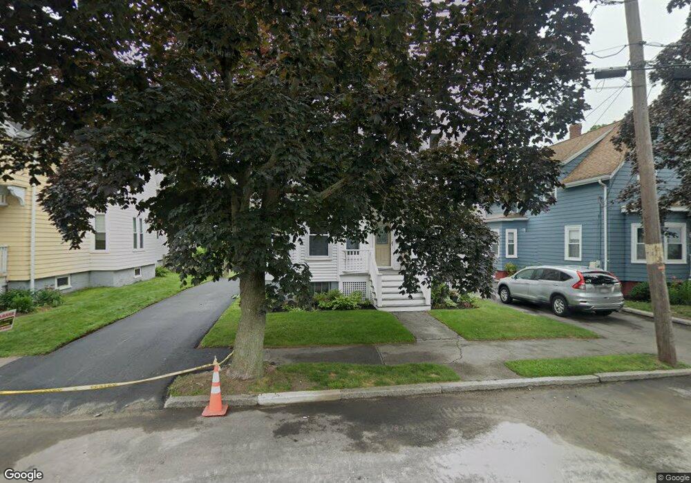
22 Maple Ave Swampscott, MA 01907
Estimated Value: $652,710 - $741,000
3
Beds
1
Bath
1,569
Sq Ft
$445/Sq Ft
Est. Value
About This Home
This home is located at 22 Maple Ave, Swampscott, MA 01907 and is currently estimated at $697,428, approximately $444 per square foot. 22 Maple Ave is a home located in Essex County with nearby schools including Swampscott Middle School and Swampscott High School.
Ownership History
Date
Name
Owned For
Owner Type
Purchase Details
Closed on
Jan 28, 2011
Sold by
Taylor Derek C and Taylor Joy E
Bought by
Badger James A and Grandpre-Badger Ellen M
Current Estimated Value
Purchase Details
Closed on
Apr 28, 2006
Sold by
Oconnell James P and Oconnell Thomas R
Bought by
Taylor Derek C
Purchase Details
Closed on
Mar 8, 1993
Sold by
Sclafani Rosalie G
Bought by
Wellspring Community
Create a Home Valuation Report for This Property
The Home Valuation Report is an in-depth analysis detailing your home's value as well as a comparison with similar homes in the area
Home Values in the Area
Average Home Value in this Area
Purchase History
| Date | Buyer | Sale Price | Title Company |
|---|---|---|---|
| Badger James A | $327,500 | -- | |
| Badger James A | $327,500 | -- | |
| Taylor Derek C | $370,000 | -- | |
| Taylor Derek C | $370,000 | -- | |
| Wellspring Community | $352,000 | -- | |
| Wellspring Community | $352,000 | -- |
Source: Public Records
Mortgage History
| Date | Status | Borrower | Loan Amount |
|---|---|---|---|
| Open | Wellspring Community | $190,000 | |
| Closed | Wellspring Community | $213,000 |
Source: Public Records
Tax History
| Year | Tax Paid | Tax Assessment Tax Assessment Total Assessment is a certain percentage of the fair market value that is determined by local assessors to be the total taxable value of land and additions on the property. | Land | Improvement |
|---|---|---|---|---|
| 2025 | $7,033 | $613,200 | $233,800 | $379,400 |
| 2024 | $6,851 | $596,300 | $222,600 | $373,700 |
| 2023 | $6,176 | $526,100 | $206,100 | $320,000 |
| 2022 | $5,934 | $462,500 | $181,400 | $281,100 |
| 2021 | $5,444 | $394,500 | $140,200 | $254,300 |
| 2020 | $5,463 | $382,000 | $131,900 | $250,100 |
| 2019 | $5,556 | $365,500 | $115,400 | $250,100 |
| 2018 | $5,683 | $355,200 | $115,400 | $239,800 |
| 2017 | $5,624 | $322,300 | $98,900 | $223,400 |
| 2016 | $5,228 | $301,700 | $78,300 | $223,400 |
| 2015 | $5,174 | $301,700 | $78,300 | $223,400 |
| 2014 | $5,013 | $268,100 | $56,100 | $212,000 |
Source: Public Records
Map
Nearby Homes
- 4 Valley Rd Unit 4
- 80 Norfolk Ave Unit 1
- 106 Norfolk Ave
- 146 Burrill St
- 143 Burrill St Unit 301
- 11 Boynton St Unit 104
- 11 Boynton St Unit 101
- 11 Boynton St Unit 103
- 11 Boynton St Unit 201
- 46 Stetson Ave
- 96 Burpee Rd Unit 1
- 100 Burrill St Unit 6
- 64 Stetson Ave
- 60 Roy St
- 97 Seymour Ave
- 28 Claremont Terrace Unit 6
- 16 Isabella St
- 53 Groveland St
- 133 Elmwood Rd Unit 2
- 56 Clark St
- 18 Maple Ave
- 18 Maple Ave Unit 1
- 24 Maple Ave
- 28 Maple Ave
- 12 Maple Ave Unit 2
- 12 Maple Ave Unit 14
- 12 Maple Ave Unit 1
- 14 Maple Ave Unit 1
- 24-26 Essex Ave Unit 1
- 24-26 Essex Ave Unit 2
- 34 Essex Ave Unit 2
- 34 Essex Ave Unit 1
- 34 Essex Ave Unit 34
- 24 Essex Ave Unit 26
- 24 Essex Ave Unit 26
- 24 Essex Ave Unit 2
- 24 Essex Ave Unit 24
- 26 Essex Ave Unit 1,26
- 24 Essex Ave Unit 2,24
- 26 Essex Ave Unit 1
Your Personal Tour Guide
Ask me questions while you tour the home.