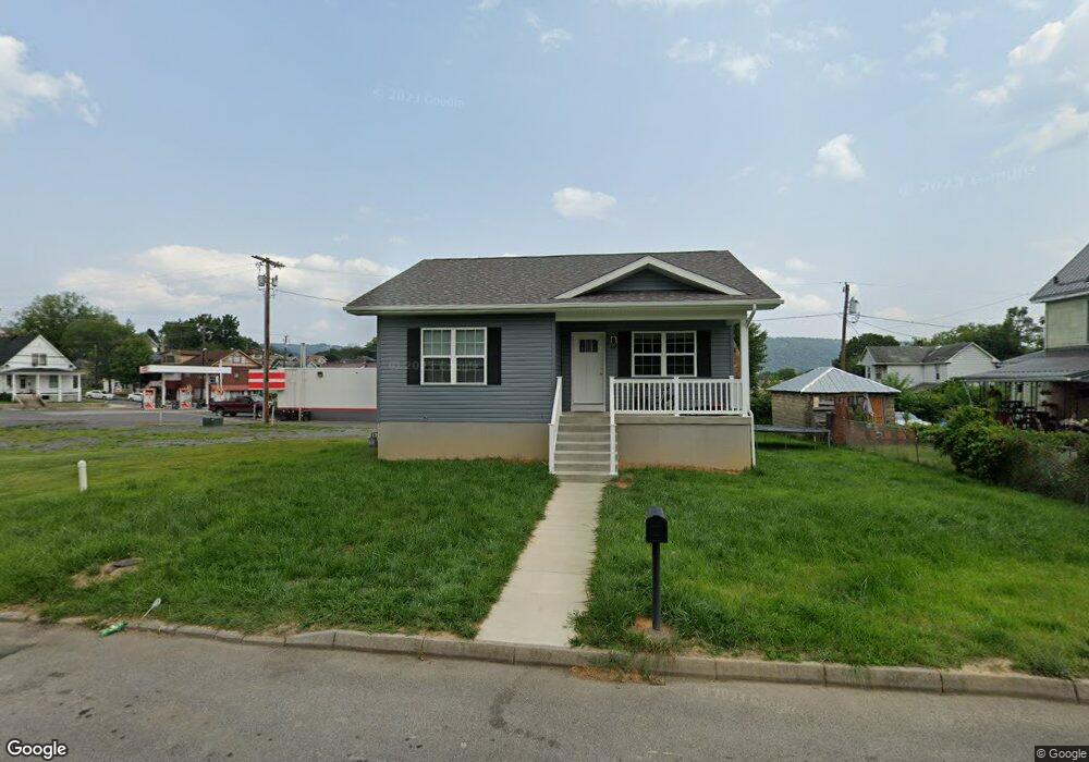
22 Maple St Cumberland, MD 21502
Estimated Value: $181,921
Studio
--
Bath
1,056
Sq Ft
$172/Sq Ft
Est. Value
About This Home
This home is located at 22 Maple St, Cumberland, MD 21502 and is currently priced at $181,921, approximately $172 per square foot. 22 Maple St is a home located in Allegany County with nearby schools including South Penn Elementary School, Washington Middle School, and Fort Hill High School.
Ownership History
Date
Name
Owned For
Owner Type
Purchase Details
Closed on
Dec 21, 2022
Sold by
Allegany County Habitat For Humanity Inc
Bought by
Hott Latisha R and Wallizer Patrick R
Current Estimated Value
Home Financials for this Owner
Home Financials are based on the most recent Mortgage that was taken out on this home.
Original Mortgage
$165,000
Interest Rate
6.15%
Mortgage Type
New Conventional
Purchase Details
Closed on
Aug 29, 2017
Sold by
Morris Keith and Morris Connie
Bought by
Allegany County Habitat For Humanity Inc
Create a Home Valuation Report for This Property
The Home Valuation Report is an in-depth analysis detailing your home's value as well as a comparison with similar homes in the area
Purchase History
| Date | Buyer | Sale Price | Title Company |
|---|---|---|---|
| Hott Latisha R | $165,000 | -- | |
| Allegany County Habitat For Humanity Inc | -- | None Available |
Source: Public Records
Mortgage History
| Date | Status | Borrower | Loan Amount |
|---|---|---|---|
| Previous Owner | Hott Latisha R | $165,000 |
Source: Public Records
Tax History
| Year | Tax Paid | Tax Assessment Tax Assessment Total Assessment is a certain percentage of the fair market value that is determined by local assessors to be the total taxable value of land and additions on the property. | Land | Improvement |
|---|---|---|---|---|
| 2025 | -- | $500 | $500 | $0 |
| 2024 | -- | $500 | $500 | $0 |
| 2023 | $0 | $500 | $500 | $0 |
| 2022 | -- | $12,500 | $12,500 | $0 |
| 2020 | $211 | $12,500 | $12,500 | $0 |
| 2019 | $212 | $12,500 | $12,500 | $0 |
| 2018 | $212 | $12,500 | $12,500 | $0 |
| 2017 | $213 | $22,500 | $0 | $0 |
| 2016 | $216 | $22,500 | $0 | $0 |
| 2015 | $217 | $22,500 | $0 | $0 |
| 2014 | $217 | $22,500 | $0 | $0 |
Source: Public Records
Map
Nearby Homes
- 820 E Oldtown Rd
- 24 Blackiston Ave
- 1102 E Oldtown Rd
- 61 Maple St
- 22 S Massachusetts Ave
- 30 Memorial Ave
- 1006 Kent Ave
- 1012 Kent Ave
- 111 Wempe Dr
- 1430 Willow Ct
- 1430 Magnolia Ct
- 717 Louisiana Ave
- 716 Winifred Rd
- 613 Louisiana Ave
- 1427 Church St
- 701 White Ave
- 610 Hill Top Dr
- 705 Hill Top Dr
- 16 Grand Ave
- 129 Race St
Your Personal Tour Guide
Ask me questions while you tour the home.