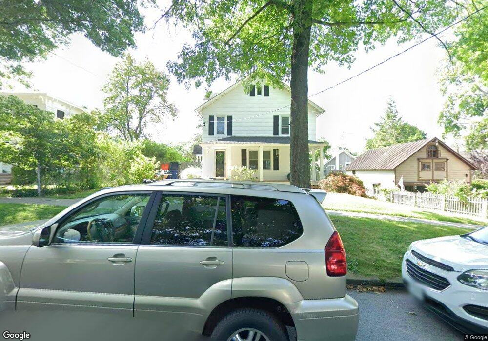
22 Merrit Ave Millbrook, NY 12545
Estimated Value: $454,653 - $688,000
3
Beds
2
Baths
1,580
Sq Ft
$362/Sq Ft
Est. Value
About This Home
This home is located at 22 Merrit Ave, Millbrook, NY 12545 and is currently estimated at $572,163, approximately $362 per square foot. 22 Merrit Ave is a home located in Dutchess County with nearby schools including Elm Drive Elementary School, Alden Place Elementary School, and Millbrook Middle School.
Ownership History
Date
Name
Owned For
Owner Type
Purchase Details
Closed on
Apr 28, 2006
Sold by
Birdsall Beatrice C
Bought by
Briggs Theodore H
Current Estimated Value
Create a Home Valuation Report for This Property
The Home Valuation Report is an in-depth analysis detailing your home's value as well as a comparison with similar homes in the area
Home Values in the Area
Average Home Value in this Area
Purchase History
We collect this data history from publicly available records. To have your information removed, we recommend requesting removal directly through your county’s website.
| Date | Buyer | Sale Price | Title Company |
|---|---|---|---|
| Briggs Theodore H | $300,500 | Allan B Rappleyea |
Source: Public Records
Tax History
| Year | Tax Paid | Tax Assessment Tax Assessment Total Assessment is a certain percentage of the fair market value that is determined by local assessors to be the total taxable value of land and additions on the property. | Land | Improvement |
|---|---|---|---|---|
| 2025 | $5,672 | $217,600 | $34,000 | $183,600 |
| 2024 | $5,672 | $217,600 | $34,000 | $183,600 |
| 2023 | $5,364 | $217,600 | $34,000 | $183,600 |
| 2022 | $5,273 | $217,600 | $34,000 | $183,600 |
| 2021 | $5,270 | $217,600 | $34,000 | $183,600 |
| 2020 | $6,473 | $217,600 | $34,000 | $183,600 |
| 2019 | $5,592 | $212,600 | $34,000 | $178,600 |
| 2018 | $5,103 | $212,600 | $34,000 | $178,600 |
| 2017 | $5,036 | $212,600 | $34,000 | $178,600 |
| 2016 | $4,958 | $212,600 | $34,000 | $178,600 |
| 2015 | -- | $212,600 | $34,000 | $178,600 |
| 2014 | -- | $212,600 | $34,000 | $178,600 |
Source: Public Records
Map
Nearby Homes
- 3311 Franklin Ave
- 44 Merrit Ave
- 33 Upper Ln
- 22 Haight Ave
- 5 Valley Farm Rd
- 188 Nine Partners Ln
- 121 Stanford Rd
- 6 Route 343
- 1 Johnson Ln
- 97 Valley Farm Rd
- 121-125 Butts Hollow Rd
- 45 Hitchcock Ln
- 66 County House Rd
- 37 Maple Hill Dr
- 43 Maple Hill Dr
- 45 Maple Hill Dr
- 477 Canoe Hill Rd
- 568 Oak Summit Rd
- 3893 Route 82
- 3875 Route 82
- 18 Merrit Ave
- 20 Merrit Ave
- 3295 Franklin Ave
- 24 Merrit Ave
- 24 Merritt Ave
- 156 Church St
- 160 Church St
- 160 Church St Unit 2
- 160 Church St Unit 3
- 160 Church St Unit 1
- 23 Merritt Ave
- 28 Merrit Ave
- 21 Merritt Ave
- 23 Merritt
- 154 Church St Unit 1
- 154 Church St
- 3289 Franklin Ave
- 27 Merritt Ave
- 3299 Franklin Ave
- 29 Merrit Ave
Your Personal Tour Guide
Ask me questions while you tour the home.