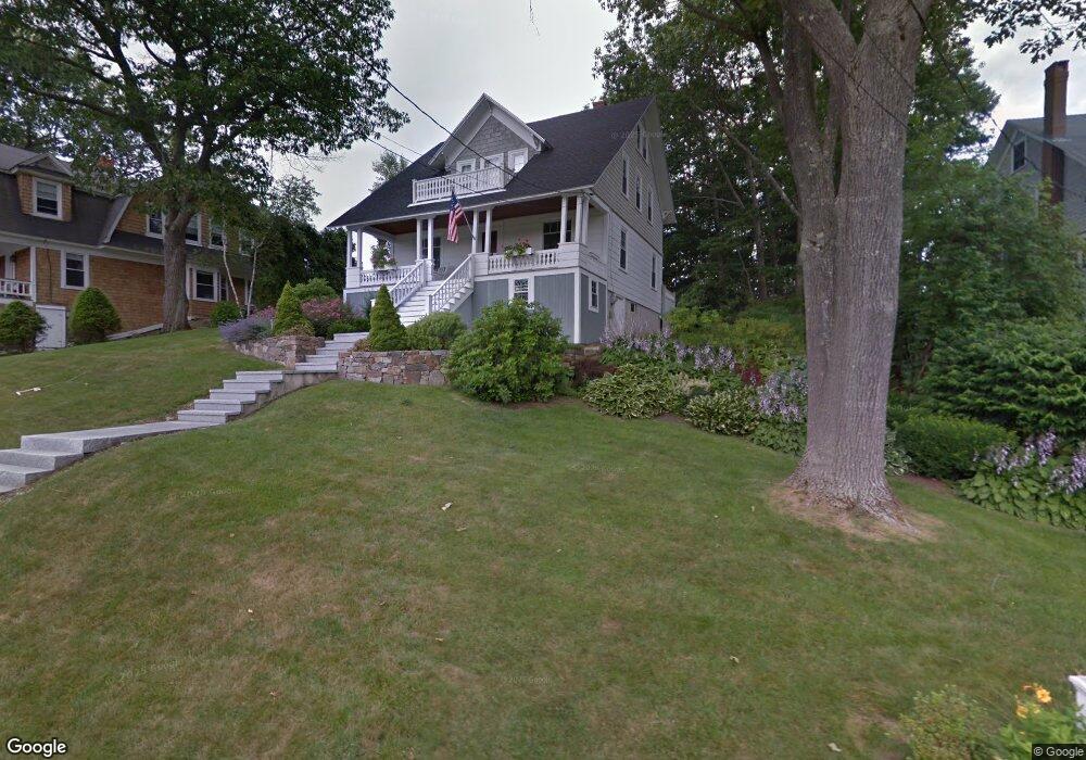
22 Oak St Kennebunk, ME 04043
Estimated Value: $1,208,000 - $1,886,000
4
Beds
2
Baths
1,741
Sq Ft
$878/Sq Ft
Est. Value
About This Home
This home is located at 22 Oak St, Kennebunk, ME 04043 and is currently estimated at $1,528,921, approximately $878 per square foot. 22 Oak St is a home located in York County with nearby schools including Kennebunk High School.
Ownership History
Date
Name
Owned For
Owner Type
Purchase Details
Closed on
Feb 2, 2023
Sold by
Coughlin Daniel C Est
Bought by
Mcginty Christine and Savitscus Lisa
Current Estimated Value
Purchase Details
Closed on
May 23, 2014
Sold by
Cathleen A Wentworth Ret
Bought by
Coughlin Daniel C
Create a Home Valuation Report for This Property
The Home Valuation Report is an in-depth analysis detailing your home's value as well as a comparison with similar homes in the area
Home Values in the Area
Average Home Value in this Area
Purchase History
| Date | Buyer | Sale Price | Title Company |
|---|---|---|---|
| Mcginty Christine | -- | None Available | |
| Coughlin Daniel C | -- | -- |
Source: Public Records
Tax History
| Year | Tax Paid | Tax Assessment Tax Assessment Total Assessment is a certain percentage of the fair market value that is determined by local assessors to be the total taxable value of land and additions on the property. | Land | Improvement |
|---|---|---|---|---|
| 2024 | $11,114 | $655,700 | $423,300 | $232,400 |
| 2023 | $10,524 | $655,700 | $423,300 | $232,400 |
| 2022 | $9,573 | $655,700 | $423,300 | $232,400 |
| 2021 | $9,344 | $655,700 | $423,300 | $232,400 |
| 2020 | $168 | $655,700 | $423,300 | $232,400 |
| 2019 | $166 | $655,700 | $423,300 | $232,400 |
| 2018 | $8,607 | $491,800 | $317,500 | $174,300 |
| 2017 | $160 | $491,800 | $317,500 | $174,300 |
| 2016 | $7,820 | $491,800 | $317,500 | $174,300 |
| 2015 | $7,525 | $491,800 | $317,500 | $174,300 |
| 2014 | $7,328 | $491,800 | $317,500 | $174,300 |
Source: Public Records
Map
Nearby Homes
- 131 Western Ave
- 221 Beach Ave
- 12 Ephraim Tyler Way
- 53 Great Hill Rd
- 13 Atlantic Cir
- 20 Surf Ln
- 143 Beach Ave Unit 205
- 143 Beach Ave Unit 203
- 189 Western Ave
- 87 Boothby Rd
- 16 Larboard Ln Unit 6
- 12 Beach Ave
- 7 Christensen Ln
- 3 Breakwater Ct Unit 1
- Lot#39 Bufflehead Cove Ln
- 5 Lake Brook Dr
- 60 Ocean Ave
- 5 Surrey Ln
- Lot 2 Woodland Dr
- 2A Ivy Ln
Your Personal Tour Guide
Ask me questions while you tour the home.