22 Stannard Ave Branford, CT 06405
Estimated Value: $537,368 - $962,000
About This Home
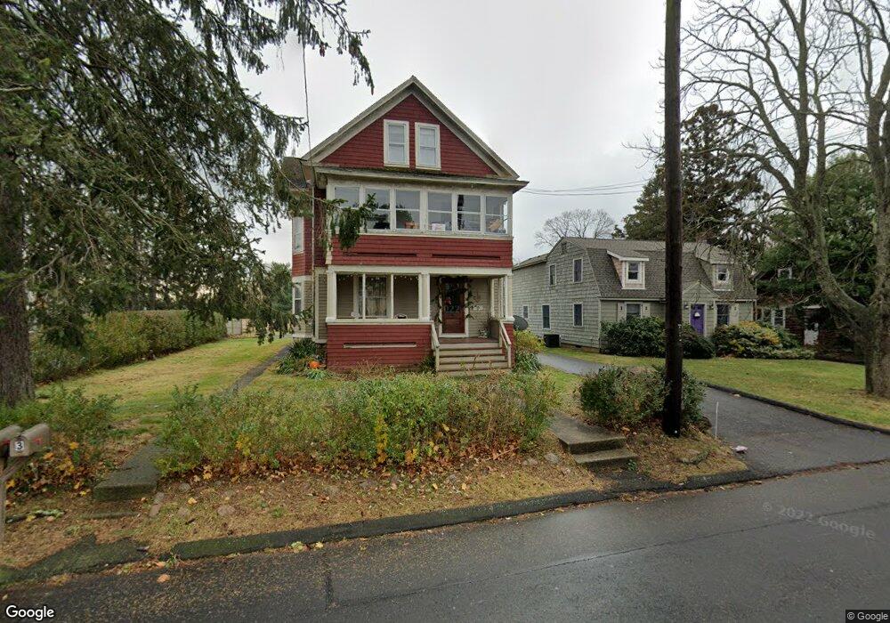
This home is located at 22 Stannard Ave, Branford, CT 06405 and is currently estimated at $747,842, approximately $252 per square foot. 22 Stannard Ave is a home located in New Haven County with nearby schools including Francis Walsh Intermediate School, Branford High School, and East Shoreline Catholic Academy.
Ownership History
We collect this data history from publicly available records. To have your information removed, we recommend requesting removal directly through your county’s website.
Purchase Details
Home Financials for this Owner
Home Financials are based on the most recent Mortgage that was taken out on this home.Home Values in the Area
Average Home Value in this Area
Purchase History
We collect this data history from publicly available records. To have your information removed, we recommend requesting removal directly through your county’s website.
| Date | Buyer | Sale Price | Title Company |
|---|---|---|---|
| $165,000 | -- |
Mortgage History
We collect this data history from publicly available records. To have your information removed, we recommend requesting removal directly through your county’s website.
| Date | Status | Borrower | Loan Amount |
|---|---|---|---|
| Open | $132,000 | ||
| Previous Owner | $150,000 |
Tax History
We collect this data history from publicly available records. To have your information removed, we recommend requesting removal directly through your county’s website.
| Year | Tax Paid | Tax Assessment Tax Assessment Total Assessment is a certain percentage of the fair market value that is determined by local assessors to be the total taxable value of land and additions on the property. | Land | Improvement |
|---|---|---|---|---|
| 2025 | $8,920 | $416,800 | $180,500 | $236,300 |
| 2024 | $8,077 | $265,000 | $98,200 | $166,800 |
| 2023 | $7,921 | $265,000 | $98,200 | $166,800 |
| 2022 | $7,804 | $265,000 | $98,200 | $166,800 |
| 2021 | $7,804 | $265,000 | $98,200 | $166,800 |
| 2020 | $7,664 | $265,000 | $98,200 | $166,800 |
| 2019 | $7,619 | $262,100 | $115,200 | $146,900 |
| 2018 | $7,507 | $262,100 | $115,200 | $146,900 |
| 2017 | $7,462 | $262,100 | $115,200 | $146,900 |
| 2016 | $7,184 | $262,100 | $115,200 | $146,900 |
| 2015 | $7,058 | $262,100 | $115,200 | $146,900 |
| 2014 | $6,878 | $262,100 | $115,200 | $146,900 |
Map
- 21 Harbor St
- 12 Castle Rock Unit 12
- 28 Mill Creek Rd
- 21 Harbour Village Unit C
- 23 Harbour Village Unit A
- 15 River Rd
- 25 Brocketts Point Rd
- 231 Pawson Rd
- 34 Howard Ave
- 59 Maple St
- 60 Maple St Unit 39A
- 60 Maple St Unit 32
- 320 Maple St
- 20 W End Ave
- 61 Dover Ct Unit B
- 17 Ballou Rd
- 3 Garden St
- 48 Home Place
- 4 Marina Village
- 59 Home Place
Ask me questions while you tour the home.