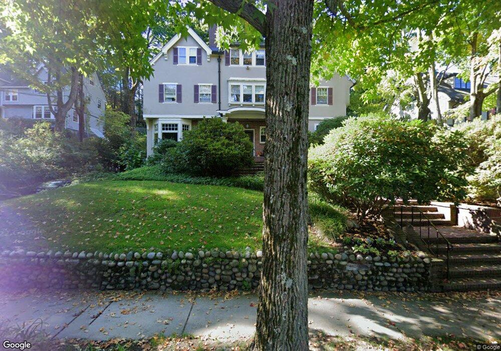
220 Buckminster Rd Brookline, MA 02445
Brookline Village NeighborhoodEstimated Value: $3,726,000 - $4,877,284
About This Home
This home is located at 220 Buckminster Rd, Brookline, MA 02445 and is currently estimated at $4,444,095, approximately $819 per square foot. 220 Buckminster Rd is a home located in Norfolk County with nearby schools including John D. Runkle School, Brookline High School, and Torah Academy.
Ownership History
We collect this data history from publicly available records. To have your information removed, we recommend requesting removal directly through your county’s website.
Purchase Details
Purchase Details
Home Values in the Area
Average Home Value in this Area
Purchase History
We collect this data history from publicly available records. To have your information removed, we recommend requesting removal directly through your county’s website.
| Date | Buyer | Sale Price | Title Company |
|---|---|---|---|
| -- | None Available | ||
| -- | None Available |
Tax History
We collect this data history from publicly available records. To have your information removed, we recommend requesting removal directly through your county’s website.
| Year | Tax Paid | Tax Assessment Tax Assessment Total Assessment is a certain percentage of the fair market value that is determined by local assessors to be the total taxable value of land and additions on the property. | Land | Improvement |
|---|---|---|---|---|
| 2025 | $41,232 | $4,177,500 | $1,558,900 | $2,618,600 |
| 2024 | $39,333 | $4,025,900 | $1,498,900 | $2,527,000 |
| 2023 | $34,867 | $3,497,200 | $1,070,900 | $2,426,300 |
| 2022 | $33,939 | $3,330,600 | $1,019,800 | $2,310,800 |
| 2021 | $31,385 | $3,202,500 | $980,600 | $2,221,900 |
| 2020 | $29,145 | $3,084,100 | $891,500 | $2,192,600 |
| 2019 | $27,522 | $2,937,200 | $849,000 | $2,088,200 |
| 2018 | $27,269 | $2,882,600 | $858,900 | $2,023,700 |
| 2017 | $26,869 | $2,719,500 | $810,200 | $1,909,300 |
| 2016 | $24,589 | $2,359,800 | $757,200 | $1,602,600 |
| 2015 | $23,554 | $2,205,400 | $707,700 | $1,497,700 |
| 2014 | $24,508 | $2,151,700 | $643,400 | $1,508,300 |
Map
- 17 Chesham Rd
- 120 Seaver St Unit C-102
- 120 Seaver St Unit B204
- 55 Leicester St
- 278 Clinton Rd
- 540 Chestnut Hill Ave
- 184 Rawson Rd
- 322 Tappan St Unit 2
- 324 Tappan St Unit 2
- 355 Buckminster Rd
- 292 Clinton Rd
- 325 Tappan St Unit 6
- 15 Catlin Rd
- 1731 Beacon St Unit 520
- 1731 Beacon St Unit 402
- 1731 Beacon St Unit 119
- 350 Tappan St Unit 1
- 56 Garrison Rd Unit 56
- 352 Tappan St Unit 1
- 231 Rawson Rd Unit 4
- 230 Buckminster Rd
- 214 Buckminster Rd
- 29 Hyslop Rd
- 219 Buckminster Rd
- 219 Buckminster Rd Unit 219
- 236 Buckminster Rd
- 15 Hyslop Rd
- 206 Buckminster Rd
- 233 Buckminster Rd
- 37 Hyslop Rd
- 209 Buckminster Rd
- 9 Hyslop Rd
- 22 Hyslop Rd
- 17 Cotswold Rd
- 20 Cotswold Rd
- 248 Buckminster Rd
- 201 Buckminster Rd
- 241 Buckminster Rd
- 79 Holland Rd
- 59 Holland Rd
Ask me questions while you tour the home.