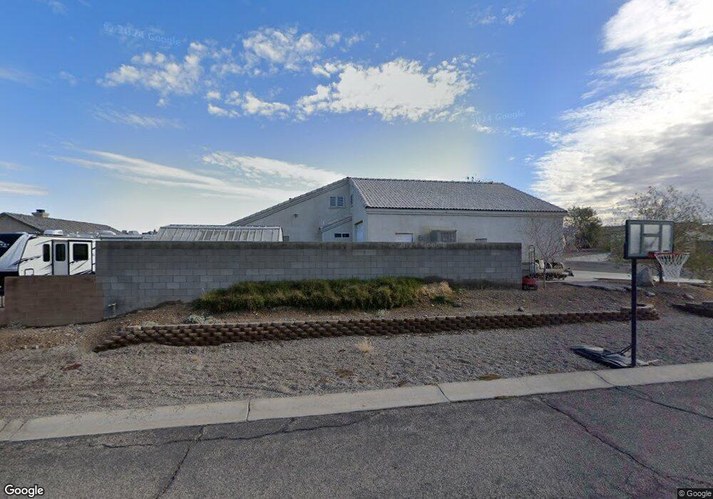
2202 E Jamie Ct Fort Mohave, AZ 86426
Estimated Value: $393,000 - $492,000
About This Home
This home is located at 2202 E Jamie Ct, Fort Mohave, AZ 86426 and is currently estimated at $442,490, approximately $215 per square foot. 2202 E Jamie Ct is a home located in Mohave County with nearby schools including Fort Mohave Elementary School, Camp Mohave Elementary School, and Mohave Valley Junior High School.
Ownership History
We collect this data history from publicly available records. To have your information removed, we recommend requesting removal directly through your county’s website.
Purchase Details
Home Financials for this Owner
Home Financials are based on the most recent Mortgage that was taken out on this home.Purchase Details
Home Financials for this Owner
Home Financials are based on the most recent Mortgage that was taken out on this home.Purchase Details
Home Financials for this Owner
Home Financials are based on the most recent Mortgage that was taken out on this home.Purchase Details
Home Financials for this Owner
Home Financials are based on the most recent Mortgage that was taken out on this home.Home Values in the Area
Average Home Value in this Area
Purchase History
We collect this data history from publicly available records. To have your information removed, we recommend requesting removal directly through your county’s website.
| Date | Buyer | Sale Price | Title Company |
|---|---|---|---|
| -- | Pioneer Title Agency | ||
| $264,900 | First American Title Ins Co | ||
| -- | First American Title Ins Co | ||
| -- | First American Title Ins Co |
Mortgage History
We collect this data history from publicly available records. To have your information removed, we recommend requesting removal directly through your county’s website.
| Date | Status | Borrower | Loan Amount |
|---|---|---|---|
| Open | $44,500 | ||
| Previous Owner | $78,140 | ||
| Previous Owner | $142,000 | ||
| Previous Owner | $211,900 |
Tax History
We collect this data history from publicly available records. To have your information removed, we recommend requesting removal directly through your county’s website.
| Year | Tax Paid | Tax Assessment Tax Assessment Total Assessment is a certain percentage of the fair market value that is determined by local assessors to be the total taxable value of land and additions on the property. | Land | Improvement |
|---|---|---|---|---|
| 2027 | $2,203 | -- | -- | -- |
| 2026 | $1,007 | -- | -- | -- |
| 2025 | $1,920 | $36,311 | $0 | $0 |
| 2024 | $1,920 | $37,689 | $0 | $0 |
| 2023 | $1,920 | $32,408 | $0 | $0 |
| 2022 | $1,884 | $25,608 | $0 | $0 |
| 2021 | $1,976 | $24,381 | $0 | $0 |
| 2019 | $1,835 | $20,678 | $0 | $0 |
| 2018 | $1,782 | $19,798 | $0 | $0 |
| 2017 | $1,767 | $19,924 | $0 | $0 |
| 2016 | $1,541 | $17,601 | $0 | $0 |
| 2015 | $1,563 | $16,204 | $0 | $0 |
Map
- 2240 Roberts Way
- 4275 S Mountain Meadow Way
- 2066 E Sundance Dr
- 2054 E Sundance Dr
- 4092 S Nicholas Dr
- 2073 E Jeffrey Dr
- 4112 S Cassidy Ct
- 1946 E Via San Marino
- 2373 E Allen Dr
- 1949 E Via Aventino
- 1936 E Via Borgata
- 1928 E Via Borgata
- 1920 E Via Borgata
- 4009 S Cassidy Dr
- 1909 E Via Aventino
- 1905 Via Borgata
- 4310 S Rafe Ave
- 4401 S Morgan Way
- 2246 Shadow Canyon Dr
- 1824 Stovall St
- 2204 E Jamie Rd
- 2210 E Jamie Rd
- 2194 E Jamie Ct
- 2192 E Jamie Ct
- 2192 E Jamie Ct
- 2192 E Jamie Ct
- 2190 E Jamie Ct
- 2190 Jamie Ct E
- 2186 E Jamie Ct
- 2198 E Jamie Ct
- 2196 E Jamie Ct
- 2188 E Jamie Ct
- 2184 E Jamie Ct
- 2216 E Jamie Rd
- 2199 E Jamie Rd
- 2207 E Jamie Rd
- 2191 E Jamie Rd
- 2248 E Roberts Way
- 2228 E Roberts Way
- 2234 E Roberts Way
Ask me questions while you tour the home.