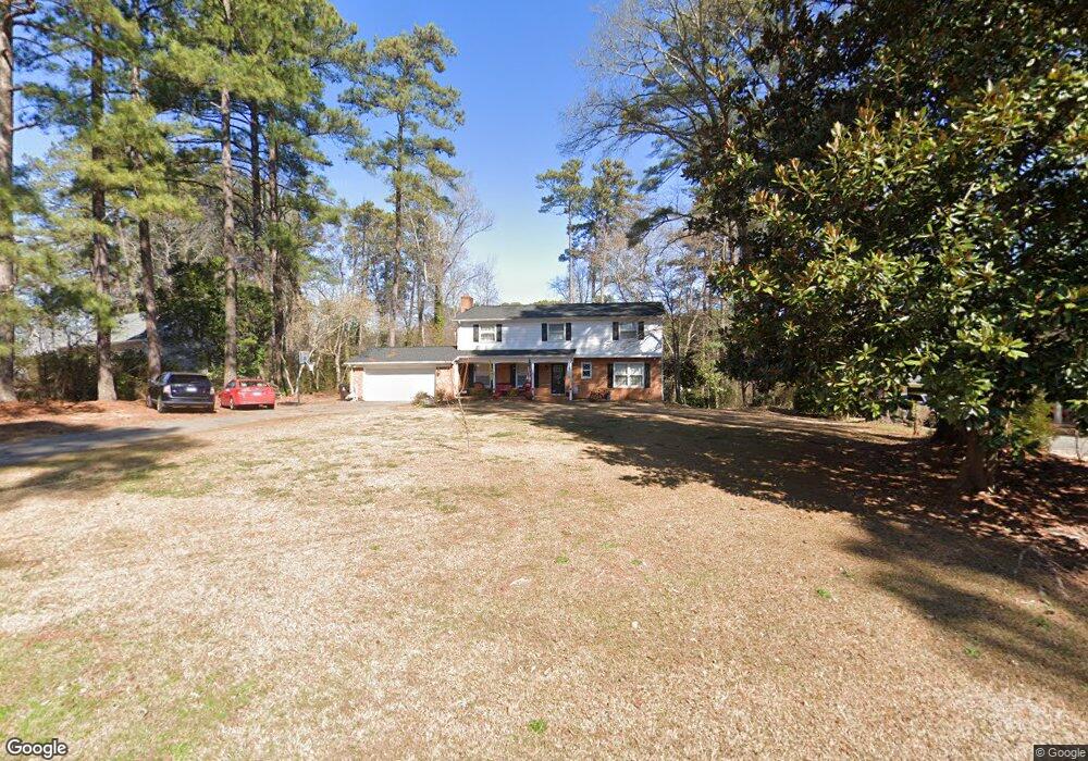
2210 Cliffside Dr Sanford, NC 27330
Estimated Value: $355,000 - $409,000
4
Beds
3
Baths
2,396
Sq Ft
$160/Sq Ft
Est. Value
About This Home
This home is located at 2210 Cliffside Dr, Sanford, NC 27330 and is currently estimated at $383,144, approximately $159 per square foot. 2210 Cliffside Dr is a home located in Lee County with nearby schools including J.R. Ingram Jr. Elementary School, West Lee Middle School, and Lee County High School.
Ownership History
Date
Name
Owned For
Owner Type
Purchase Details
Closed on
Apr 8, 2021
Sold by
Duncan Jamy and Duncan Miriam
Bought by
Sossamon Brad and Sossamon Jamie
Current Estimated Value
Home Financials for this Owner
Home Financials are based on the most recent Mortgage that was taken out on this home.
Original Mortgage
$295,260
Outstanding Balance
$266,154
Interest Rate
2.9%
Mortgage Type
VA
Estimated Equity
$116,990
Purchase Details
Closed on
Mar 3, 2010
Sold by
Pruette Margaret H
Bought by
Duncan Jamy and Duncan Miriam
Home Financials for this Owner
Home Financials are based on the most recent Mortgage that was taken out on this home.
Original Mortgage
$152,203
Interest Rate
4.97%
Mortgage Type
VA
Purchase Details
Closed on
Dec 5, 1966
Bought by
Pruette Frank H
Create a Home Valuation Report for This Property
The Home Valuation Report is an in-depth analysis detailing your home's value as well as a comparison with similar homes in the area
Home Values in the Area
Average Home Value in this Area
Purchase History
| Date | Buyer | Sale Price | Title Company |
|---|---|---|---|
| Sossamon Brad | $285,000 | None Available | |
| Sossamon Brad | $285,000 | Joeckel Jenny | |
| Duncan Jamy | $149,000 | None Available | |
| Pruette Frank H | -- | -- |
Source: Public Records
Mortgage History
| Date | Status | Borrower | Loan Amount |
|---|---|---|---|
| Open | Sossamon Brad | $295,260 | |
| Closed | Sossamon Brad | $295,260 | |
| Previous Owner | Duncan Jamy | $152,203 |
Source: Public Records
Tax History
| Year | Tax Paid | Tax Assessment Tax Assessment Total Assessment is a certain percentage of the fair market value that is determined by local assessors to be the total taxable value of land and additions on the property. | Land | Improvement |
|---|---|---|---|---|
| 2025 | $3,933 | $345,700 | $30,000 | $315,700 |
| 2024 | $3,913 | $345,700 | $30,000 | $315,700 |
| 2023 | $3,903 | $345,700 | $30,000 | $315,700 |
| 2022 | $3,414 | $229,200 | $27,500 | $201,700 |
| 2021 | $2,275 | $142,400 | $27,500 | $114,900 |
| 2020 | $2,268 | $142,400 | $27,500 | $114,900 |
| 2019 | $2,228 | $142,400 | $27,500 | $114,900 |
| 2018 | $2,346 | $149,900 | $31,500 | $118,400 |
| 2017 | $2,316 | $149,900 | $31,500 | $118,400 |
| 2016 | $2,291 | $149,900 | $31,500 | $118,400 |
| 2014 | $2,179 | $149,900 | $31,500 | $118,400 |
Source: Public Records
Map
Nearby Homes
- 0 Lot A Carbonton Rd
- 209 Arlington Cir
- 1701 Portico Cir
- 0 Sutphin Dr
- 2400 Carbonton Rd
- 1832 Sutphin Dr
- 0 Carbonton Rd Unit 100529193
- 0 Carbonton Rd Unit 749750
- 0 Carbonton Rd Unit 24371434
- 217 Winterlocken Dr
- 2917 Condor St
- 503 N Franklin Dr
- 822 Fitts St
- 1609 Spring Ln
- 309 S Currie Dr
- 113 Rosemont Ln
- 2313 Weatherwood Ct
- 109 Rosemont Ln
- 319 Park Ave
- 2600 Taton Ct
- 2206 Cliffside Dr
- 2216 Cliffside Dr
- 611 N Currie Dr
- 2202 Cliffside Dr
- 2207 Cliffside Dr
- 2222 Cliffside Dr
- 2203 Cliffside Dr
- 2217 Cliffside Dr
- 704 Mcleod Dr
- 716 Mcleod Dr
- 2223 Cliffside Dr
- 515 N Currie Dr
- 600 N Currie Dr
- 600 N Currie Dr
- 600 N Currie Dr
- 600 N Currie Dr
- 600 N Currie Dr
- 0 Radius Dr Unit 1901867
- 0 Radius Dr Unit 499041
- 0 Radius Dr Unit 44
Your Personal Tour Guide
Ask me questions while you tour the home.