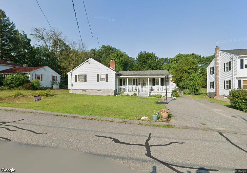
222 Burnham Rd Lowell, MA 01852
Belvidere NeighborhoodEstimated Value: $632,000 - $729,000
4
Beds
2
Baths
2,170
Sq Ft
$312/Sq Ft
Est. Value
About This Home
This home is located at 222 Burnham Rd, Lowell, MA 01852 and is currently estimated at $676,285, approximately $311 per square foot. 222 Burnham Rd is a home located in Middlesex County with nearby schools including Moody Elementary School, Abraham Lincoln Elementary School, and Greenhalge Elementary School.
Ownership History
Date
Name
Owned For
Owner Type
Purchase Details
Closed on
May 2, 2025
Sold by
Destrempe Debra A and Destrempe Raymond G
Bought by
Destrempe Scott A and Destrempe Jeffrey R
Current Estimated Value
Purchase Details
Closed on
Jul 18, 2006
Sold by
Beland Norma L
Bought by
Destrempe Debra A and Beland Norma
Create a Home Valuation Report for This Property
The Home Valuation Report is an in-depth analysis detailing your home's value as well as a comparison with similar homes in the area
Home Values in the Area
Average Home Value in this Area
Purchase History
We collect this data history from publicly available records. To have your information removed, we recommend requesting removal directly through your county’s website.
| Date | Buyer | Sale Price | Title Company |
|---|---|---|---|
| Destrempe Scott A | -- | None Available | |
| Destrempe Scott A | -- | None Available | |
| Destrempe Debra A | -- | -- | |
| Destrempe Debra A | -- | -- |
Source: Public Records
Mortgage History
We collect this data history from publicly available records. To have your information removed, we recommend requesting removal directly through your county’s website.
| Date | Status | Borrower | Loan Amount |
|---|---|---|---|
| Previous Owner | Destrempe Debra A | $121,000 | |
| Previous Owner | Destrempe Debra A | $38,000 |
Source: Public Records
Tax History
| Year | Tax Paid | Tax Assessment Tax Assessment Total Assessment is a certain percentage of the fair market value that is determined by local assessors to be the total taxable value of land and additions on the property. | Land | Improvement |
|---|---|---|---|---|
| 2025 | $6,981 | $608,100 | $249,100 | $359,000 |
| 2024 | $6,593 | $553,600 | $232,800 | $320,800 |
| 2023 | $6,271 | $504,900 | $202,500 | $302,400 |
| 2022 | $5,761 | $454,000 | $178,600 | $275,400 |
| 2021 | $5,591 | $415,400 | $155,600 | $259,800 |
| 2020 | $5,154 | $385,800 | $155,600 | $230,200 |
| 2019 | $5,393 | $384,100 | $148,800 | $235,300 |
| 2018 | $5,166 | $359,000 | $141,700 | $217,300 |
| 2017 | $4,888 | $327,600 | $125,900 | $201,700 |
| 2016 | $4,801 | $316,700 | $119,900 | $196,800 |
| 2015 | $4,824 | $311,600 | $119,900 | $191,700 |
| 2013 | $4,209 | $280,400 | $123,600 | $156,800 |
Source: Public Records
Map
Nearby Homes
- 134 River Rd
- 105 Stafford Rd
- 80 Brigham Ave
- 87 Dancause Rd
- 85 Nassau St
- 57 Garden Rd
- 219 River Rd
- 588 Andover St
- 112 Percy St
- 34 E 6th St
- 81 Reservoir St
- 52 Christian St
- Lots 1-12 Christian Hill Dev
- 82 Christian St
- 333 First Street Blvd Unit 209
- 215 Lexington Rd
- 35 Enfield St
- Lot 11 Christian St
- Lot 12 Christian St
- Lot 9 Christian St
- 214 Burnham Rd
- 72 Russell St
- 230 Burnham Rd
- 64 Russell St
- 213 Burnham Rd
- 221 Burnham Rd
- 205 Burnham Rd
- 192 Burnham Rd
- 227 Burnham Rd
- 238 Burnham Rd
- 95 Wollaston St
- 197 Burnham Rd
- 56 Russell St
- 233 Burnham Rd
- 244 Burnham Rd
- 89 Wollaston St
- 191 Burnham Rd
- 239 Burnham Rd
- 96 Wollaston St
- 115 Fetherston Ave
Your Personal Tour Guide
Ask me questions while you tour the home.