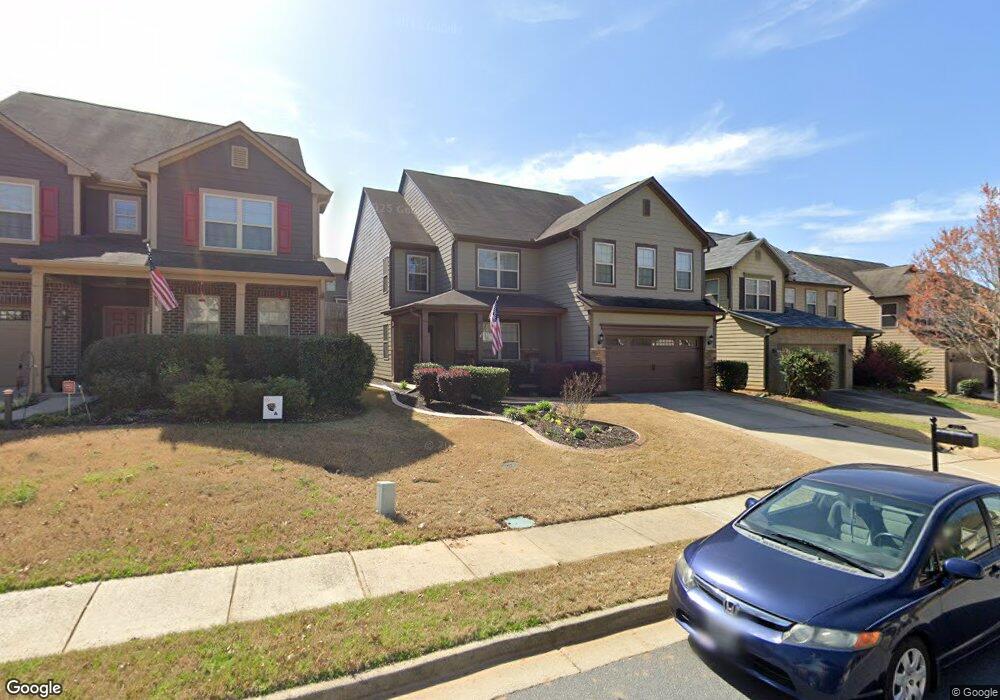
222 Shaw Dr Acworth, GA 30102
Oak Grove NeighborhoodEstimated Value: $473,446 - $499,000
3
Beds
3
Baths
3,130
Sq Ft
$155/Sq Ft
Est. Value
About This Home
This home is located at 222 Shaw Dr, Acworth, GA 30102 and is currently estimated at $486,223, approximately $155 per square foot. 222 Shaw Dr is a home located in Cherokee County with nearby schools including Clark Creek Elementary School, E. T. Booth Middle School, and Etowah High School.
Ownership History
Date
Name
Owned For
Owner Type
Purchase Details
Closed on
Mar 20, 2008
Sold by
Parker Sheila W
Bought by
Parker Luke B and Parker Sheila W
Current Estimated Value
Home Financials for this Owner
Home Financials are based on the most recent Mortgage that was taken out on this home.
Original Mortgage
$77,500
Outstanding Balance
$49,292
Interest Rate
6.22%
Mortgage Type
New Conventional
Estimated Equity
$436,931
Create a Home Valuation Report for This Property
The Home Valuation Report is an in-depth analysis detailing your home's value as well as a comparison with similar homes in the area
Home Values in the Area
Average Home Value in this Area
Purchase History
| Date | Buyer | Sale Price | Title Company |
|---|---|---|---|
| Parker Luke B | -- | -- | |
| Parker Sheila W | $207,500 | -- |
Source: Public Records
Mortgage History
| Date | Status | Borrower | Loan Amount |
|---|---|---|---|
| Open | Parker Sheila W | $77,500 |
Source: Public Records
Tax History
| Year | Tax Paid | Tax Assessment Tax Assessment Total Assessment is a certain percentage of the fair market value that is determined by local assessors to be the total taxable value of land and additions on the property. | Land | Improvement |
|---|---|---|---|---|
| 2025 | $959 | $185,480 | $36,000 | $149,480 |
| 2024 | $929 | $178,320 | $34,000 | $144,320 |
| 2023 | $799 | $181,280 | $34,000 | $147,280 |
| 2022 | $888 | $151,520 | $30,000 | $121,520 |
| 2021 | $853 | $121,960 | $20,000 | $101,960 |
| 2020 | $820 | $112,280 | $20,000 | $92,280 |
| 2019 | $793 | $105,120 | $20,000 | $85,120 |
| 2018 | $786 | $99,640 | $17,600 | $82,040 |
| 2017 | $804 | $248,000 | $19,200 | $80,000 |
| 2016 | $815 | $238,900 | $19,200 | $76,360 |
| 2015 | $817 | $224,400 | $19,200 | $70,560 |
| 2014 | $791 | $206,500 | $14,000 | $68,600 |
Source: Public Records
Map
Nearby Homes
Your Personal Tour Guide
Ask me questions while you tour the home.