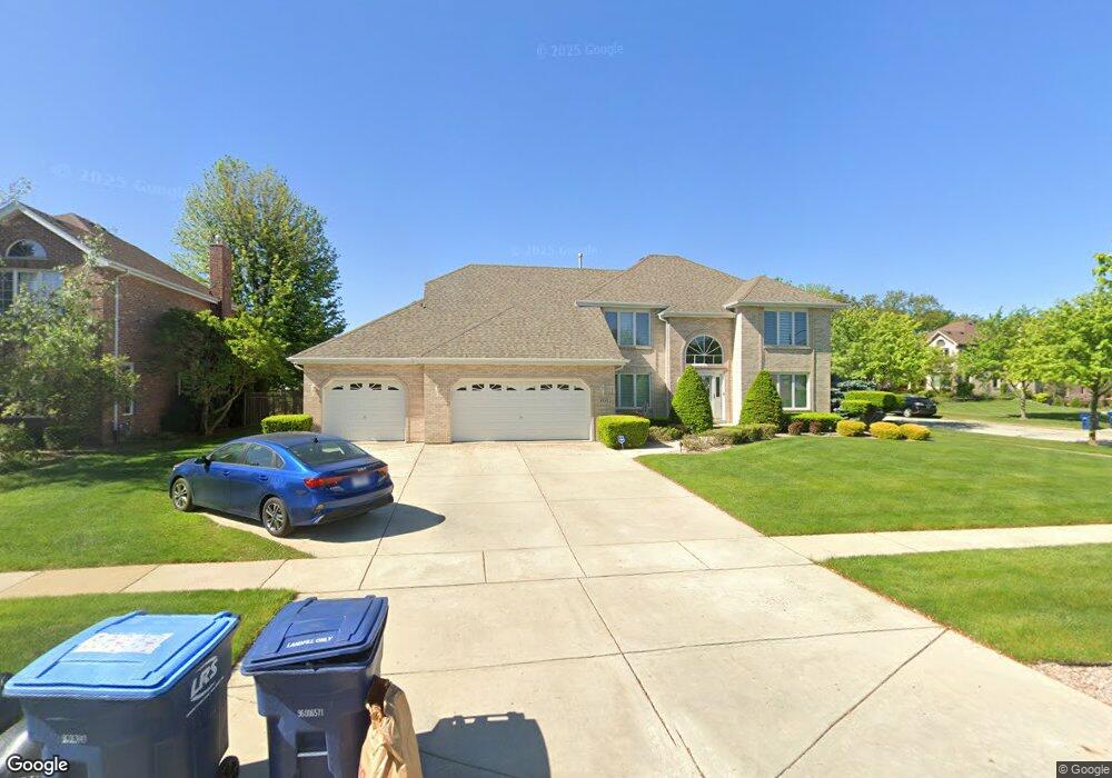
2221 Dunmore Dr Darien, IL 60561
Estimated Value: $767,941 - $922,000
About This Home
This home is located at 2221 Dunmore Dr, Darien, IL 60561 and is currently estimated at $836,485, approximately $273 per square foot. 2221 Dunmore Dr is a home located in DuPage County with nearby schools including Concord Elementary School, Cass Jr High School, and Hinsdale South High School.
Ownership History
We collect this data history from publicly available records. To have your information removed, we recommend requesting removal directly through your county’s website.
Purchase Details
Home Financials for this Owner
Home Financials are based on the most recent Mortgage that was taken out on this home.Home Values in the Area
Average Home Value in this Area
Purchase History
We collect this data history from publicly available records. To have your information removed, we recommend requesting removal directly through your county’s website.
| Date | Buyer | Sale Price | Title Company |
|---|---|---|---|
| $441,500 | -- |
Mortgage History
We collect this data history from publicly available records. To have your information removed, we recommend requesting removal directly through your county’s website.
| Date | Status | Borrower | Loan Amount |
|---|---|---|---|
| Previous Owner | $95,000 |
Tax History
We collect this data history from publicly available records. To have your information removed, we recommend requesting removal directly through your county’s website.
| Year | Tax Paid | Tax Assessment Tax Assessment Total Assessment is a certain percentage of the fair market value that is determined by local assessors to be the total taxable value of land and additions on the property. | Land | Improvement |
|---|---|---|---|---|
| 2024 | $14,322 | $229,699 | $81,639 | $148,060 |
| 2023 | $13,763 | $211,160 | $75,050 | $136,110 |
| 2022 | $13,113 | $201,890 | $71,760 | $130,130 |
| 2021 | $12,176 | $199,590 | $70,940 | $128,650 |
| 2020 | $11,964 | $195,630 | $69,530 | $126,100 |
| 2019 | $11,512 | $187,700 | $66,710 | $120,990 |
| 2018 | $11,320 | $188,440 | $66,290 | $122,150 |
| 2017 | $11,063 | $181,330 | $63,790 | $117,540 |
| 2016 | $12,089 | $192,860 | $60,880 | $131,980 |
| 2015 | $11,864 | $181,450 | $57,280 | $124,170 |
| 2014 | $11,679 | $176,420 | $55,690 | $120,730 |
| 2013 | $11,258 | $175,590 | $55,430 | $120,160 |
Map
- 325 Oldfield Rd
- 315 Oldfield Rd
- 400 Frontage Rd
- 2004 Oldfield Rd
- 8701 Lake Ridge Dr
- 9025 Darien Woods Ct
- 607 Berkshire Ct
- 8904 Lemont Rd
- 8408 Lakeside Dr
- 806 Plainfield Rd
- 704 Plainfield Rd
- 8122 Fairmount Ave
- 9014 Gloucester Rd
- 2963 87th St
- 2985 87th St
- 1263 Harleyford Rd
- 8048 Highland Ave
- 8903 Vail Ln
- 8240 Lemont Rd
- 3020 Spring Green Dr
- 2217 Dunmore Dr
- 8909 Brandon Rd
- 8913 Brandon Rd
- 8900 Kilkenny Dr
- 2301 Dunmore Dr
- 2220 Dunmore Dr
- 8904 Middleton Rd
- 2224 Dunmore Dr
- 2300 Dunmore Dr
- 2305 Dunmore Dr
- 8908 Middleton Rd
- 8904 Kilkenny Dr
- 8904 Kilkenny Dr
- 8901 Kilkenny Dr
- 8917 Brandon Rd
- 2304 Dunmore Dr
- 8912 Middleton Rd
- 8912 Kilkenny Dr
- 8905 Kilkenny Dr
- 8901 Tara Hill Rd
Ask me questions while you tour the home.