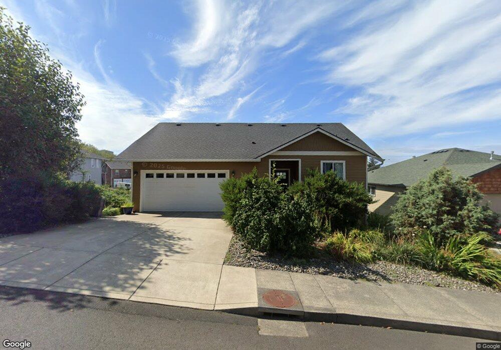
2225 N Fork Rd Seaside, OR 97138
Estimated Value: $582,800 - $738,000
About This Home
This home is located at 2225 N Fork Rd, Seaside, OR 97138 and is currently estimated at $662,200, approximately $294 per square foot. 2225 N Fork Rd is a home located in Clatsop County with nearby schools including Seaside High School.
Ownership History
We collect this data history from publicly available records. To have your information removed, we recommend requesting removal directly through your county’s website.
Purchase Details
Home Financials for this Owner
Home Financials are based on the most recent Mortgage that was taken out on this home.Purchase Details
Home Financials for this Owner
Home Financials are based on the most recent Mortgage that was taken out on this home.Purchase Details
Purchase History
We collect this data history from publicly available records. To have your information removed, we recommend requesting removal directly through your county’s website.
| Date | Buyer | Sale Price | Title Company |
|---|---|---|---|
| $360,000 | Pacific Title Company | ||
| $110,000 | Accommodation | ||
| $660,000 | Pacific Title Company |
Mortgage History
We collect this data history from publicly available records. To have your information removed, we recommend requesting removal directly through your county’s website.
| Date | Status | Borrower | Loan Amount |
|---|---|---|---|
| Open | $288,000 | ||
| Previous Owner | $420,000 |
Tax History
We collect this data history from publicly available records. To have your information removed, we recommend requesting removal directly through your county’s website.
| Year | Tax Paid | Tax Assessment Tax Assessment Total Assessment is a certain percentage of the fair market value that is determined by local assessors to be the total taxable value of land and additions on the property. | Land | Improvement |
|---|---|---|---|---|
| 2025 | $5,344 | $371,893 | -- | -- |
| 2024 | $5,187 | $361,062 | -- | -- |
| 2023 | $5,034 | $350,547 | $0 | $0 |
| 2022 | $4,896 | $340,338 | $0 | $0 |
| 2021 | $4,792 | $330,426 | $0 | $0 |
| 2020 | $4,680 | $320,803 | $0 | $0 |
| 2019 | $4,553 | $311,460 | $0 | $0 |
| 2018 | $4,372 | $302,389 | $0 | $0 |
| 2017 | $3,084 | $223,040 | $0 | $0 |
| 2016 | $492 | $40,979 | $40,979 | $0 |
| 2015 | $574 | $47,650 | $47,650 | $0 |
| 2014 | $640 | $50,157 | $0 | $0 |
| 2013 | -- | $51,709 | $0 | $0 |
Map
- 2285 N Fork Rd
- 2344 Royal View Dr
- 1915 N Fork Ct
- 2316 Royal View Dr
- 2133 Middle Fork Cir
- 1775 Thompson Falls Dr
- 2550 Boehm Acres Rd
- 2657 N Hwy 101 Unit 6
- 0 Cross Creek St Unit 12
- 0 Cross Creek St Unit 10
- 0 Cross Creek St Unit 11
- 0 Cross Creek St Unit 26-112
- 0 Cross Creek St Unit 13
- 0 Cross Creek St Unit 26-114
- 0 Cross Creek St Unit 26-115
- 0 Cross Creek St Unit 26-116
- 0 Cross Creek St Unit 14
- 0 Cross Creek St Unit 26-117
- 2674 U S 101
- 0 N Wahanna Rd
- 2235 N Fork Rd
- 2235 1weuoquzdxbz Fork
- 2235 N Fork
- 2215 N Fork Rd
- 2351 N Fork Rd
- 2351 N Fork Dr
- 2245 N Fork Rd
- 2209 N Fork Rd
- 2240 N Fork Rd
- 2367 N Fork Rd
- 2387 N Fork Rd
- 2203 North Fork Rd
- 2220 North Fork Rd
- 2255 N Fork Rd
- 2337 N Fork Rd
- 2348 N Fork Dr
- 2348 N Fork Rd
- 1915 N Fork Rd
- 0 N Fork Rd Unit 51
- -1 N Fork Rd
Ask me questions while you tour the home.