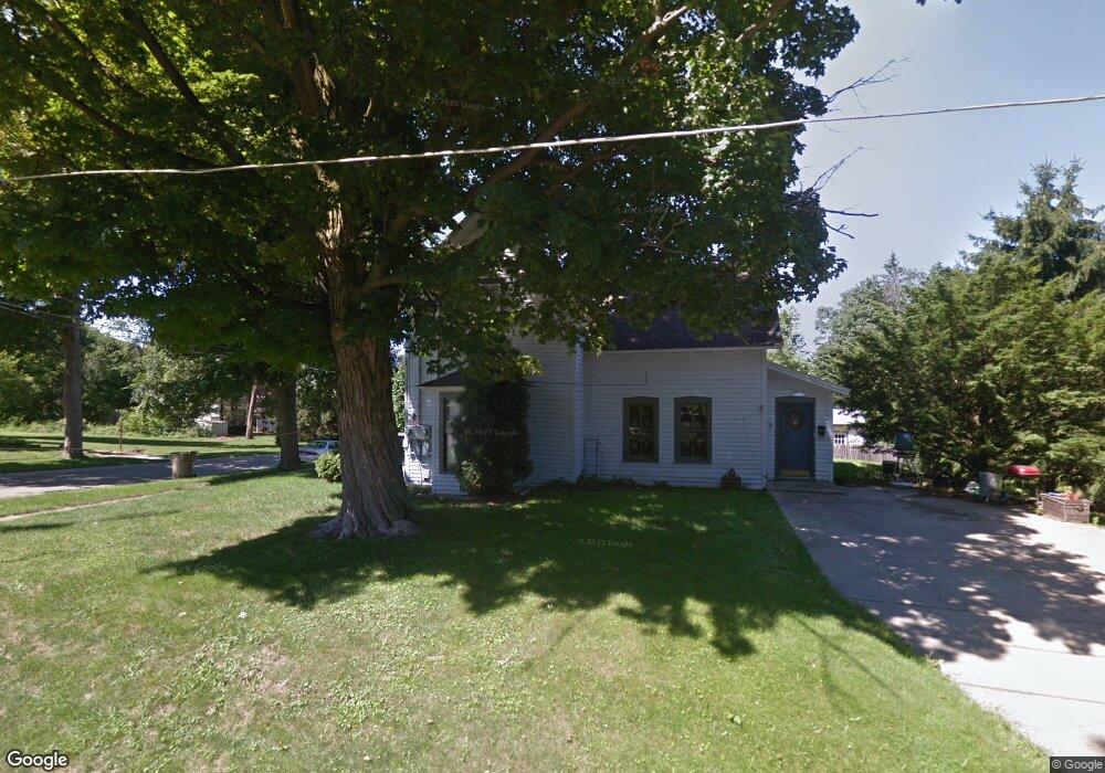
223 Maple St Rockford, MI 49341
Estimated Value: $249,000 - $344,000
About This Home
This home is located at 223 Maple St, Rockford, MI 49341 and is currently estimated at $307,792, approximately $182 per square foot. 223 Maple St is a home located in Kent County with nearby schools including Parkside Elementary School, North Rockford Middle School, and Rockford High School Freshman Center.
Ownership History
We collect this data history from publicly available records. To have your information removed, we recommend requesting removal directly through your county’s website.
Purchase Details
Purchase Details
Home Financials for this Owner
Home Financials are based on the most recent Mortgage that was taken out on this home.Purchase Details
Purchase Details
Home Financials for this Owner
Home Financials are based on the most recent Mortgage that was taken out on this home.Purchase Details
Home Financials for this Owner
Home Financials are based on the most recent Mortgage that was taken out on this home.Purchase Details
Home Financials for this Owner
Home Financials are based on the most recent Mortgage that was taken out on this home.Purchase Details
Purchase Details
Home Values in the Area
Average Home Value in this Area
Purchase History
We collect this data history from publicly available records. To have your information removed, we recommend requesting removal directly through your county’s website.
| Date | Buyer | Sale Price | Title Company |
|---|---|---|---|
| $265,000 | Chicago Title | ||
| $96,500 | Chicago Title Of Michigan | ||
| -- | Ppr Title Agency | ||
| $114,000 | -- | ||
| -- | Fatic | ||
| -- | Fatic | ||
| -- | Michigan Title Company | ||
| -- | Michigan Title Company | ||
| -- | -- | ||
| -- | -- | ||
| $66,500 | -- |
Mortgage History
We collect this data history from publicly available records. To have your information removed, we recommend requesting removal directly through your county’s website.
| Date | Status | Borrower | Loan Amount |
|---|---|---|---|
| Previous Owner | $99,000 | ||
| Previous Owner | $79,800 | ||
| Previous Owner | $65,000 | ||
| Previous Owner | $61,800 |
Tax History
We collect this data history from publicly available records. To have your information removed, we recommend requesting removal directly through your county’s website.
| Year | Tax Paid | Tax Assessment Tax Assessment Total Assessment is a certain percentage of the fair market value that is determined by local assessors to be the total taxable value of land and additions on the property. | Land | Improvement |
|---|---|---|---|---|
| 2025 | $3,110 | $143,500 | $0 | $0 |
| 2024 | $30 | $125,400 | $0 | $0 |
| 2023 | $2,891 | $108,200 | $0 | $0 |
| 2022 | $3,794 | $96,900 | $0 | $0 |
| 2021 | $3,634 | $84,600 | $0 | $0 |
| 2020 | $2,625 | $78,700 | $0 | $0 |
| 2019 | $3,039 | $69,900 | $0 | $0 |
| 2018 | $3,014 | $67,300 | $0 | $0 |
| 2017 | $2,948 | $62,000 | $0 | $0 |
| 2016 | $2,271 | $56,200 | $0 | $0 |
| 2015 | -- | $56,200 | $0 | $0 |
| 2013 | -- | $52,900 | $0 | $0 |
Map
- 227 E Division St
- 165 E Division St NE
- 6652 S Square Ln Unit 49
- 126 N Monroe St
- 148 Tamarack Ln NE Unit 2B
- 144 Tamarack Ln NE Unit 1B
- 155 Tamarack Ln NE
- 151 Tamarack Ln NE
- 140 Krause St
- 5043 New Orleans Dr NE
- 8507 Courtland Dr NE Unit 4
- 245 Helen Dr
- 10410 W Division St NE
- 4611 Windcliff Dr NE Unit 1
- 194 Hunters Ln NE Unit 37
- 213 Hunters Ln NE Unit 21
- 141 Highland Dr
- 217 Hunters Ln NE Unit 6
- 8264 Atlanta Ct NE
- 475 Northland Ct NE
- 223 Maple St Unit A & B
- 223 Maple St NE
- 223 Maple St NE Unit A & B
- 219 Maple St NE
- 219 Maple St
- 21 S Dayton St
- 226 Maple St
- 34 S Fremont St NE
- 30 S Dayton St
- 28 S Fremont St NE
- 15 S Dayton St
- 20 S Fremont St NE
- 24 S Dayton St
- 226 Maple St NE
- 236 Maple St
- 236 Maple St NE
- 206 Maple St
- 18 S Dayton St
- 12 S Fremont St NE
- 220 Maple St
Ask me questions while you tour the home.