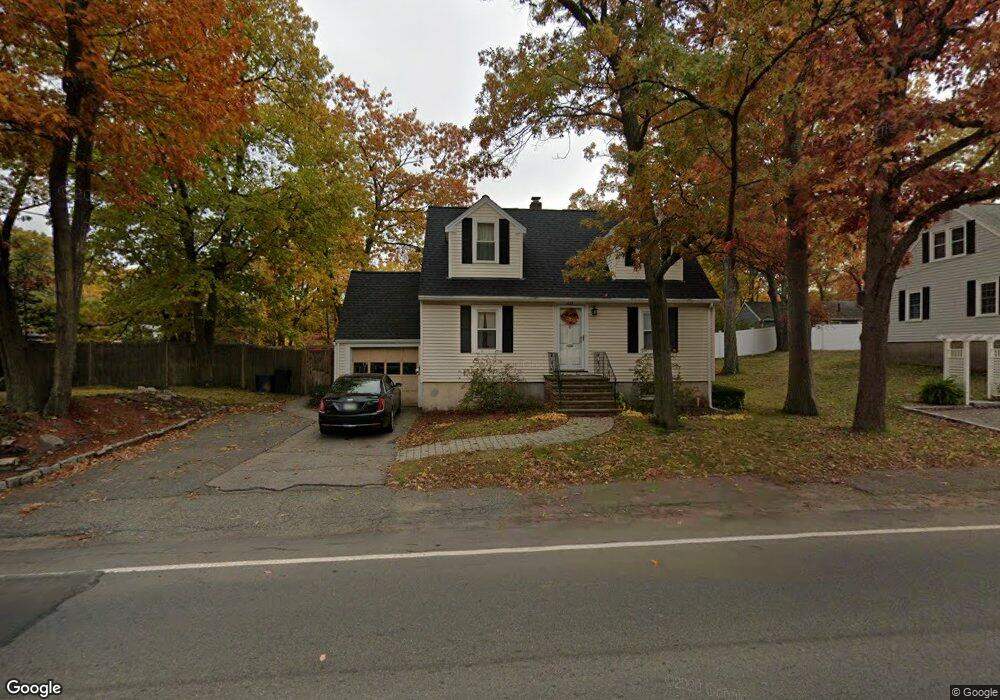
223 Sprague St Dedham, MA 02026
The Manor NeighborhoodEstimated Value: $716,125 - $895,000
3
Beds
2
Baths
1,814
Sq Ft
$443/Sq Ft
Est. Value
About This Home
This home is located at 223 Sprague St, Dedham, MA 02026 and is currently estimated at $803,781, approximately $443 per square foot. 223 Sprague St is a home located in Norfolk County with nearby schools including Greenlodge Elementary School, Dedham Middle School, and Dedham High School.
Ownership History
Date
Name
Owned For
Owner Type
Purchase Details
Closed on
Nov 16, 2023
Sold by
Thomas Roscoe and Thomas Rebecca
Bought by
Rebecca A Thomas Lt and Thomas
Current Estimated Value
Purchase Details
Closed on
Nov 22, 1994
Sold by
Bestwick Patricia A
Bought by
Thomas Roscoe and Thomas Rebecca
Create a Home Valuation Report for This Property
The Home Valuation Report is an in-depth analysis detailing your home's value as well as a comparison with similar homes in the area
Home Values in the Area
Average Home Value in this Area
Purchase History
| Date | Buyer | Sale Price | Title Company |
|---|---|---|---|
| Rebecca A Thomas Lt | -- | None Available | |
| Rebecca A Thomas Lt | -- | None Available | |
| Thomas Roscoe | $146,500 | -- | |
| Thomas Roscoe | $146,500 | -- |
Source: Public Records
Mortgage History
| Date | Status | Borrower | Loan Amount |
|---|---|---|---|
| Previous Owner | Thomas Roscoe | $120,000 | |
| Previous Owner | Thomas Roscoe | $143,114 |
Source: Public Records
Tax History
| Year | Tax Paid | Tax Assessment Tax Assessment Total Assessment is a certain percentage of the fair market value that is determined by local assessors to be the total taxable value of land and additions on the property. | Land | Improvement |
|---|---|---|---|---|
| 2025 | $7,356 | $582,900 | $260,000 | $322,900 |
| 2024 | $7,451 | $596,100 | $246,200 | $349,900 |
| 2023 | $6,973 | $543,100 | $218,600 | $324,500 |
| 2022 | $6,623 | $496,100 | $214,000 | $282,100 |
| 2021 | $6,150 | $449,900 | $209,400 | $240,500 |
| 2020 | $6,045 | $440,600 | $200,100 | $240,500 |
| 2019 | $5,627 | $397,700 | $174,000 | $223,700 |
| 2018 | $5,012 | $344,500 | $155,600 | $188,900 |
| 2017 | $4,940 | $334,700 | $145,800 | $188,900 |
| 2016 | $4,698 | $303,300 | $127,300 | $176,000 |
| 2015 | $4,572 | $288,100 | $120,600 | $167,500 |
| 2014 | $4,404 | $273,900 | $118,000 | $155,900 |
Source: Public Records
Map
Nearby Homes
- 10 Westchester Cir
- 219 Sprague St
- 120 Hillsdale Rd
- 222 Sprague St
- 131 Hillsdale Rd
- 123 Hillsdale Rd
- 234 Sprague St Unit 1
- 234 Sprague St
- 121 Hillsdale Rd
- 114 Hillsdale Rd
- 230 Sprague St
- 18 Westchester Cir
- 235 Sprague St
- 218 Sprague St
- 149 Turner St
- 214 Sprague St
- 15 Westchester Cir
- 210 Sprague St
- 99 Hillsdale Rd
- 250 Sprague St
Your Personal Tour Guide
Ask me questions while you tour the home.