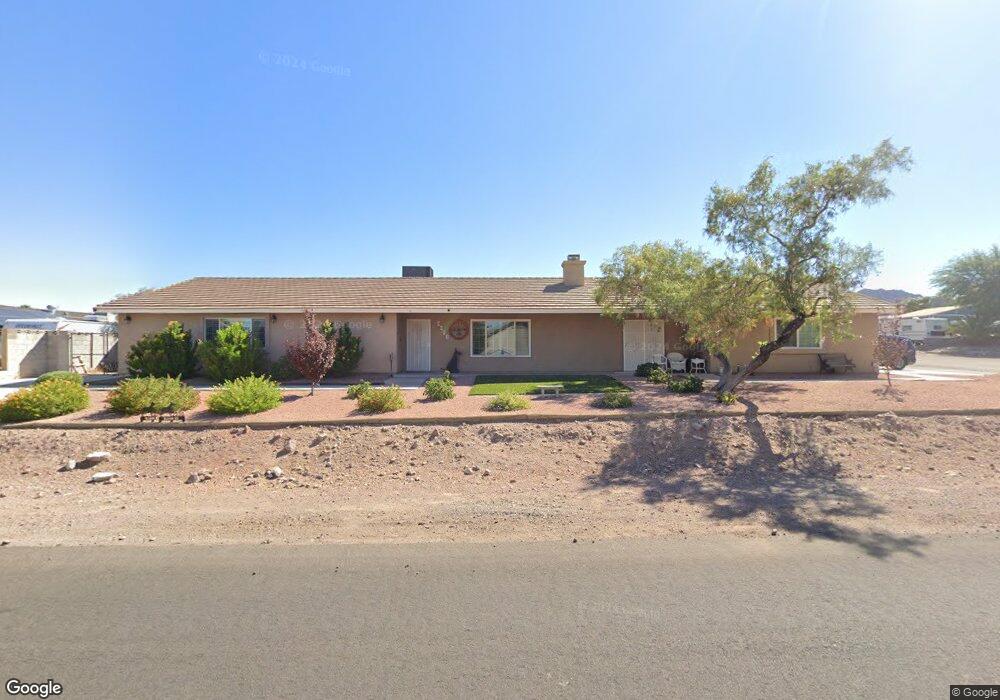
2230 Roan Rd Henderson, NV 89002
River Mountain NeighborhoodEstimated Value: $555,000 - $666,006
4
Beds
4
Baths
2,120
Sq Ft
$291/Sq Ft
Est. Value
About This Home
This home is located at 2230 Roan Rd, Henderson, NV 89002 and is currently estimated at $617,752, approximately $291 per square foot. 2230 Roan Rd is a home located in Clark County with nearby schools including John Dooley Elementary School, B Mahlon Brown Academy of International Studies, and Basic Academy of International Studies.
Ownership History
Date
Name
Owned For
Owner Type
Purchase Details
Closed on
May 9, 2019
Sold by
Johns Sharon
Bought by
Sharon Johns Family Trust
Current Estimated Value
Purchase Details
Closed on
Jul 31, 1996
Sold by
Tontsch William G and Tontsch Mary Ann
Bought by
Johns John G and Johns Sharon
Home Financials for this Owner
Home Financials are based on the most recent Mortgage that was taken out on this home.
Original Mortgage
$128,000
Outstanding Balance
$6,520
Interest Rate
8.2%
Estimated Equity
$611,232
Purchase Details
Closed on
Aug 11, 1995
Sold by
Anderson Ann
Bought by
Tontsch William G and Tontsch Mary Ann
Home Financials for this Owner
Home Financials are based on the most recent Mortgage that was taken out on this home.
Original Mortgage
$100,000
Interest Rate
6.37%
Create a Home Valuation Report for This Property
The Home Valuation Report is an in-depth analysis detailing your home's value as well as a comparison with similar homes in the area
Home Values in the Area
Average Home Value in this Area
Purchase History
| Date | Buyer | Sale Price | Title Company |
|---|---|---|---|
| Sharon Johns Family Trust | -- | None Available | |
| Johns John G | $160,000 | Old Republic Title Company | |
| Tontsch William G | $127,500 | United Title |
Source: Public Records
Mortgage History
| Date | Status | Borrower | Loan Amount |
|---|---|---|---|
| Open | Johns John G | $128,000 | |
| Previous Owner | Tontsch William G | $100,000 |
Source: Public Records
Tax History
| Year | Tax Paid | Tax Assessment Tax Assessment Total Assessment is a certain percentage of the fair market value that is determined by local assessors to be the total taxable value of land and additions on the property. | Land | Improvement |
|---|---|---|---|---|
| 2026 | $2,884 | $140,733 | $53,200 | $87,533 |
| 2025 | $2,800 | $138,855 | $49,000 | $89,855 |
| 2024 | $2,719 | $138,855 | $49,000 | $89,855 |
| 2023 | $2,719 | $137,487 | $52,500 | $84,987 |
| 2022 | $2,642 | $123,938 | $45,500 | $78,438 |
| 2021 | $2,566 | $109,851 | $35,000 | $74,851 |
| 2020 | $2,488 | $116,488 | $42,000 | $74,488 |
| 2019 | $2,459 | $105,107 | $31,500 | $73,607 |
| 2018 | $2,346 | $100,436 | $29,050 | $71,386 |
| 2017 | $2,376 | $83,273 | $28,000 | $55,273 |
| 2016 | $1,728 | $76,779 | $21,000 | $55,779 |
| 2015 | $1,724 | $58,975 | $14,000 | $44,975 |
| 2014 | $1,674 | $59,921 | $14,000 | $45,921 |
Source: Public Records
Map
Nearby Homes
- 1591 Rocking Horse Dr
- 1560 Sundown Dr
- 2413 Gold Camp St
- 1590 Mustang Dr
- 1671 Mustang Dr
- 2199 Maple Shade St
- 2451 Aladdin Lamp St
- 2276 Sky Island Dr
- 2289 Sky Island Dr
- 1596 Rusty Ridge Ln
- 1586 Rusty Ridge Ln
- 2001 Appaloosa Rd
- 1305 Paseo Del Oso Ln
- 2502 Crafty Clint Ln
- 1571 Rusty Ridge Ln
- 1294 Paseo Del Oso Ln
- 2031 Buckeye Reef St
- 1557 Ward Frontier Ln
- 2169 Rio Rancho Pointe Place
- 2002 Darla St
- 1610 Stirrup Dr
- 1601 Sundown Dr
- 1590 Stirrup Dr
- 1611 Sundown Dr
- 1601 Stirrup Dr
- 1591 Sundown Dr
- 1611 Stirrup Dr
- 1620 Stirrup Dr
- 0 Sundown Dr
- 1621 Sundown Dr
- 1580 Stirrup Dr
- 1621 Stirrup Dr
- 1590 Tumbleweed Dr
- 1581 Sundown Dr
- 1600 Sundown Dr
- 1600 Tumbleweed Dr
- 1610 Sundown Dr
- 1610 Tumbleweed Dr
- 1581 Stirrup
- 1631 Stirrup Dr
Your Personal Tour Guide
Ask me questions while you tour the home.