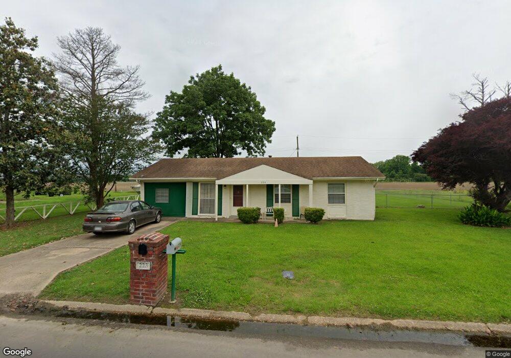
224 Gibson Cir Dermott, AR 71638
Estimated Value: $71,000 - $90,000
Studio
2
Baths
1,474
Sq Ft
$53/Sq Ft
Est. Value
About This Home
This home is located at 224 Gibson Cir, Dermott, AR 71638 and is currently estimated at $78,503, approximately $53 per square foot. 224 Gibson Cir is a home located in Chicot County with nearby schools including Dermott Elementary School and Dermott High School.
Ownership History
Date
Name
Owned For
Owner Type
Purchase Details
Closed on
Apr 10, 2026
Sold by
Shelton Michael and Shelton Tina D
Bought by
Dean Arnetia
Current Estimated Value
Purchase Details
Closed on
Aug 15, 2025
Sold by
Shelton Michael and Shelton Tina
Bought by
Dean Arnetia K
Purchase Details
Closed on
Aug 6, 2002
Bought by
Tina Shelton Etvir
Purchase Details
Closed on
Jul 16, 2002
Bought by
Tina Shelton Etvir
Purchase Details
Closed on
Jun 26, 2002
Bought by
Sec Housing/Urban Development
Purchase Details
Closed on
Oct 10, 2001
Bought by
Sec and Housing
Purchase Details
Closed on
Jun 19, 2001
Bought by
Mortgage Elect Regist Syst Inc
Purchase Details
Closed on
Jul 1, 1988
Bought by
From
Purchase Details
Closed on
Nov 1, 1973
Bought by
From
Create a Home Valuation Report for This Property
The Home Valuation Report is an in-depth analysis detailing your home's value as well as a comparison with similar homes in the area
Home Values in the Area
Average Home Value in this Area
Purchase History
We collect this data history from publicly available records. To have your information removed, we recommend requesting removal directly through your county’s website.
| Date | Buyer | Sale Price | Title Company |
|---|---|---|---|
| Dean Arnetia | -- | None Listed On Document | |
| Dean Arnetia K | -- | None Listed On Document | |
| Tina Shelton Etvir | -- | -- | |
| Tina Shelton Etvir | -- | -- | |
| Sec Housing/Urban Development | -- | -- | |
| Sec | -- | -- | |
| Mortgage Elect Regist Syst Inc | -- | -- | |
| From | -- | -- | |
| From | -- | -- |
Source: Public Records
Tax History
| Year | Tax Paid | Tax Assessment Tax Assessment Total Assessment is a certain percentage of the fair market value that is determined by local assessors to be the total taxable value of land and additions on the property. | Land | Improvement |
|---|---|---|---|---|
| 2025 | $674 | $10,040 | $380 | $9,660 |
| 2024 | $566 | $10,040 | $380 | $9,660 |
| 2023 | $556 | $9,980 | $380 | $9,600 |
| 2022 | $650 | $9,980 | $380 | $9,600 |
| 2021 | $611 | $9,980 | $380 | $9,600 |
| 2020 | $477 | $9,980 | $380 | $9,600 |
| 2019 | $528 | $9,980 | $380 | $9,600 |
| 2018 | $459 | $7,050 | $750 | $6,300 |
| 2017 | $398 | $7,050 | $750 | $6,300 |
| 2016 | $451 | $7,050 | $750 | $6,300 |
| 2015 | -- | $7,050 | $750 | $6,300 |
| 2014 | -- | $7,050 | $750 | $6,300 |
| 2013 | -- | $7,050 | $750 | $6,300 |
Source: Public Records
Map
Nearby Homes
- 410 S Trotter St
- 1014 W Daniels St
- 0 0 Unit N Norwood St
- 933 Skipper Bridge Rd
- Lot 7 W Ash St
- 305 N School St
- 604 E Howard St
- 407 N Shepherd St
- Lot 6 N Knox St
- 0 N Trotter St
- Lot 6 N Alma St
- 0 Arkansas 35
- Lot 1 N Hardy St
- 0 Wolfe St
- Lots 10-11 Wolfe St
- 0 N Main St
- 0 E Hickory St
- Lot 12 W Mulberry St
- 0 W Mulberry St
- Lot 7 N Wolf St
Your Personal Tour Guide
Ask me questions while you tour the home.