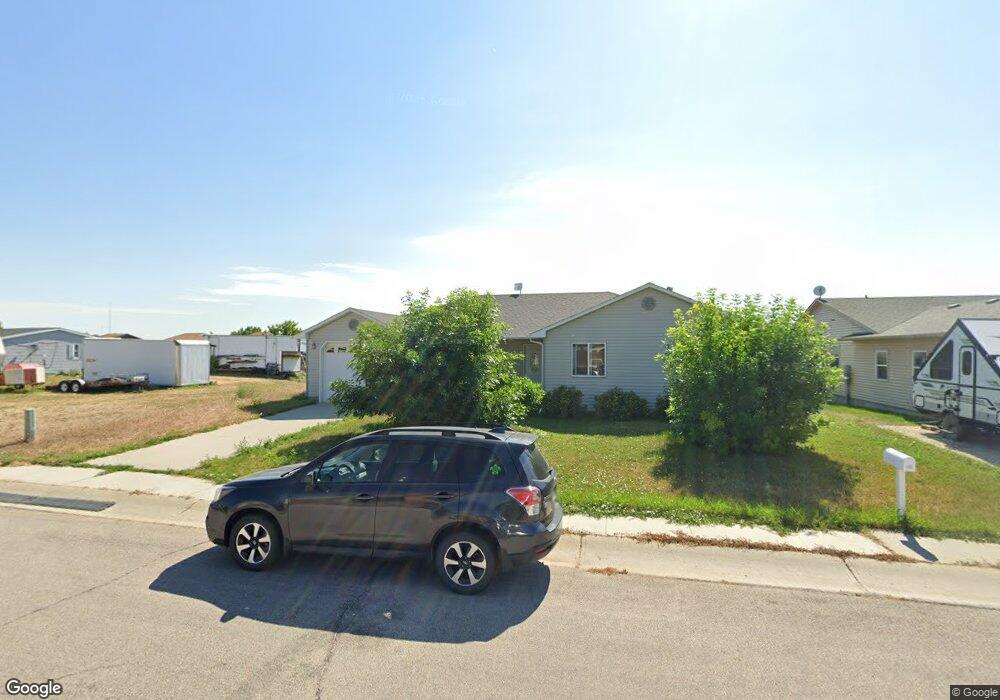
225 Angus Loop Douglas, WY 82633
Estimated Value: $271,000 - $335,000
3
Beds
3
Baths
3,194
Sq Ft
$95/Sq Ft
Est. Value
About This Home
This home is located at 225 Angus Loop, Douglas, WY 82633 and is currently estimated at $303,157, approximately $94 per square foot. 225 Angus Loop is a home located in Converse County with nearby schools including Douglas High School.
Ownership History
Date
Name
Owned For
Owner Type
Purchase Details
Closed on
Apr 8, 2022
Sold by
Thomas Trammell Donald
Bought by
Trammell Daniel Thomas and Trammell Michael
Current Estimated Value
Home Financials for this Owner
Home Financials are based on the most recent Mortgage that was taken out on this home.
Original Mortgage
$277,777
Outstanding Balance
$258,038
Interest Rate
3.89%
Mortgage Type
New Conventional
Estimated Equity
$45,119
Purchase Details
Closed on
Oct 16, 2006
Sold by
Paquette Chris S and Paquette Brandi L
Bought by
Trammell Don T and Trammell Cecil Ann
Create a Home Valuation Report for This Property
The Home Valuation Report is an in-depth analysis detailing your home's value as well as a comparison with similar homes in the area
Home Values in the Area
Average Home Value in this Area
Purchase History
| Date | Buyer | Sale Price | Title Company |
|---|---|---|---|
| Trammell Daniel Thomas | -- | None Listed On Document | |
| Trammell Don T | -- | None Availabel |
Source: Public Records
Mortgage History
| Date | Status | Borrower | Loan Amount |
|---|---|---|---|
| Open | Trammell Daniel Thomas | $277,777 |
Source: Public Records
Tax History
| Year | Tax Paid | Tax Assessment Tax Assessment Total Assessment is a certain percentage of the fair market value that is determined by local assessors to be the total taxable value of land and additions on the property. | Land | Improvement |
|---|---|---|---|---|
| 2025 | $1,632 | $19,076 | $2,768 | $16,308 |
| 2024 | $1,632 | $24,599 | $3,691 | $20,908 |
| 2023 | $1,705 | $25,545 | $3,691 | $21,854 |
| 2022 | $1,511 | $22,486 | $3,515 | $18,971 |
| 2021 | $1,493 | $21,960 | $3,515 | $18,445 |
| 2020 | $1,450 | $21,729 | $3,515 | $18,214 |
| 2019 | $1,375 | $20,531 | $3,515 | $17,016 |
| 2018 | $1,305 | $19,825 | $3,515 | $16,310 |
| 2017 | $1,438 | $21,803 | $3,515 | $18,288 |
| 2015 | $1,452 | $22,078 | $3,480 | $18,598 |
| 2014 | $1,349 | $20,461 | $3,620 | $16,841 |
Source: Public Records
Map
Nearby Homes
- 217 S Windriver Dr
- 807 Leal St
- 935 Flicker St
- 0 S Riverbend Dr Unit 20231853
- 401 S Russell Lot 46 Ave
- 401 S Russell Lot 175 Ave
- 401 S Russell Lot 116 Ave
- 1901 Cold Springs Rd
- 0 W Richards St
- 1261 Sweetwater Rd
- 670 N Wind River Dr
- 1384 Sweetwater Rd
- 1102 N Riverbend Dr
- 981 Meadowlark Dr
- 1092 Riverbend Dr
- 326 1/2 N 3rd St
- 232 N 5th St
- 340 Hobbit Hole Dr
- 600 Birch St
- 610 Charles St
- 229 Angus Loop
- 240 Laprele Dr
- 238 La Prele Dr
- 238 Laprele Dr
- 230 La Prele Dr Unit Pearson
- 230 La Prele Dr
- 217 Angus Loop
- 246 Laprele Dr
- 248 Laprele Dr
- 233 Angus Loop
- 254 Laprele Dr
- 224 Laprele Dr
- 222 Angus Loop
- 256 Laprele Dr
- 222 Laprele Dr
- 226 Angus Loop
- 237 Angus Loop
- 213 Angus Loop
- 262 Laprele Dr
- 216 Laprele Dr
Your Personal Tour Guide
Ask me questions while you tour the home.