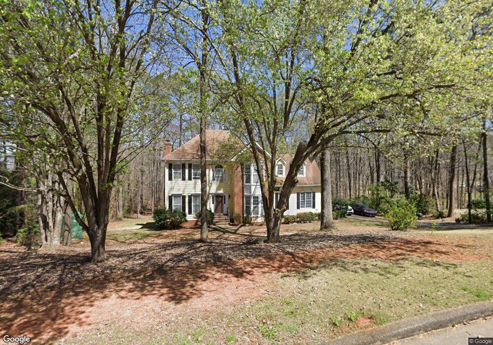
225 Ashford Cir Lagrange, GA 30240
Estimated Value: $380,561 - $423,000
About This Home
This home is located at 225 Ashford Cir, Lagrange, GA 30240 and is currently estimated at $400,890, approximately $156 per square foot. 225 Ashford Cir is a home located in Troup County with nearby schools including Franklin Forest Elementary School, Hollis Hand Elementary School, and Ethel W. Kight Elementary School.
Ownership History
We collect this data history from publicly available records. To have your information removed, we recommend requesting removal directly through your county’s website.
Purchase Details
Purchase Details
Purchase Details
Purchase History
We collect this data history from publicly available records. To have your information removed, we recommend requesting removal directly through your county’s website.
| Date | Buyer | Sale Price | Title Company |
|---|---|---|---|
| $226,000 | -- | ||
| $172,500 | -- | ||
| -- | -- |
Tax History
We collect this data history from publicly available records. To have your information removed, we recommend requesting removal directly through your county’s website.
| Year | Tax Paid | Tax Assessment Tax Assessment Total Assessment is a certain percentage of the fair market value that is determined by local assessors to be the total taxable value of land and additions on the property. | Land | Improvement |
|---|---|---|---|---|
| 2025 | $3,789 | $145,200 | $18,000 | $127,200 |
| 2024 | $3,577 | $133,160 | $18,000 | $115,160 |
| 2023 | $3,232 | $120,480 | $14,000 | $106,480 |
| 2022 | $3,089 | $112,680 | $14,000 | $98,680 |
| 2021 | $2,753 | $93,280 | $14,000 | $79,280 |
| 2020 | $2,753 | $93,280 | $14,000 | $79,280 |
| 2019 | $2,734 | $92,640 | $16,000 | $76,640 |
| 2018 | $2,734 | $92,640 | $16,000 | $76,640 |
| 2017 | $2,734 | $92,640 | $16,000 | $76,640 |
| 2016 | $2,712 | $91,896 | $16,000 | $75,896 |
| 2015 | $2,717 | $91,896 | $16,000 | $75,896 |
| 2014 | $2,264 | $90,331 | $16,000 | $74,331 |
| 2013 | -- | $98,600 | $16,000 | $82,600 |
Map
- 216 Ashford Cir
- 312 Ashford Cir
- 103 Windridge
- 205 River Oaks Dr
- 107 Windridge
- 129 Lismore Dr
- 109 Windridge
- 209 River Oaks Dr
- 406 Ashford Cir
- 103 Woodchase
- 117 Woodchase
- 501 Ashford Cir
- 413 Ashford Cir
- 118 Sunny Point Cir
- 118 Woodchase
- 101 Ridgeview Dr
- 91 Richmond Dr
- 127 Ashling Dr
- 130 Sunny Point Cir
- 132 Sunny Point Cir
- 227 Ashford Cir
- 223 Ashford Cir
- 222 Ashford Cir
- 229 Ashford Cir
- 221 Ashford Cir
- 97 Windridge
- 220 Ashford Cir
- 224 Ashford Cir
- 96 Windridge
- 219 Ashford Cir
- 121 Red Oak Trail
- 119 Red Oak Trail
- 100 Saint Angela Merici Ct
- 218 Ashford Cir
- 123 Red Oak Trail
- 120 Moss Creek Dr
- 233 Ashford Cir
- 217 Ashford Cir
- 117 Red Oak Trail
- 102 Saint Angela Merici Ct
Ask me questions while you tour the home.