Estimated Value: $213,000 - $225,000
2
Beds
3
Baths
1,302
Sq Ft
$170/Sq Ft
Est. Value
About This Home
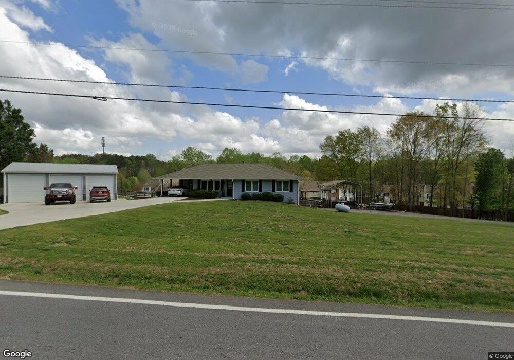
This home is located at 225 Enterprise Path, Hiram, GA 30141 and is currently estimated at $221,949, approximately $170 per square foot. 225 Enterprise Path is a home located in Paulding County with nearby schools including Hiram Elementary School, P. B. Ritch Middle School, and Hiram High School.
Ownership History
Date
Name
Owned For
Owner Type
Purchase Details
Closed on
Nov 29, 2007
Sold by
Humphrey Barry J and Humphrey Patricia A
Bought by
Davis Sharon S
Current Estimated Value
Home Financials for this Owner
Home Financials are based on the most recent Mortgage that was taken out on this home.
Original Mortgage
$94,905
Outstanding Balance
$58,166
Interest Rate
6.22%
Mortgage Type
New Conventional
Estimated Equity
$163,783
Purchase Details
Closed on
Feb 27, 2003
Sold by
Secretary and Hud
Bought by
Humphrey Barry J and Humphrey Patricia A
Home Financials for this Owner
Home Financials are based on the most recent Mortgage that was taken out on this home.
Original Mortgage
$71,325
Interest Rate
5.82%
Mortgage Type
New Conventional
Purchase Details
Closed on
Jun 5, 2002
Sold by
Chase Manhattan Mortgage Corp
Purchase Details
Closed on
Jun 4, 2002
Sold by
Besley Manuel A
Purchase Details
Closed on
Jun 4, 2001
Sold by
Regions Bank
Home Financials for this Owner
Home Financials are based on the most recent Mortgage that was taken out on this home.
Original Mortgage
$92,000
Interest Rate
6.95%
Mortgage Type
New Conventional
Purchase Details
Closed on
May 14, 2001
Sold by
Besley Manuel A
Home Financials for this Owner
Home Financials are based on the most recent Mortgage that was taken out on this home.
Original Mortgage
$92,000
Interest Rate
6.95%
Mortgage Type
New Conventional
Purchase Details
Closed on
May 13, 2001
Sold by
Westwinds Development Inc
Home Financials for this Owner
Home Financials are based on the most recent Mortgage that was taken out on this home.
Original Mortgage
$92,000
Interest Rate
6.95%
Mortgage Type
New Conventional
Purchase Details
Closed on
May 12, 2001
Sold by
Steve Simpson Investments Inc
Home Financials for this Owner
Home Financials are based on the most recent Mortgage that was taken out on this home.
Original Mortgage
$92,000
Interest Rate
6.95%
Mortgage Type
New Conventional
Purchase Details
Closed on
Apr 26, 2001
Sold by
West Winds Development Inc
Bought by
Besley Manuel A
Home Financials for this Owner
Home Financials are based on the most recent Mortgage that was taken out on this home.
Original Mortgage
$92,000
Interest Rate
6.95%
Mortgage Type
New Conventional
Create a Home Valuation Report for This Property
The Home Valuation Report is an in-depth analysis detailing your home's value as well as a comparison with similar homes in the area
Home Values in the Area
Average Home Value in this Area
Purchase History
| Date | Buyer | Sale Price | Title Company |
|---|---|---|---|
| Davis Sharon S | $99,900 | -- | |
| Humphrey Barry J | -- | -- | |
| -- | -- | -- | |
| -- | $96,600 | -- | |
| -- | $96,600 | -- | |
| -- | -- | -- | |
| -- | -- | -- | |
| -- | $93,500 | -- | |
| -- | -- | -- | |
| Besley Manuel A | $93,500 | -- |
Source: Public Records
Mortgage History
| Date | Status | Borrower | Loan Amount |
|---|---|---|---|
| Open | Davis Sharon S | $94,905 | |
| Previous Owner | -- | $71,325 | |
| Previous Owner | Besley Manuel A | $92,000 |
Source: Public Records
Tax History
| Year | Tax Paid | Tax Assessment Tax Assessment Total Assessment is a certain percentage of the fair market value that is determined by local assessors to be the total taxable value of land and additions on the property. | Land | Improvement |
|---|---|---|---|---|
| 2025 | $578 | $100,460 | $12,000 | $88,460 |
| 2024 | $569 | $87,576 | $12,000 | $75,576 |
| 2023 | $679 | $87,672 | $12,000 | $75,672 |
| 2022 | $1,181 | $75,764 | $12,000 | $63,764 |
| 2021 | $1,598 | $54,992 | $6,000 | $48,992 |
| 2020 | $1,564 | $52,644 | $6,000 | $46,644 |
| 2019 | $1,501 | $49,812 | $6,000 | $43,812 |
| 2018 | $1,111 | $36,868 | $4,000 | $32,868 |
| 2017 | $959 | $31,388 | $4,000 | $27,388 |
| 2016 | $909 | $30,048 | $4,000 | $26,048 |
| 2015 | $936 | $30,428 | $4,000 | $26,428 |
| 2014 | $633 | $20,052 | $4,000 | $16,052 |
| 2013 | -- | $16,080 | $4,000 | $12,080 |
Source: Public Records
Map
Nearby Homes
- 209 Enterprise Path
- 137 Venture Path
- 636 Hardy Way
- 301 C W Sims Rd
- 371 C W Sims Rd
- 107 Hardy Way
- 241 Hardy Way
- 132 Hardy Way
- 000 Us Highway 278
- 89 Hiram Park Ct
- 264 Denver Ave
- 329 Hiram Douglasville Hwy
- 28 Greystone Ridge
- 132 Highland Falls Dr
- 263 Hiram Douglasville Hwy
- 0 Old Mill Rd Unit 10687112
- 100 Highland Falls Dr
- 491 Hiram Douglasville Hwy
- 295 Hiram Acworth Hwy
- 277 Highland Falls Blvd
- 229 Enterprise Path
- 221 Enterprise Path
- 233 Enterprise Path
- 217 Enterprise Path
- 217 Enterprise Path Unit 1
- 217 Enterprise Path Unit 217
- 237 Enterprise Path
- 213 Enterprise Path
- 241 Enterprise Path
- 205 Enterprise Path
- 245 Enterprise Path
- 201 Enterprise Path Unit 201
- 201 Enterprise Path
- 201 Enterprise Path
- 253 Enterprise Path
- 253 Enterprise Path Unit 252
- 253 Enterprise Path Unit 2
- 253 Enterprise Path Unit 253
- 249 Enterprise Path
- 249 Enterprise Path Unit 249
Your Personal Tour Guide
Ask me questions while you tour the home.