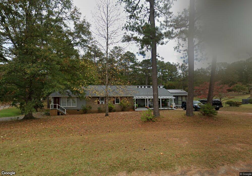
225 Roberta Rd Manchester, GA 31816
Estimated Value: $172,000 - $255,000
3
Beds
3
Baths
2,629
Sq Ft
$83/Sq Ft
Est. Value
About This Home
This home is located at 225 Roberta Rd, Manchester, GA 31816 and is currently estimated at $217,761, approximately $82 per square foot. 225 Roberta Rd is a home located in Meriwether County with nearby schools including Mountain View Elementary School, Manchester Middle School, and Manchester High School.
Ownership History
Date
Name
Owned For
Owner Type
Purchase Details
Closed on
Mar 29, 2019
Sold by
Us Bank Trust National Association
Bought by
Shaffer Karen E
Current Estimated Value
Purchase Details
Closed on
Sep 4, 2018
Sold by
Davidson Angelia S
Bought by
Us Bank Trust National Association Trust
Purchase Details
Closed on
Dec 13, 2002
Sold by
Connell James C and Connell Pe
Bought by
Davidson Christopher
Purchase Details
Closed on
Oct 1, 1995
Sold by
Roberts Doris and Roberts Edwa
Bought by
Connell James C and Connell Pe
Purchase Details
Closed on
Jan 1, 1979
Bought by
Roberts Doris and Roberts Edwa
Create a Home Valuation Report for This Property
The Home Valuation Report is an in-depth analysis detailing your home's value as well as a comparison with similar homes in the area
Home Values in the Area
Average Home Value in this Area
Purchase History
| Date | Buyer | Sale Price | Title Company |
|---|---|---|---|
| Shaffer Karen E | $70,000 | -- | |
| Us Bank Trust National Association Trust | -- | -- | |
| Davidson Christopher | -- | -- | |
| Davidson Christopher | $133,000 | -- | |
| Connell James C | $3,800 | -- | |
| Roberts Doris | $3,500 | -- |
Source: Public Records
Tax History
| Year | Tax Paid | Tax Assessment Tax Assessment Total Assessment is a certain percentage of the fair market value that is determined by local assessors to be the total taxable value of land and additions on the property. | Land | Improvement |
|---|---|---|---|---|
| 2025 | $1,540 | $66,680 | $5,960 | $60,720 |
| 2024 | $1,584 | $65,040 | $5,960 | $59,080 |
| 2023 | $1,495 | $45,080 | $5,960 | $39,120 |
| 2022 | $1,495 | $45,080 | $5,960 | $39,120 |
| 2021 | $1,585 | $47,000 | $5,960 | $41,040 |
| 2020 | $926 | $47,000 | $5,960 | $41,040 |
| 2019 | $1,666 | $47,000 | $5,960 | $41,040 |
| 2018 | $1,865 | $63,920 | $7,480 | $56,440 |
| 2017 | $1,885 | $63,920 | $7,480 | $56,440 |
| 2016 | $1,678 | $63,920 | $7,480 | $56,440 |
| 2015 | $1,681 | $63,920 | $7,480 | $56,440 |
| 2014 | $1,682 | $63,920 | $7,480 | $56,440 |
| 2013 | -- | $63,920 | $7,480 | $56,440 |
Source: Public Records
Map
Nearby Homes
- 2563 Roosevelt Hwy
- 4181 Roosevelt Hwy
- 802 Jd Parham Dr
- 0 W Main St Unit 228104
- 403 W Broxton Ln
- 1188 Phil Howe Rd
- 504 Webster Dr
- 514 Farris Blvd
- 921 Mccurdy Blvd
- 522 4th St
- 825 Mccurdy Blvd
- 709 Jenni Ln
- 410 W 3rd St
- 907 Mayes Way
- 604 Farris Blvd
- 1425 River Rd
- 731 Jenni Ln
- 617 Mayes Way
- 28 Johnson Ave
- 307 3rd Ave
Your Personal Tour Guide
Ask me questions while you tour the home.