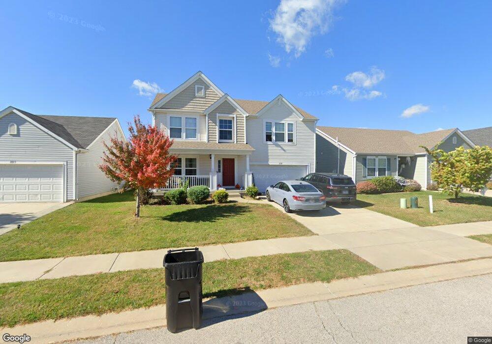
227 Sparrow Point Ln Belleville, IL 62221
Estimated Value: $264,000 - $333,000
About This Home
This home is located at 227 Sparrow Point Ln, Belleville, IL 62221 and is currently estimated at $294,540, approximately $216 per square foot. 227 Sparrow Point Ln is a home with nearby schools including Mascoutah High School and Zion Lutheran School Belleville.
Ownership History
We collect this data history from publicly available records. To have your information removed, we recommend requesting removal directly through your county’s website.
Purchase Details
Purchase Details
Home Financials for this Owner
Home Financials are based on the most recent Mortgage that was taken out on this home.Home Values in the Area
Average Home Value in this Area
Purchase History
We collect this data history from publicly available records. To have your information removed, we recommend requesting removal directly through your county’s website.
| Date | Buyer | Sale Price | Title Company |
|---|---|---|---|
| -- | Benchmark Title Company | ||
| $185,500 | Pgp Title Inc |
Mortgage History
We collect this data history from publicly available records. To have your information removed, we recommend requesting removal directly through your county’s website.
| Date | Status | Borrower | Loan Amount |
|---|---|---|---|
| Previous Owner | $185,480 |
Tax History
We collect this data history from publicly available records. To have your information removed, we recommend requesting removal directly through your county’s website.
| Year | Tax Paid | Tax Assessment Tax Assessment Total Assessment is a certain percentage of the fair market value that is determined by local assessors to be the total taxable value of land and additions on the property. | Land | Improvement |
|---|---|---|---|---|
| 2024 | -- | $84,262 | $12,075 | $72,187 |
| 2023 | -- | $77,283 | $11,837 | $65,446 |
| 2022 | $0 | $69,574 | $10,656 | $58,918 |
| 2021 | $0 | $64,319 | $9,851 | $54,468 |
| 2020 | $5,516 | $60,824 | $9,316 | $51,508 |
| 2019 | $5,516 | $58,996 | $9,331 | $49,665 |
| 2018 | $5,424 | $57,720 | $9,129 | $48,591 |
| 2017 | $5,424 | $57,314 | $9,065 | $48,249 |
| 2016 | $5,332 | $56,096 | $8,872 | $47,224 |
| 2014 | $419 | $5,050 | $328 | $4,722 |
Map
- 2781 Cedar Grove Dr
- 2798 London Ln
- 2528 Commons Pkwy
- 2520 Welsch Dr
- 3220 Eastridge Dr
- 916 Crosswinds Dr
- 3280 Springbrook Dr
- 425 Weatherstone Dr
- 37 Hemlock Dr
- 4 Shady Ln
- 10 Fawnlily Dr
- 320 Sumter Dr
- 241 Brookmanor Ct
- 365 Bunker Hill Rd
- 1501 Vicksburg Dr
- 33 Fawnlily Dr
- 2766 Brookmeadow Dr
- 3219 Cloverridge Ln
- 240 Sundew Dr
- 15 Moonglow Dr
- 211 Sparrow Point Ln
- 207 Sparrow Point Ln
- 215 Sparrow Point Ln
- 223 Sparrow Point Ln
- 2641 Commons Pkwy
- 2637 Commons Pkwy
- 204 Greenleaf Cir
- 2633 Commons Pkwy
- 216 Sparrow Point Ln
- 220 Sparrow Point Ln
- 212 Sparrow Point Ln
- 208 Sparrow Point Ln
- 2629 Commons Pkwy
- 224 Sparrow Point Ln
- 204 Sparrow Point Ln
- 208 Greenleaf Cir
- 231 Sparrow Point Ln
- 2625 Commons Pkwy
- 200 Greenleaf Cir
- 2701 Commons Pkwy
Ask me questions while you tour the home.