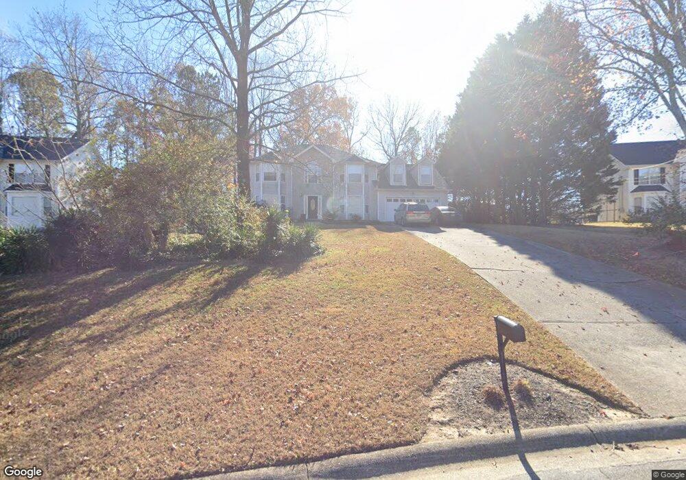
2272 Rocksram Ct Unit 3 Buford, GA 30519
Estimated Value: $382,000 - $433,000
4
Beds
3
Baths
2,512
Sq Ft
$160/Sq Ft
Est. Value
About This Home
This home is located at 2272 Rocksram Ct Unit 3, Buford, GA 30519 and is currently estimated at $402,254, approximately $160 per square foot. 2272 Rocksram Ct Unit 3 is a home located in Gwinnett County with nearby schools including Woodward Mill Elementary School, Twin Rivers Middle School, and Mountain View High School.
Ownership History
Date
Name
Owned For
Owner Type
Purchase Details
Closed on
Jun 1, 2012
Sold by
Deutsche Bank National Tru
Bought by
E T Co
Current Estimated Value
Purchase Details
Closed on
May 3, 2011
Sold by
Samuel Bridgette
Bought by
Deutsche Bank Series 2005-R6
Purchase Details
Closed on
Apr 9, 2004
Sold by
Mcmahan Debra
Bought by
Samuel Bridgette
Home Financials for this Owner
Home Financials are based on the most recent Mortgage that was taken out on this home.
Original Mortgage
$116,800
Interest Rate
9.1%
Mortgage Type
New Conventional
Purchase Details
Closed on
Oct 13, 1993
Sold by
Countryside Inv Co
Bought by
Bonelli Vern J Debra
Home Financials for this Owner
Home Financials are based on the most recent Mortgage that was taken out on this home.
Original Mortgage
$84,550
Interest Rate
6.81%
Create a Home Valuation Report for This Property
The Home Valuation Report is an in-depth analysis detailing your home's value as well as a comparison with similar homes in the area
Home Values in the Area
Average Home Value in this Area
Purchase History
| Date | Buyer | Sale Price | Title Company |
|---|---|---|---|
| E T Co | $84,000 | -- | |
| Deutsche Bank Series 2005-R6 | $93,750 | -- | |
| Samuel Bridgette | $146,000 | -- | |
| Bonelli Vern J Debra | $105,800 | -- |
Source: Public Records
Mortgage History
| Date | Status | Borrower | Loan Amount |
|---|---|---|---|
| Previous Owner | Samuel Bridgette | $116,800 | |
| Previous Owner | Bonelli Vern J Debra | $84,550 |
Source: Public Records
Tax History
| Year | Tax Paid | Tax Assessment Tax Assessment Total Assessment is a certain percentage of the fair market value that is determined by local assessors to be the total taxable value of land and additions on the property. | Land | Improvement |
|---|---|---|---|---|
| 2025 | $5,629 | $148,720 | $28,000 | $120,720 |
| 2024 | -- | $162,560 | $28,000 | $134,560 |
| 2023 | $4,426 | $162,560 | $28,000 | $134,560 |
| 2022 | $3,991 | $113,120 | $16,000 | $97,120 |
| 2021 | $3,991 | $100,400 | $16,000 | $84,400 |
| 2020 | $3,360 | $82,400 | $16,000 | $66,400 |
| 2019 | $2,599 | $82,400 | $16,000 | $66,400 |
| 2018 | $3,239 | $82,400 | $16,000 | $66,400 |
| 2016 | $2,941 | $73,400 | $12,400 | $61,000 |
| 2015 | $2,599 | $62,880 | $8,400 | $54,480 |
| 2014 | -- | $62,880 | $8,400 | $54,480 |
Source: Public Records
Map
Nearby Homes
- 2242 Rocksram Ct
- 2317 Rocksram Ct
- 2159 Sunny Hill Rd
- 1910 Rocksram Dr
- 2199 Sunny Hill Rd
- 2220 Sunny Hill Rd
- 1948 Trestlebrook Way Unit 3
- 2375 Rock Springs Rd
- 2004 Brittlebank Ln
- 1521 Jami Hollow Way
- 1845 Hanover West Dr
- 1876 Hanover West Dr
- 1975 Wynfield Point Dr
- 2012 Arbor Springs Way
- 2053 Arbor Springs Way
- 1677 Old Peachtree Rd
- 1939 Sunny Hill Rd
- 1965 Holland Park Dr NE
- 2226 Sun Valley Ct
- 1798 Braselton Hwy
- 2272 Rocksram Ct
- 2272 Rockstam Ct
- 2262 Rocksram Ct Unit 3
- 2282 Rocksram Ct
- 1855 Charleston Oak Cir Unit 41
- 1855 Charleston Oak Cir
- 1865 Charleston Oak Cir
- 2252 Rocksram Ct Unit 3
- 1875 Charleston Oak Cir
- 1845 Charleston Oak Cir
- 2287 Rocksram Ct Unit 3
- 2267 Rocksram Ct
- 2257 Rocksram Ct
- 1885 Charleston Oak Cir Unit 38
- 1885 Charleston Oak Cir
- 2297 Rocksram Ct
- 2302 Rocksram Ct
- 1835 Charleston Oak Cir Unit 1
- 2305 Charleston Oak Cir
- 2247 Rocksram Ct
Your Personal Tour Guide
Ask me questions while you tour the home.