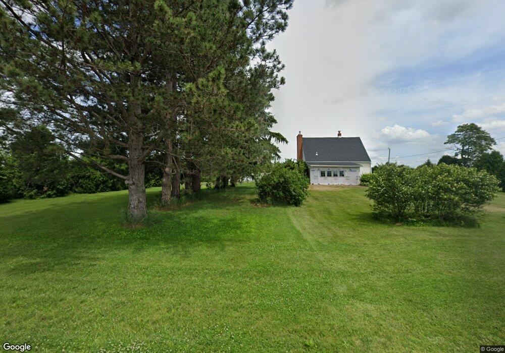
22860 Euler Rd Weston, OH 43569
Estimated Value: $561,000
3
Beds
1
Bath
1,075
Sq Ft
$522/Sq Ft
Est. Value
About This Home
This home is located at 22860 Euler Rd, Weston, OH 43569 and is currently estimated at $561,000, approximately $521 per square foot. 22860 Euler Rd is a home located in Wood County with nearby schools including Otsego Elementary School, Otsego Junior High School, and Otsego High School.
Ownership History
Date
Name
Owned For
Owner Type
Purchase Details
Closed on
Apr 13, 2022
Sold by
P & J Thayer Family Limited Partnership
Bought by
Spoerl Thomas M
Current Estimated Value
Home Financials for this Owner
Home Financials are based on the most recent Mortgage that was taken out on this home.
Original Mortgage
$750,000
Outstanding Balance
$652,377
Interest Rate
4.16%
Mortgage Type
New Conventional
Estimated Equity
-$91,377
Purchase Details
Closed on
Jan 31, 2020
Sold by
Dyke Cletys Eugene and Dyke Cletys
Bought by
P & J Thayer Family Limited Partnership
Home Financials for this Owner
Home Financials are based on the most recent Mortgage that was taken out on this home.
Original Mortgage
$575,000
Interest Rate
3.7%
Mortgage Type
Future Advance Clause Open End Mortgage
Purchase Details
Closed on
Jan 12, 1981
Bought by
Dyke Cletys E
Create a Home Valuation Report for This Property
The Home Valuation Report is an in-depth analysis detailing your home's value as well as a comparison with similar homes in the area
Purchase History
| Date | Buyer | Sale Price | Title Company |
|---|---|---|---|
| Spoerl Thomas M | $831,166 | -- | |
| P & J Thayer Family Limited Partnership | $770,500 | None Available | |
| Dyke Cletys E | -- | -- |
Source: Public Records
Mortgage History
| Date | Status | Borrower | Loan Amount |
|---|---|---|---|
| Open | Spoerl Thomas M | $750,000 | |
| Previous Owner | P & J Thayer Family Limited Partnership | $575,000 |
Source: Public Records
Tax History
| Year | Tax Paid | Tax Assessment Tax Assessment Total Assessment is a certain percentage of the fair market value that is determined by local assessors to be the total taxable value of land and additions on the property. | Land | Improvement |
|---|---|---|---|---|
| 2025 | $3,723 | $174,055 | $174,055 | -- |
| 2024 | $3,829 | $174,055 | $174,055 | -- |
| 2023 | $3,829 | $174,060 | $174,060 | $0 |
| 2021 | $2,363 | $174,060 | $174,060 | $0 |
| 2020 | $2,375 | $174,060 | $174,060 | $0 |
| 2019 | $4,042 | $157,430 | $157,430 | $0 |
| 2018 | $5,252 | $201,610 | $175,320 | $26,290 |
| 2017 | $4,727 | $201,610 | $175,320 | $26,290 |
| 2016 | $5,505 | $153,060 | $127,400 | $25,660 |
| 2015 | $5,505 | $153,060 | $127,400 | $25,660 |
| 2014 | $5,734 | $153,060 | $127,400 | $25,660 |
| 2013 | $3,454 | $115,820 | $90,160 | $25,660 |
Source: Public Records
Map
Nearby Homes
- 22487 U S 6
- 13439 Ash St
- 21490 Portage Rd
- 20280 Locust St
- 20175 Taylor St
- 23763 Front St
- 24526 Village Ln Unit 24526
- 0 Manore Lot A Rd Unit 6130402
- 0 Manore Lot B Rd Unit 6130403
- 12577 S River Rd
- 0 Sand Ridge Rd Unit 10004038
- 17884 Euler Rd
- 12200 S River Rd
- 22759 Defiance Pike
- 234 N East St
- 440 Vine St
- 0 Kellogg Rd Unit 6125521
- 17345 Reams Rd
- 10855 S River Rd
- 81 Back Bay Rd
- 13951 Custar Rd
- 14233 Custar Rd
- 14398 Custar Rd
- 14480 Custar Rd
- 14641 Custar Rd
- 23230 Junkins Rd
- 23256 Junkins Rd
- 14736 Custar Rd
- 23520 Euler Rd
- 23565 Euler Rd
- 13719 Junkins Rd
- 23454 Junkins Rd
- 14867 Custar Rd
- 14735 Custar Rd Unit 867
- 2356 Junkins Rd
- 13975 Milton Rd
- 22016 Euler Rd
- 13217 Custar Rd
- 23722 Euler Rd
- 14265 Milton Rd
Your Personal Tour Guide
Ask me questions while you tour the home.