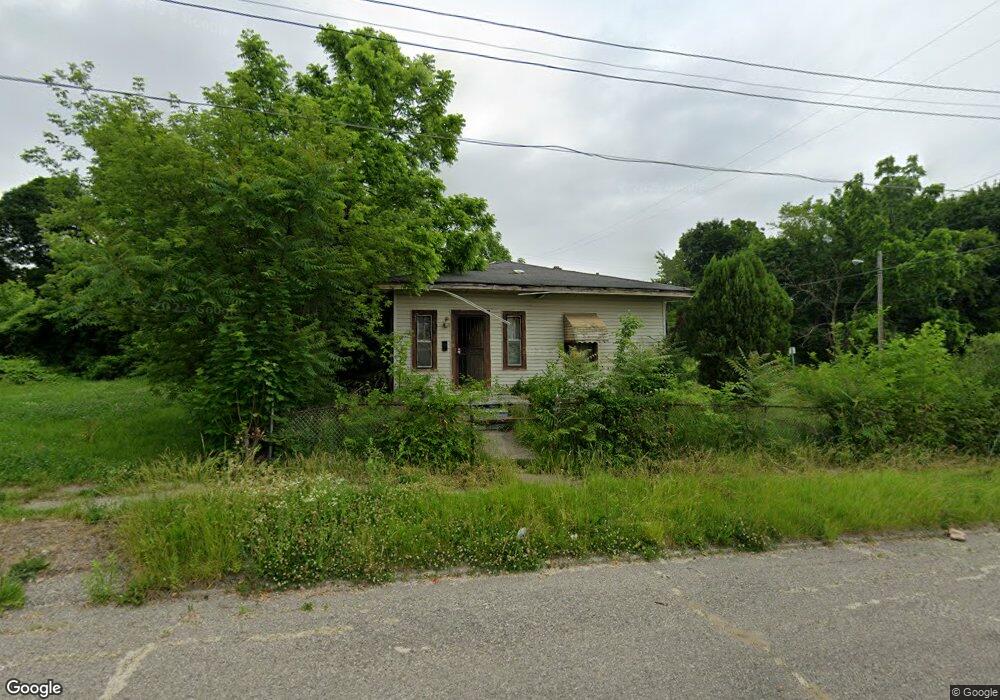
229 Crosby St Flint, MI 48503
Downtown Flint NeighborhoodEstimated Value: $40,000 - $50,000
About This Home
This home is located at 229 Crosby St, Flint, MI 48503 and is currently estimated at $45,876, approximately $41 per square foot. 229 Crosby St is a home located in Genesee County with nearby schools including Doyle/Ryder School, Flint Cultural Center Academy, and Flint Cultural Center Academy High School.
Ownership History
We collect this data history from publicly available records. To have your information removed, we recommend requesting removal directly through your county’s website.
Purchase Details
Purchase Details
Purchase Details
Purchase Details
Purchase Details
Purchase Details
Purchase Details
Purchase Details
Home Values in the Area
Average Home Value in this Area
Purchase History
We collect this data history from publicly available records. To have your information removed, we recommend requesting removal directly through your county’s website.
| Date | Buyer | Sale Price | Title Company |
|---|---|---|---|
| -- | None Listed On Document | ||
| -- | None Listed On Document | ||
| -- | None Available | ||
| -- | None Available | ||
| -- | None Available | ||
| $17,192 | None Available | ||
| -- | First American Title Ins Co | ||
| -- | -- |
Tax History
We collect this data history from publicly available records. To have your information removed, we recommend requesting removal directly through your county’s website.
| Year | Tax Paid | Tax Assessment Tax Assessment Total Assessment is a certain percentage of the fair market value that is determined by local assessors to be the total taxable value of land and additions on the property. | Land | Improvement |
|---|---|---|---|---|
| 2025 | $793 | $10,200 | $0 | $0 |
| 2024 | $782 | $8,000 | $0 | $0 |
| 2023 | $398 | $7,200 | $0 | $0 |
| 2022 | $0 | $7,700 | $0 | $0 |
| 2021 | $401 | $7,000 | $0 | $0 |
| 2020 | $382 | $5,400 | $0 | $0 |
| 2019 | $456 | $4,100 | $0 | $0 |
| 2018 | $340 | $3,700 | $0 | $0 |
| 2017 | $336 | $0 | $0 | $0 |
| 2016 | $335 | $0 | $0 | $0 |
| 2015 | -- | $0 | $0 | $0 |
| 2014 | -- | $0 | $0 | $0 |
| 2012 | -- | $3,100 | $0 | $0 |
Map
- 1545 Martin Luther King Ave
- 800 Martin Luther King Ave
- 2134 Martin Luther King Ave
- 1606 Garland St
- 134 Stockdale St
- 1644 Mason St
- 604 Page St
- 1214 Root St
- 114 W Hamilton Ave
- 575 Louisa St
- 420 E Dayton St
- 2209 Mason St
- 1501 Vanderbilt Dr
- 2309 Mason St
- 1710 Wilberforce Cir
- 1706 Wilberforce Cir
- 134 W Baker St
- 1006 W 8th Ave
- 124 W Rankin St
- 1651 N Chevrolet Ave
Ask me questions while you tour the home.