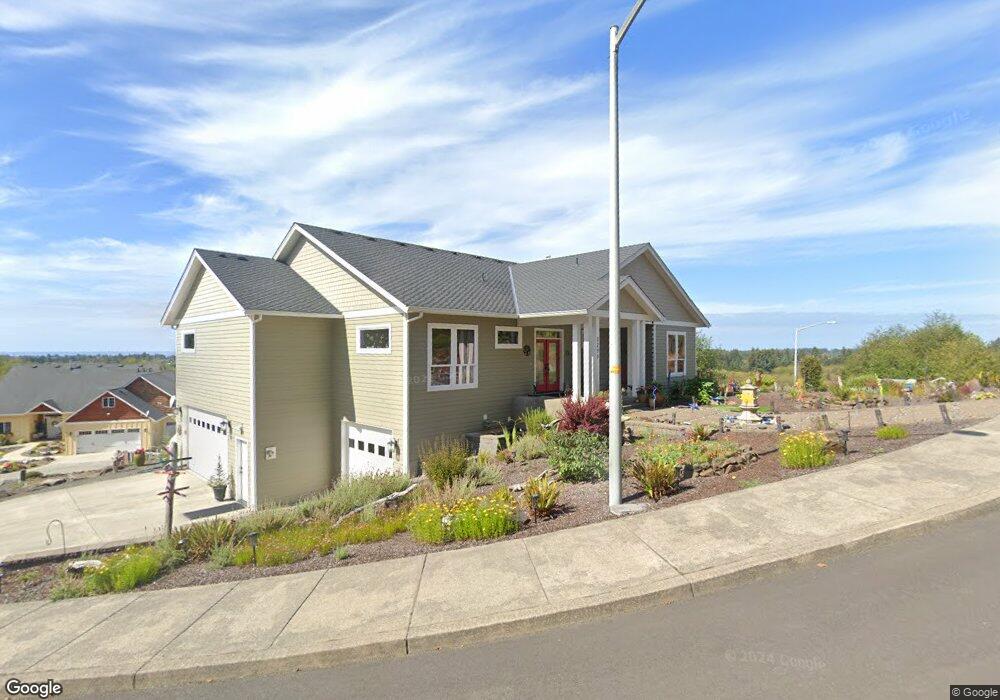
2295 N Fork Rd Seaside, OR 97138
Estimated Value: $743,000 - $915,000
3
Beds
3
Baths
2,770
Sq Ft
$310/Sq Ft
Est. Value
About This Home
This home is located at 2295 N Fork Rd, Seaside, OR 97138 and is currently estimated at $858,117, approximately $309 per square foot. 2295 N Fork Rd is a home located in Clatsop County with nearby schools including Seaside High School.
Ownership History
Date
Name
Owned For
Owner Type
Purchase Details
Closed on
Apr 21, 2014
Sold by
Marshall Patricia A
Bought by
Littlejohn Kevin and Littlejohn Gayle M
Current Estimated Value
Purchase Details
Closed on
Apr 28, 2009
Sold by
Olstedt Construction Inc
Bought by
Marshall Patricia A
Home Financials for this Owner
Home Financials are based on the most recent Mortgage that was taken out on this home.
Original Mortgage
$75,000
Interest Rate
4.99%
Mortgage Type
Purchase Money Mortgage
Create a Home Valuation Report for This Property
The Home Valuation Report is an in-depth analysis detailing your home's value as well as a comparison with similar homes in the area
Purchase History
| Date | Buyer | Sale Price | Title Company |
|---|---|---|---|
| Littlejohn Kevin | $75,000 | Pacific Title Company | |
| Marshall Patricia A | $100,000 | Pacific Title Company |
Source: Public Records
Mortgage History
| Date | Status | Borrower | Loan Amount |
|---|---|---|---|
| Previous Owner | Marshall Patricia A | $75,000 |
Source: Public Records
Tax History
| Year | Tax Paid | Tax Assessment Tax Assessment Total Assessment is a certain percentage of the fair market value that is determined by local assessors to be the total taxable value of land and additions on the property. | Land | Improvement |
|---|---|---|---|---|
| 2025 | $7,698 | $535,729 | -- | -- |
| 2024 | $7,472 | $520,126 | -- | -- |
| 2023 | $7,251 | $504,978 | $0 | $0 |
| 2022 | $7,053 | $490,271 | $0 | $0 |
| 2021 | $6,904 | $475,992 | $0 | $0 |
| 2020 | $6,742 | $462,129 | $0 | $0 |
| 2019 | $6,558 | $448,670 | $0 | $0 |
Source: Public Records
Map
Nearby Homes
- 2285 N Fork Rd
- 2344 Royal View Dr
- 2188 Stanley Lake Ct
- 2110 Thompson Falls Dr
- 2550 Boehm Acres Rd
- 2657 N Hwy 101 Unit 6
- 0 Cross Creek St Unit 12
- 0 Cross Creek St Unit 10
- 0 Cross Creek St Unit 11
- 0 Cross Creek St Unit 26-112
- 0 Cross Creek St Unit 13
- 0 Cross Creek St Unit 26-114
- 0 Cross Creek St Unit 26-115
- 0 Cross Creek St Unit 26-116
- 0 Cross Creek St Unit 14
- 0 Cross Creek St Unit 26-117
- 2674 U S 101
- 481 Hillside Loop
- 0 N Wahanna Rd
- 802 25th Ave
- 2295 N Fork Rd Unit 51
- 2275 N Fork Rd Unit 53
- 2294 North Fork Rd
- 2317 N Fork Rd
- 2333 N Fork Rd
- 1992 N Fork Rd Unit 33
- 1992 N Fork Rd
- 2270 North Fork Rd
- 2255 N Fork Rd
- 1980 1weuoqtd6zpd Fork 1weuounxpaq3
- 1980 N Fork Ct
- 1980 N Fork Rd
- 1980 N Fork Rd Unit 32
- 2337 N Fork Rd
- 2245 N Fork Rd
- 1903 N Fork Rd
- 1903 N Fork
- 1903 N Fork Ct
- 1915 N Fork Ct
- 2235 1weuoquzdxbz Fork
Your Personal Tour Guide
Ask me questions while you tour the home.