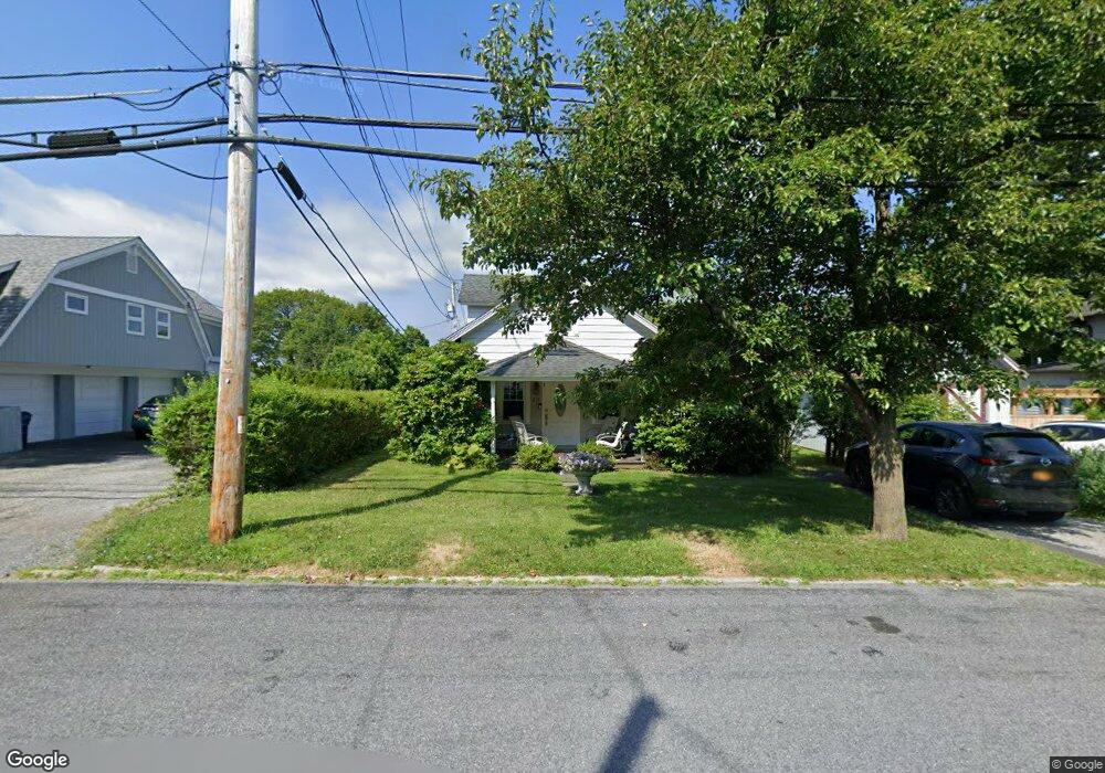
23 Maple Ave Millbrook, NY 12545
Estimated Value: $269,000 - $362,000
2
Beds
2
Baths
1,074
Sq Ft
$301/Sq Ft
Est. Value
About This Home
This home is located at 23 Maple Ave, Millbrook, NY 12545 and is currently estimated at $322,785, approximately $300 per square foot. 23 Maple Ave is a home located in Dutchess County with nearby schools including Elm Drive Elementary School, Alden Place Elementary School, and Millbrook Middle School.
Ownership History
Date
Name
Owned For
Owner Type
Purchase Details
Closed on
Aug 26, 2022
Sold by
Viacava Frank Est and Viacava
Bought by
Viacava Richard
Current Estimated Value
Purchase Details
Closed on
Jul 30, 1997
Sold by
Shanks Catherine R
Bought by
Viacara Frank B
Purchase Details
Closed on
Jul 25, 1994
Sold by
Jenkins Helen A
Bought by
Shanks Catherine R
Create a Home Valuation Report for This Property
The Home Valuation Report is an in-depth analysis detailing your home's value as well as a comparison with similar homes in the area
Home Values in the Area
Average Home Value in this Area
Purchase History
| Date | Buyer | Sale Price | Title Company |
|---|---|---|---|
| Viacava Richard | -- | None Available | |
| Viacara Frank B | $105,000 | -- | |
| Viacara Frank B | $105,000 | -- | |
| Shanks Catherine R | $82,480 | -- | |
| Shanks Catherine R | $82,480 | -- |
Source: Public Records
Tax History
| Year | Tax Paid | Tax Assessment Tax Assessment Total Assessment is a certain percentage of the fair market value that is determined by local assessors to be the total taxable value of land and additions on the property. | Land | Improvement |
|---|---|---|---|---|
| 2024 | $3,887 | $149,100 | $24,500 | $124,600 |
| 2023 | $3,675 | $149,100 | $24,500 | $124,600 |
| 2022 | $3,613 | $149,100 | $24,500 | $124,600 |
| 2021 | $3,611 | $149,100 | $24,500 | $124,600 |
| 2020 | $3,729 | $149,100 | $24,500 | $124,600 |
| 2019 | $3,692 | $149,100 | $24,500 | $124,600 |
| 2018 | $3,579 | $149,100 | $24,500 | $124,600 |
| 2017 | $3,532 | $149,100 | $24,500 | $124,600 |
| 2016 | $3,477 | $149,100 | $24,500 | $124,600 |
| 2015 | -- | $149,100 | $24,500 | $124,600 |
| 2014 | -- | $149,100 | $24,500 | $124,600 |
Source: Public Records
Map
Nearby Homes
- 44 Merrit Ave
- 3311 Franklin Ave
- 188 Nine Partners Ln
- 121 Stanford Rd
- TBD Stanford Rd
- 121-125 Butts Hollow Rd
- 97 Valley Farm Rd
- 20 Orchard Hill Dr
- 45 Hitchcock Ln
- 121 Valley Farm Rd
- 66 County House Rd
- 37 Maple Hill Dr
- 3985 Route 82
- 43 Maple Hill Dr
- 45 Maple Hill Dr
- 568 Oak Summit Rd
- 477 Canoe Hill Rd
- 3893 Route 82
- 508 Woodstock Rd
- 4388 Route 82
- 44 Merritt Ave Unit 1
- 44 Merritt Ave
- 44 Merritt Ave
- 48 Merrit Ave
- 48 Merritt Ave
- 3315 Franklin Ave
- 42 Merrit Ave
- 7 Merrit Ave
- 7 Merrit Ave
- 3313 Franklin Ave
- 0 College La Unit 404961
- 0 College La Unit 402296
- 0 College La Unit 397674
- 0 College La Unit 393063
- 40 Merrit Ave
- 45 Merrit Ave
- 45 Merritt Ave
- 43 Merrit Ave
- 41 Merrit Ave
- 3320 Franklin Ave
Your Personal Tour Guide
Ask me questions while you tour the home.