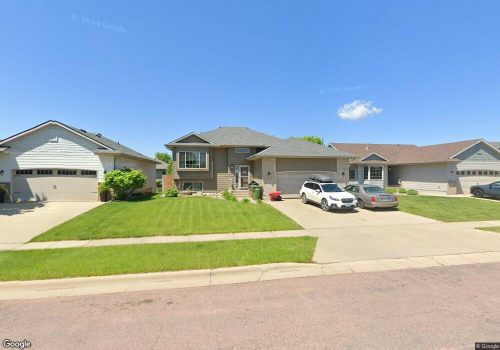
2301 S Hofstad Ave Sioux Falls, SD 57106
Northwest Sioux Falls NeighborhoodEstimated Value: $372,943 - $396,000
4
Beds
3
Baths
2,120
Sq Ft
$180/Sq Ft
Est. Value
About This Home
This home is located at 2301 S Hofstad Ave, Sioux Falls, SD 57106 and is currently estimated at $381,486, approximately $179 per square foot. 2301 S Hofstad Ave is a home located in Minnehaha County with nearby schools including Tea Area Middle School, Tea Area High School, and St. Michael Elementary.
Ownership History
Date
Name
Owned For
Owner Type
Purchase Details
Closed on
Sep 16, 2025
Sold by
Clark Nathan S and Clark Y
Bought by
Clark Katelynne A and Clark Y
Current Estimated Value
Purchase Details
Closed on
Jun 19, 2019
Sold by
Musil David H
Bought by
Clark Nathan S and Clark Katelynne A
Home Financials for this Owner
Home Financials are based on the most recent Mortgage that was taken out on this home.
Original Mortgage
$247,253
Interest Rate
4.1%
Mortgage Type
New Conventional
Create a Home Valuation Report for This Property
The Home Valuation Report is an in-depth analysis detailing your home's value as well as a comparison with similar homes in the area
Home Values in the Area
Average Home Value in this Area
Purchase History
We collect this data history from publicly available records. To have your information removed, we recommend requesting removal directly through your county’s website.
| Date | Buyer | Sale Price | Title Company |
|---|---|---|---|
| Clark Katelynne A | -- | -- | |
| Clark Nathan S | $255,000 | None Available |
Source: Public Records
Mortgage History
We collect this data history from publicly available records. To have your information removed, we recommend requesting removal directly through your county’s website.
| Date | Status | Borrower | Loan Amount |
|---|---|---|---|
| Previous Owner | Clark Nathan S | $247,253 |
Source: Public Records
Tax History
| Year | Tax Paid | Tax Assessment Tax Assessment Total Assessment is a certain percentage of the fair market value that is determined by local assessors to be the total taxable value of land and additions on the property. | Land | Improvement |
|---|---|---|---|---|
| 2025 | $4,696 | $311,600 | $35,700 | $275,900 |
| 2024 | $4,696 | $319,300 | $35,700 | $283,600 |
| 2023 | $5,157 | $315,700 | $26,000 | $289,700 |
| 2022 | $4,783 | $277,700 | $26,000 | $251,700 |
| 2021 | $4,114 | $227,800 | $0 | $0 |
| 2020 | $4,114 | $229,500 | $0 | $0 |
| 2019 | $4,001 | $221,315 | $0 | $0 |
| 2018 | $3,788 | $216,494 | $0 | $0 |
| 2017 | $3,493 | $202,865 | $26,880 | $175,985 |
| 2016 | $3,493 | $192,339 | $25,536 | $166,803 |
| 2015 | $3,573 | $181,627 | $25,536 | $156,091 |
| 2014 | $3,635 | $181,581 | $25,536 | $156,045 |
Source: Public Records
Map
Nearby Homes
- 2217 S Ollerich Ave
- 2300 S June Ave
- 9268 W Norma Trail Unit 6
- 2021 S Haraldson Ave
- 9218 W Norma Trail
- 9308 W 32nd St Unit 10
- 9308 W 32nd St Unit 4
- 9308 W 32nd St Unit 6
- 9308 W 32nd St Unit 9
- 9308 W 32nd St Unit 8
- 9308 W 32nd St Unit 2
- 2300 S Mary Beth Ave
- 9233 W Laverne Wipf St St
- 8611 W Grinn Place Unit 18
- 1930 S Sonoma Place
- 8508 W Laverne Wipf St St Unit 13
- 8509 W Grinn Place Unit 33
- 8506 W Lavern Wipf St Unit 12
- 2301 S Creekview Ave
- 9500 W Broek Dr
- 2305 S Hofstad Ave
- 2217 S Hofstad Ave
- 2309 S Hofstad Ave
- 2213 S Hofstad Ave
- 2304 S Macey Ave
- 2300 S Macey Ave
- 2216 S Macey Ave
- 2300 S Hofstad Ave
- 2304 S Hofstad Ave
- 2313 S Hofstad Ave
- 2216 S Hofstad Ave
- 2308 S Macey Ave
- 2209 S Hofstad Ave
- 2308 S Hofstad Ave
- 2212 S Hofstad Ave
- 2312 S Macey Ave
- 2312 S Hofstad Ave
- 2208 S Macey Ave
- 2208 S Hofstad Ave
- 2205 S Hofstad Ave
Your Personal Tour Guide
Ask me questions while you tour the home.