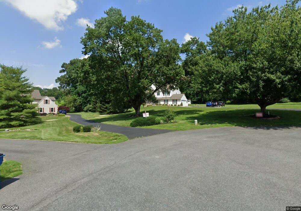
231 Cedar Crest Ln Kennett Square, PA 19348
Estimated Value: $545,000 - $699,000
4
Beds
3
Baths
2,096
Sq Ft
$300/Sq Ft
Est. Value
About This Home
This home is located at 231 Cedar Crest Ln, Kennett Square, PA 19348 and is currently estimated at $629,034, approximately $300 per square foot. 231 Cedar Crest Ln is a home located in Chester County with nearby schools including Kennett Middle School, Kennett High School, and Upland Country Day School.
Ownership History
Date
Name
Owned For
Owner Type
Purchase Details
Closed on
Oct 30, 2003
Sold by
Dsk Inc
Bought by
Fragale Michael A and Fragale Deana L
Current Estimated Value
Home Financials for this Owner
Home Financials are based on the most recent Mortgage that was taken out on this home.
Original Mortgage
$175,000
Outstanding Balance
$80,058
Interest Rate
5.81%
Mortgage Type
Purchase Money Mortgage
Estimated Equity
$548,976
Create a Home Valuation Report for This Property
The Home Valuation Report is an in-depth analysis detailing your home's value as well as a comparison with similar homes in the area
Home Values in the Area
Average Home Value in this Area
Purchase History
| Date | Buyer | Sale Price | Title Company |
|---|---|---|---|
| Fragale Michael A | $279,130 | -- |
Source: Public Records
Mortgage History
| Date | Status | Borrower | Loan Amount |
|---|---|---|---|
| Open | Fragale Michael A | $175,000 |
Source: Public Records
Tax History
| Year | Tax Paid | Tax Assessment Tax Assessment Total Assessment is a certain percentage of the fair market value that is determined by local assessors to be the total taxable value of land and additions on the property. | Land | Improvement |
|---|---|---|---|---|
| 2025 | $9,944 | $248,300 | $72,940 | $175,360 |
| 2024 | $9,944 | $248,300 | $72,940 | $175,360 |
| 2023 | $9,274 | $239,600 | $72,940 | $166,660 |
| 2022 | $9,139 | $239,600 | $72,940 | $166,660 |
| 2021 | $9,046 | $239,600 | $72,940 | $166,660 |
| 2020 | $8,874 | $239,600 | $72,940 | $166,660 |
| 2019 | $8,754 | $239,600 | $72,940 | $166,660 |
| 2018 | $8,618 | $239,600 | $72,940 | $166,660 |
| 2017 | $8,441 | $239,600 | $72,940 | $166,660 |
| 2016 | $950 | $239,600 | $72,940 | $166,660 |
| 2015 | $950 | $239,600 | $72,940 | $166,660 |
| 2014 | $950 | $239,600 | $72,940 | $166,660 |
Source: Public Records
Map
Nearby Homes
- 256 Line Rd
- 217 Kestrel Ct
- 292 Kestrel Ct
- 104 Deer Creek Crossing
- 259 S Thistle Down
- 13 Tullow Hill Dr
- 112 Bancroft Rd
- 11 Tullow Hill Dr
- 15 Tullow Hill Dr
- 9 Tullow Hill Dr
- 103 Foragers Ln
- 5 Tullow Hill Dr
- 131 Foragers Ln
- 150 Foragers Ln
- 140 Foragers Ln
- 130 Foragers Ln
- 112 Foragers Ln
- 138 Foragers Ln
- 156 Bancroft Rd Unit CARLTON
- 156 Bancroft Rd Unit SUTTON
- 233 Cedar Crest Ln
- 229 Cedar Crest Ln
- 227 Cedar Crest Ln
- 225 Cedar Crest Ln
- 460 Cedar Spring Rd
- 251 Kestrel Ct
- 249 Kestrel Ct
- 247 Kestrel Ct
- 245 Kestrel Ct
- 223 Cedar Crest Ln
- 257 Kestrel Ct
- 259 Kestrel Ct
- 239 Kestrel Ct
- 261 Kestrel Ct
- 237 Kestrel Ct
- 263 Kestrel Ct
- 269 Kestrel Ct
- 227 Kestrel Ct
- 434 Cedar Spring Rd
- 271 Kestrel Ct
Your Personal Tour Guide
Ask me questions while you tour the home.