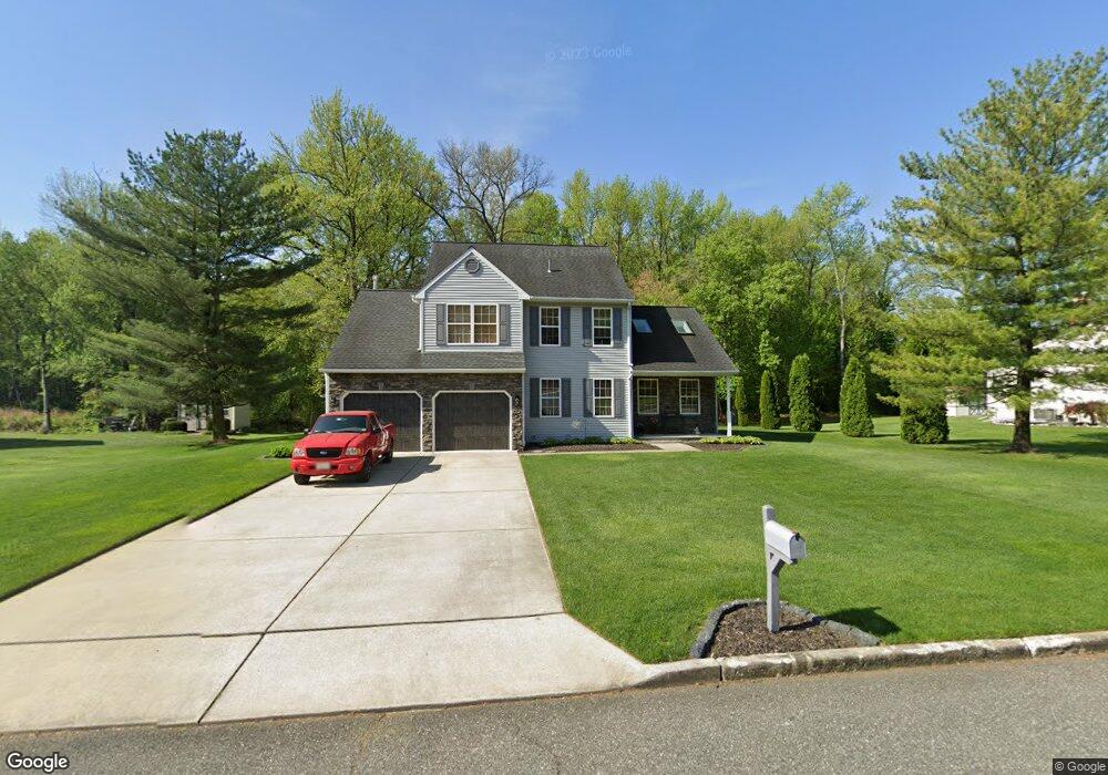
231 Dowdy Dr Gibbstown, NJ 08027
Estimated Value: $334,741 - $366,000
Studio
--
Bath
1,720
Sq Ft
$202/Sq Ft
Est. Value
About This Home
This home is located at 231 Dowdy Dr, Gibbstown, NJ 08027 and is currently estimated at $347,685, approximately $202 per square foot. 231 Dowdy Dr is a home located in Gloucester County with nearby schools including Nehaunsey Middle School and Guardian Angels Regional School.
Ownership History
Date
Name
Owned For
Owner Type
Purchase Details
Closed on
Sep 9, 1988
Bought by
Justice Steven and Justice Johanna
Current Estimated Value
Create a Home Valuation Report for This Property
The Home Valuation Report is an in-depth analysis detailing your home's value as well as a comparison with similar homes in the area
Home Values in the Area
Average Home Value in this Area
Purchase History
We collect this data history from publicly available records. To have your information removed, we recommend requesting removal directly through your county’s website.
| Date | Buyer | Sale Price | Title Company |
|---|---|---|---|
| Justice Steven | $24,500 | -- |
Source: Public Records
Tax History
| Year | Tax Paid | Tax Assessment Tax Assessment Total Assessment is a certain percentage of the fair market value that is determined by local assessors to be the total taxable value of land and additions on the property. | Land | Improvement |
|---|---|---|---|---|
| 2025 | $6,690 | $194,300 | $44,000 | $150,300 |
| 2024 | $6,338 | $194,300 | $44,000 | $150,300 |
| 2023 | $6,338 | $194,300 | $44,000 | $150,300 |
| 2022 | $6,342 | $194,300 | $44,000 | $150,300 |
| 2021 | $6,276 | $194,300 | $44,000 | $150,300 |
| 2020 | $6,363 | $194,300 | $44,000 | $150,300 |
| 2019 | $6,367 | $194,300 | $44,000 | $150,300 |
| 2018 | $6,187 | $194,300 | $44,000 | $150,300 |
| 2017 | $6,037 | $194,300 | $44,000 | $150,300 |
| 2016 | $5,971 | $194,300 | $44,000 | $150,300 |
| 2015 | $5,778 | $194,300 | $44,000 | $150,300 |
| 2014 | $5,530 | $194,300 | $44,000 | $150,300 |
Source: Public Records
Map
Nearby Homes
- 77 Harmony Rd
- 438 Lock Ave
- 351 Croce Ave
- 44 S Market St
- 50 E Vine St
- 56 W Broad St
- 448 Thomson Ave
- 255 Elizabeth Ave
- 400 Thomson Ave
- 354 Memorial Ave
- 1224 Heddon Ave
- 311 Morton Ave
- 403 W Broad St
- 459 W Broad St
- L18 20 W Broad St
- 316 W Broad St
- 0 Dora & Huff Ave
- 1265 Walter Ave
- 157 S Poplar St
- 104 Patterson Ave
Your Personal Tour Guide
Ask me questions while you tour the home.