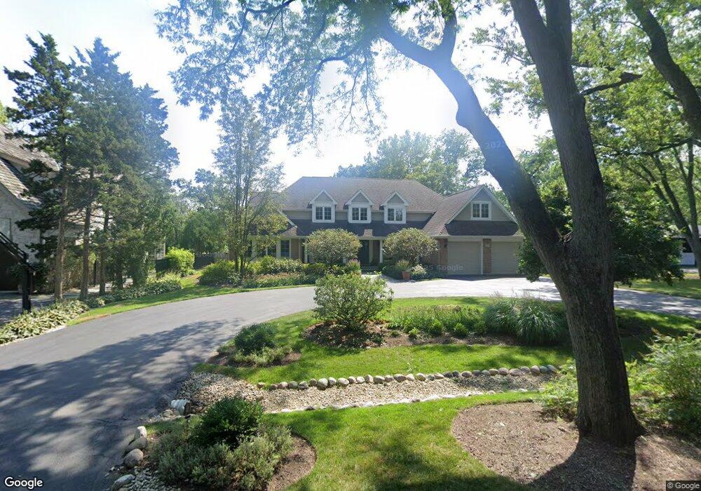
231 Ramsay Rd Deerfield, IL 60015
Briarwood NeighborhoodEstimated Value: $1,478,000 - $1,751,000
About This Home
This home is located at 231 Ramsay Rd, Deerfield, IL 60015 and is currently estimated at $1,637,137, approximately $324 per square foot. 231 Ramsay Rd is a home located in Lake County with nearby schools including Kipling Elementary School, Alan B Shepard Middle School, and Deerfield High School.
Ownership History
We collect this data history from publicly available records. To have your information removed, we recommend requesting removal directly through your county’s website.
Purchase Details
Home Financials for this Owner
Home Financials are based on the most recent Mortgage that was taken out on this home.Purchase Details
Home Financials for this Owner
Home Financials are based on the most recent Mortgage that was taken out on this home.Home Values in the Area
Average Home Value in this Area
Purchase History
We collect this data history from publicly available records. To have your information removed, we recommend requesting removal directly through your county’s website.
| Date | Buyer | Sale Price | Title Company |
|---|---|---|---|
| $1,550,000 | Chicago Title Insurance Co | ||
| $380,000 | Attorneys Natl Title Network |
Mortgage History
We collect this data history from publicly available records. To have your information removed, we recommend requesting removal directly through your county’s website.
| Date | Status | Borrower | Loan Amount |
|---|---|---|---|
| Open | $650,000 | ||
| Previous Owner | $304,000 |
Tax History
We collect this data history from publicly available records. To have your information removed, we recommend requesting removal directly through your county’s website.
| Year | Tax Paid | Tax Assessment Tax Assessment Total Assessment is a certain percentage of the fair market value that is determined by local assessors to be the total taxable value of land and additions on the property. | Land | Improvement |
|---|---|---|---|---|
| 2025 | $27,052 | $404,459 | $96,242 | $308,217 |
| 2024 | $23,991 | $301,395 | $91,799 | $209,596 |
| 2023 | $28,161 | $262,952 | $80,090 | $182,862 |
| 2022 | $28,161 | $303,280 | $86,023 | $217,257 |
| 2021 | $26,580 | $292,403 | $82,938 | $209,465 |
| 2020 | $25,563 | $293,019 | $83,113 | $209,906 |
| 2019 | $24,983 | $292,522 | $82,972 | $209,550 |
| 2018 | $24,172 | $294,809 | $87,945 | $206,864 |
| 2017 | $23,984 | $293,868 | $87,664 | $206,204 |
| 2016 | $23,337 | $282,756 | $84,349 | $198,407 |
| 2015 | $22,874 | $265,673 | $79,253 | $186,420 |
| 2014 | $22,716 | $266,757 | $79,819 | $186,938 |
| 2012 | $22,159 | $264,404 | $79,115 | $185,289 |
Map
- 980 Brand Ln
- 939 Westcliff Ln
- 860 Heather Rd
- 912 Oxford Rd
- 901 Kenton Rd
- 1958 Castlewood Rd
- 1153 Kenton Rd
- 1055 Hillcrest Ave
- 860 Kenton Rd
- 1148 Kenton Rd
- 850 Kenton Rd
- 707 Brierhill Rd
- 1311 Carlisle Place
- 755 Kipling Place
- 757 Kipling Place
- 944 Rosemary Terrace
- 1317 Knollwood Rd
- 1300 Knollwood Rd
- 126 Millstone Rd
- 528 Cumnor Ct
- 243 Ramsay Rd
- 1035 Meadowbrook Ln
- 1009 Meadowbrook Ln
- 219 Ramsay Rd
- 1065 Meadowbrook Ln
- 1010 Meadowbrook Ln
- 240 Ramsay Rd
- 200 Manor Dr
- 193 Ramsay Rd
- 230 Ramsay Rd
- 1055 Meadowbrook Ln
- 1075 Meadowbrook Ln
- 960 Meadowbrook Ln
- 1050 Meadowbrook Ln
- 220 Ramsay Rd
- 323 Ramsay Rd
- 1040 Lampton Ln
- 200 Ramsay Rd
- 941 Beverly Place
- 320 Margate Terrace
Ask me questions while you tour the home.