Estimated Value: $646,000 - $793,000
3
Beds
2
Baths
1,540
Sq Ft
$458/Sq Ft
Est. Value
About This Home
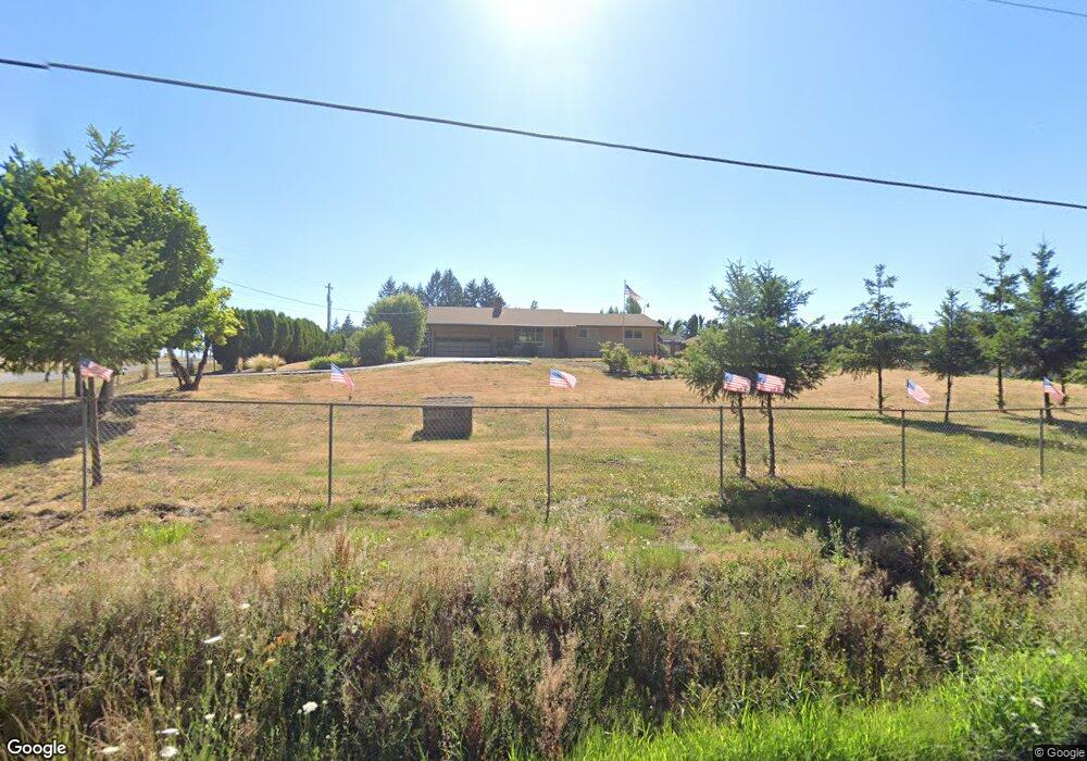
This home is located at 23196 S Central Point Rd, Canby, OR 97013 and is currently estimated at $705,205, approximately $457 per square foot. 23196 S Central Point Rd is a home located in Clackamas County with nearby schools including Cecile Trost Elementary School, Carus School, and Baker Prairie Middle School.
Ownership History
Date
Name
Owned For
Owner Type
Purchase Details
Closed on
Jul 1, 2021
Sold by
Hight Tracey and Hight Douglas
Bought by
Parker Jacob Adam and Parker Carrie Lynn
Current Estimated Value
Home Financials for this Owner
Home Financials are based on the most recent Mortgage that was taken out on this home.
Original Mortgage
$130,000
Outstanding Balance
$98,704
Interest Rate
2.9%
Mortgage Type
New Conventional
Estimated Equity
$606,501
Purchase Details
Closed on
Sep 14, 2015
Sold by
Hight Douglas Jay
Bought by
Hight Tracey and Hight Douglas
Home Financials for this Owner
Home Financials are based on the most recent Mortgage that was taken out on this home.
Original Mortgage
$80,000
Interest Rate
3.89%
Mortgage Type
Credit Line Revolving
Create a Home Valuation Report for This Property
The Home Valuation Report is an in-depth analysis detailing your home's value as well as a comparison with similar homes in the area
Purchase History
We collect this data history from publicly available records. To have your information removed, we recommend requesting removal directly through your county’s website.
| Date | Buyer | Sale Price | Title Company |
|---|---|---|---|
| Parker Jacob Adam | $600,000 | Wfg Title | |
| Hight Tracey | -- | Stewart Title |
Source: Public Records
Mortgage History
We collect this data history from publicly available records. To have your information removed, we recommend requesting removal directly through your county’s website.
| Date | Status | Borrower | Loan Amount |
|---|---|---|---|
| Open | Parker Jacob Adam | $130,000 | |
| Previous Owner | Hight Tracey | $80,000 |
Source: Public Records
Tax History
| Year | Tax Paid | Tax Assessment Tax Assessment Total Assessment is a certain percentage of the fair market value that is determined by local assessors to be the total taxable value of land and additions on the property. | Land | Improvement |
|---|---|---|---|---|
| 2025 | $4,814 | $336,404 | -- | -- |
| 2024 | $4,680 | $326,606 | -- | -- |
| 2023 | $4,680 | $317,094 | $0 | $0 |
| 2022 | $4,280 | $307,859 | $0 | $0 |
| 2021 | $4,113 | $298,893 | $0 | $0 |
| 2020 | $4,051 | $290,188 | $0 | $0 |
| 2019 | $3,839 | $281,736 | $0 | $0 |
| 2018 | $3,760 | $273,530 | $0 | $0 |
| 2017 | $3,668 | $265,563 | $0 | $0 |
| 2016 | $3,542 | $257,828 | $0 | $0 |
| 2015 | $3,416 | $250,318 | $0 | $0 |
| 2014 | $3,318 | $243,027 | $0 | $0 |
Source: Public Records
Map
Nearby Homes
- 12368 S New Era Rd
- 22420 S Parrot Creek Rd
- 12333 S New Era Rd
- 22992 S Haines Rd
- 22396 S Parrot Creek Rd
- 9917 S Carriage Ln
- 10038 S New Era Rd Unit 5
- 21951 S Highway 99 E
- 13392 S Carus Rd
- 2147 NE Spitz Rd
- 105 S Hazel Dell Way
- 2125 NE Spitz Rd
- 1873 N Teakwood St
- 21381 S Hwy 99e
- 32020 SW Peach Cove Rd
- 1969 NE 20th Ave
- 1947 NE 21st Ave
- 10202 S New Era Rd
- 1152 Tansy Ln
- 10285 S New Era Rd
- 23252 S Central Point Rd
- 11602 S Makin Ln
- 23151 S Central Point Rd
- 11628 S Makin Ln
- 23185 S Central Point Rd
- 11648 S Makin Ln
- 23108 S Central Point Rd
- 22011 S Central Point Rd
- 0 S Central Point Rd
- 23348 S Central Point Rd
- 23330 S Central Point Rd
- 11715 S Makin Ln
- 11730 S Makin Ln
- 23051 S Central Point Rd
- 11750 S Makin Ln
- 11765 S Makin Ln
- 23078 S Central Point Rd
- 23374 S Payton Dr
- 22986 S Central Point Rd
- 23400 S Central Point Rd
Your Personal Tour Guide
Ask me questions while you tour the home.