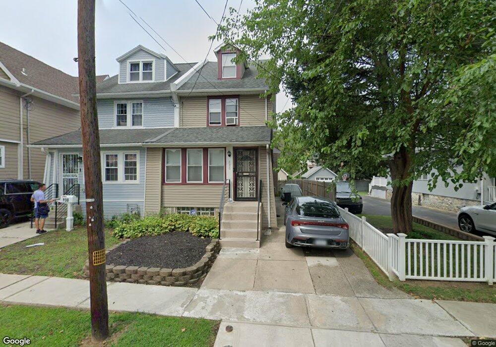
232 Melrose Ave Lansdowne, PA 19050
Estimated Value: $211,000 - $277,000
3
Beds
1
Bath
1,430
Sq Ft
$171/Sq Ft
Est. Value
About This Home
This home is located at 232 Melrose Ave, Lansdowne, PA 19050 and is currently estimated at $244,309, approximately $170 per square foot. 232 Melrose Ave is a home located in Delaware County with nearby schools including East Lansdowne Elementary School, Penn Wood Middle School, and Penn Wood High School - Cypress Street Campus.
Ownership History
Date
Name
Owned For
Owner Type
Purchase Details
Closed on
Apr 28, 1998
Sold by
Mcmullen Ronald G and Mcmullen Margaret L
Bought by
Shaw Gregory and Shaw Renee B
Current Estimated Value
Home Financials for this Owner
Home Financials are based on the most recent Mortgage that was taken out on this home.
Original Mortgage
$67,500
Outstanding Balance
$14,739
Interest Rate
10%
Estimated Equity
$229,570
Create a Home Valuation Report for This Property
The Home Valuation Report is an in-depth analysis detailing your home's value as well as a comparison with similar homes in the area
Home Values in the Area
Average Home Value in this Area
Purchase History
| Date | Buyer | Sale Price | Title Company |
|---|---|---|---|
| Shaw Gregory | $75,000 | T A Title Insurance Company |
Source: Public Records
Mortgage History
| Date | Status | Borrower | Loan Amount |
|---|---|---|---|
| Open | Shaw Gregory | $67,500 |
Source: Public Records
Tax History
| Year | Tax Paid | Tax Assessment Tax Assessment Total Assessment is a certain percentage of the fair market value that is determined by local assessors to be the total taxable value of land and additions on the property. | Land | Improvement |
|---|---|---|---|---|
| 2025 | $5,769 | $135,010 | $44,510 | $90,500 |
| 2024 | $5,769 | $135,010 | $44,510 | $90,500 |
| 2023 | $4,313 | $135,010 | $44,510 | $90,500 |
| 2022 | $5,203 | $135,010 | $44,510 | $90,500 |
| 2021 | $7,758 | $135,010 | $44,510 | $90,500 |
| 2020 | $4,617 | $70,100 | $19,250 | $50,850 |
| 2019 | $4,540 | $70,100 | $19,250 | $50,850 |
| 2018 | $4,480 | $70,100 | $0 | $0 |
| 2017 | $4,251 | $70,100 | $0 | $0 |
| 2016 | $385 | $70,100 | $0 | $0 |
| 2015 | $385 | $70,100 | $0 | $0 |
| 2014 | $385 | $70,100 | $0 | $0 |
Source: Public Records
Map
Nearby Homes
- 269 Hirst Ave
- 0 Hirst Ave
- 7218 Radbourne Rd
- 319 E Essex Ave
- 315 E Essex Ave
- 219 N Wycombe Ave
- 40 Lamport Rd
- 314 E Essex Ave
- 402 Long Ln
- 178 N Union Ave
- 217 E Greenwood Ave
- 46 Lamport Rd
- 54 Springton Rd
- 614 Littlecroft Rd
- 58 Gilpin Rd
- 7160 Clover Ln
- 212 N Maple Ave
- 184 Midway Ave
- 113 A A000 N Union Ave
- 109 Lexington Ave
- 230 Melrose Ave
- 234 Melrose Ave
- 228 Melrose Ave
- 222 Melrose Ave
- 231 Hirst Ave
- 229 Hirst Ave
- 220 Melrose Ave
- 233 Hirst Ave
- 227 Hirst Ave
- 237 Hirst Ave
- 233 Melrose Ave
- 241 Hirst Ave
- 229 Melrose Ave
- 237 Melrose Ave
- 225 Melrose Ave
- 241 Melrose Ave
- 245 Hirst Ave
- 248 Melrose Ave
- 215 Melrose Ave
- 250 Melrose Ave
Your Personal Tour Guide
Ask me questions while you tour the home.