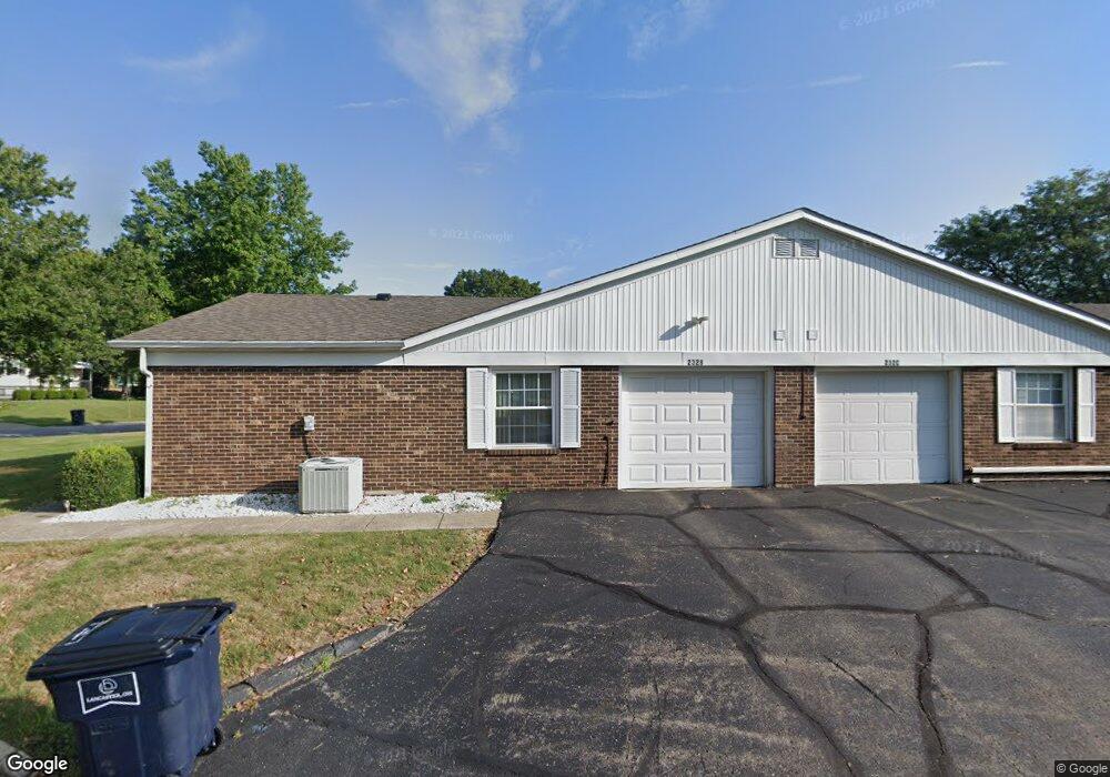
232 Trace Dr Unit B Lancaster, OH 43130
Estimated Value: $181,620 - $194,000
About This Home
This home is located at 232 Trace Dr Unit B, Lancaster, OH 43130 and is currently estimated at $189,155, approximately $185 per square foot. 232 Trace Dr Unit B is a home located in Fairfield County with nearby schools including General Sherman Junior High School, Lancaster High School, and St Mary Elementary School.
Ownership History
We collect this data history from publicly available records. To have your information removed, we recommend requesting removal directly through your county’s website.
Purchase Details
Home Financials for this Owner
Home Financials are based on the most recent Mortgage that was taken out on this home.Purchase Details
Home Financials for this Owner
Home Financials are based on the most recent Mortgage that was taken out on this home.Purchase Details
Purchase Details
Purchase Details
Purchase Details
Home Values in the Area
Average Home Value in this Area
Purchase History
We collect this data history from publicly available records. To have your information removed, we recommend requesting removal directly through your county’s website.
| Date | Buyer | Sale Price | Title Company |
|---|---|---|---|
| $148,000 | None Available | ||
| $148,000 | None Available | ||
| $90,000 | Valmer Land Title Agency | ||
| $90,000 | Valmer Land Title Agency | ||
| -- | Attorney | ||
| -- | Attorney | ||
| -- | Attorney | ||
| -- | Attorney | ||
| $67,000 | -- | ||
| $67,000 | -- | ||
| $54,000 | -- | ||
| $54,000 | -- |
Mortgage History
We collect this data history from publicly available records. To have your information removed, we recommend requesting removal directly through your county’s website.
| Date | Status | Borrower | Loan Amount |
|---|---|---|---|
| Open | $130,050 | ||
| Previous Owner | $80,000 |
Tax History
We collect this data history from publicly available records. To have your information removed, we recommend requesting removal directly through your county’s website.
| Year | Tax Paid | Tax Assessment Tax Assessment Total Assessment is a certain percentage of the fair market value that is determined by local assessors to be the total taxable value of land and additions on the property. | Land | Improvement |
|---|---|---|---|---|
| 2025 | $3,436 | $55,530 | $14,000 | $41,530 |
| 2024 | $3,436 | $38,220 | $7,000 | $31,220 |
| 2023 | $1,390 | $38,220 | $7,000 | $31,220 |
| 2022 | $1,396 | $38,220 | $7,000 | $31,220 |
| 2021 | $1,224 | $31,390 | $7,000 | $24,390 |
| 2020 | $887 | $31,390 | $7,000 | $24,390 |
| 2019 | $804 | $31,390 | $7,000 | $24,390 |
| 2018 | $1,011 | $25,370 | $7,000 | $18,370 |
| 2017 | $1,011 | $27,040 | $7,000 | $20,040 |
| 2016 | $985 | $27,040 | $7,000 | $20,040 |
| 2015 | $981 | $26,150 | $7,000 | $19,150 |
| 2014 | $935 | $26,150 | $7,000 | $19,150 |
| 2013 | $935 | $26,150 | $7,000 | $19,150 |
Map
- 356 Ridgemere Way
- 1111 Linda Ln
- 435 Alison Ct
- 1141 Dornoch Dr
- 114-116 S Cedar Ave
- 979 W Hubert Ave
- 1414 Cedar Hill Rd
- 1511 Cedar Hill Rd
- 729 Pennsylvania Ave
- 239 Talmadge Ave
- 1125 W Main St
- 701 Mithoff Dr
- 135 S Roosevelt Ave
- 134 Sherman Ave
- 200 Sherman Ave
- 157 Cedar Hill Rd
- 741 Spring St
- 0 Highland Ave
- 307 Maud Ave
- 420 W Mulberry St
- 232 Trace Dr
- 232 Trace Dr Unit 6B
- 232 Trace Dr Unit C
- 250 Trace Dr
- 250 Trace Dr C
- 0 Canterbury Ct Unit 438A
- 951 Canterbury Ct
- 951 Canterbury Ct Unit 5B
- 951 Canterbury Ct Unit 5A
- 951 Canterbury Ct Unit 5D
- 951 Canterbury Ct Unit D
- 951 Canterbury Ct Unit A
- 951 Canterbury Ct Unit C
- 951 Canterbury Ct
- 250 Trace Dr
- 250 Trace Dr
- 250 Trace Dr
- 250 Trace Dr Unit 7D
- 250 Trace Dr Unit D
- 250 Trace Dr Unit B
Ask me questions while you tour the home.