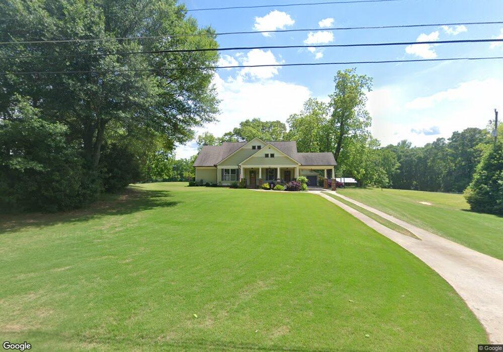
233 E Camp St Moreland, GA 30259
Estimated Value: $366,000 - $416,000
3
Beds
2
Baths
1,974
Sq Ft
$202/Sq Ft
Est. Value
About This Home
This home is located at 233 E Camp St, Moreland, GA 30259 and is currently estimated at $399,614, approximately $202 per square foot. 233 E Camp St is a home located in Coweta County with nearby schools including Moreland Elementary School, Smokey Road Middle School, and Newnan High School.
Ownership History
Date
Name
Owned For
Owner Type
Purchase Details
Closed on
Jun 25, 2015
Sold by
Hurst Patricia Cato
Bought by
Cole George J and Cole Melinda P
Current Estimated Value
Purchase Details
Closed on
Sep 28, 2011
Sold by
Hurst John W
Bought by
Hurst Patricia Cato
Purchase Details
Closed on
Aug 26, 2011
Sold by
Hurst Patricia Cato
Bought by
Hurst John W
Purchase Details
Closed on
Sep 4, 2008
Sold by
Hurst Kendal W
Bought by
Hurst Patricia C
Purchase Details
Closed on
May 31, 1985
Bought by
Hurst Kendal W
Create a Home Valuation Report for This Property
The Home Valuation Report is an in-depth analysis detailing your home's value as well as a comparison with similar homes in the area
Home Values in the Area
Average Home Value in this Area
Purchase History
| Date | Buyer | Sale Price | Title Company |
|---|---|---|---|
| Cole George J | $62,500 | -- | |
| Hurst Patricia Cato | -- | -- | |
| Hurst John W | -- | -- | |
| Hurst Patricia Cato | -- | -- | |
| Hurst Patricia C | -- | -- | |
| Hurst Kendal W | -- | -- |
Source: Public Records
Tax History
| Year | Tax Paid | Tax Assessment Tax Assessment Total Assessment is a certain percentage of the fair market value that is determined by local assessors to be the total taxable value of land and additions on the property. | Land | Improvement |
|---|---|---|---|---|
| 2025 | $3,973 | $159,150 | $12,000 | $147,150 |
| 2024 | $4,365 | $174,915 | $12,000 | $162,915 |
| 2023 | $4,365 | $138,125 | $12,000 | $126,125 |
Source: Public Records
Map
Nearby Homes
- 189 E Camp St
- 8 Cameron St
- 188 Ball St
- 2794 S Highway 29
- 568 Martin Mill Rd
- 10 Last St
- 3430 S Highway 29
- 0 Teasley Trail Unit 10600969
- 79 Lamb Rd
- 2 Whites Pond Rd
- 120 Bexton Rd
- 885 Alex Stephens Rd Unit LOT 1
- 837 Alex Stephens Rd Unit 2
- 757 Alex Stephens Rd Unit 5
- 779 Alex Stephens Rd Unit LOT 4
- 63 Whites Pond Rd
- 110 Moreland Oaks Dr
- 19 Allison Rd
- 0 Bethlehem Church Rd Unit 26780795
- 0 Bethlehem Church Rd Unit 10720996
Your Personal Tour Guide
Ask me questions while you tour the home.