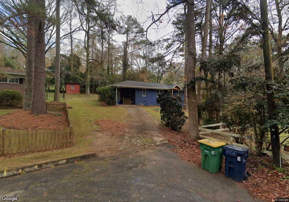
235 Riverside Dr Athens, GA 30606
Beechwood NeighborhoodEstimated Value: $286,000 - $360,000
3
Beds
2
Baths
1,176
Sq Ft
$265/Sq Ft
Est. Value
About This Home
This home is located at 235 Riverside Dr, Athens, GA 30606 and is currently estimated at $311,311, approximately $264 per square foot. 235 Riverside Dr is a home located in Clarke County with nearby schools including Bettye Henderson Holston Elementary School, Clarke Middle School, and Clarke Central High School.
Ownership History
Date
Name
Owned For
Owner Type
Purchase Details
Closed on
Jan 30, 2020
Sold by
Rivers Dean
Bought by
Vanhoose Joe Michael
Current Estimated Value
Home Financials for this Owner
Home Financials are based on the most recent Mortgage that was taken out on this home.
Original Mortgage
$152,000
Outstanding Balance
$134,324
Interest Rate
3.72%
Mortgage Type
New Conventional
Estimated Equity
$176,987
Purchase Details
Closed on
Jun 10, 2015
Sold by
Manus Renfred C
Bought by
Rivers Dean and Rivers Stephanie K
Home Financials for this Owner
Home Financials are based on the most recent Mortgage that was taken out on this home.
Original Mortgage
$92,000
Interest Rate
3.92%
Mortgage Type
New Conventional
Purchase Details
Closed on
Apr 5, 2012
Sold by
Manus Ruth P
Bought by
Manus Renfred C and Manus Danny J
Create a Home Valuation Report for This Property
The Home Valuation Report is an in-depth analysis detailing your home's value as well as a comparison with similar homes in the area
Home Values in the Area
Average Home Value in this Area
Purchase History
| Date | Buyer | Sale Price | Title Company |
|---|---|---|---|
| Vanhoose Joe Michael | $160,000 | -- | |
| Rivers Dean | $115,000 | -- | |
| Manus Renfred C | -- | -- |
Source: Public Records
Mortgage History
| Date | Status | Borrower | Loan Amount |
|---|---|---|---|
| Open | Vanhoose Joe Michael | $152,000 | |
| Previous Owner | Rivers Dean | $92,000 |
Source: Public Records
Tax History
| Year | Tax Paid | Tax Assessment Tax Assessment Total Assessment is a certain percentage of the fair market value that is determined by local assessors to be the total taxable value of land and additions on the property. | Land | Improvement |
|---|---|---|---|---|
| 2025 | $3,896 | $125,485 | $16,000 | $109,485 |
| 2024 | $3,896 | $116,963 | $14,000 | $102,963 |
| 2023 | $3,655 | $106,396 | $14,000 | $92,396 |
| 2022 | $2,660 | $83,394 | $12,000 | $71,394 |
| 2021 | $2,157 | $64,260 | $10,400 | $53,860 |
| 2020 | $1,553 | $56,088 | $10,400 | $45,688 |
| 2019 | $1,260 | $47,119 | $10,400 | $36,719 |
| 2018 | $1,260 | $47,119 | $10,400 | $36,719 |
| 2017 | $1,221 | $45,969 | $9,600 | $36,369 |
| 2016 | $1,138 | $43,521 | $9,600 | $33,921 |
| 2015 | $1,349 | $39,674 | $9,600 | $30,074 |
| 2014 | -- | $39,352 | $9,600 | $29,752 |
Source: Public Records
Map
Nearby Homes
- 195 Sycamore Dr Unit C24
- 195 Sycamore Dr Unit E39
- 2505 W Broad St Unit 138
- 2505 W Broad St Unit 924
- 2505 W Broad St Unit 332
- 50 Pine Valley Dr
- 210 Pine Valley Dr
- 255 Pine Valley Dr
- 123 Tamara Ct
- 110 Valley St
- 347 Hampton Park Dr
- 302 Hampton Park Dr
- 665 W Lake Dr
- 232 Epps Bridge Rd Unit 1A
- 330 Stoneland Dr
- 130 Wexford Place
- 105 Magnolia Terrace
- 109 Saint James Dr
- 1720 Timothy Rd
- 550 Fortson Rd
- 245 Riverside Dr
- 130 Dell Ave
- 140 Dell Ave
- 215 Riverside Dr
- 150 Dell Ave
- 120 Dell Ave
- 135 Dell Ave
- 145 Riverhill Ct
- 145 Dell Rd
- 145 Dell Ave
- 210 Riverside Dr
- 208 Riverside Dr
- 125 Dell Ave
- 170 Dell Ave
- 1/10 ac Riverside Dr
- 155 Dell Ave
- 204 Riverside Dr
- 205 Briarcliff Rd
- 715 Riverhill Dr
- 207 Briarcliff Rd
Your Personal Tour Guide
Ask me questions while you tour the home.