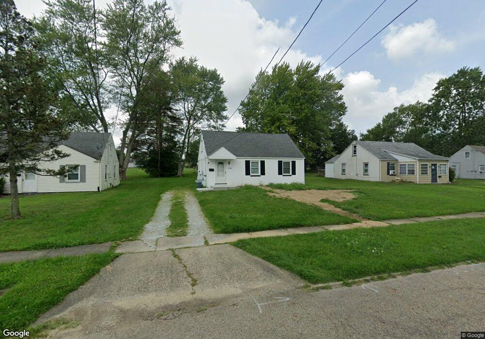
2369 Clark Ave Alliance, OH 44601
Estimated Value: $94,049 - $122,000
2
Beds
1
Bath
768
Sq Ft
$144/Sq Ft
Est. Value
About This Home
This home is located at 2369 Clark Ave, Alliance, OH 44601 and is currently estimated at $110,350, approximately $143 per square foot. 2369 Clark Ave is a home located in Stark County with nearby schools including Alliance Elementary School at Rockhill, Alliance Intermediate School at Northside, and Alliance Middle School.
Create a Home Valuation Report for This Property
The Home Valuation Report is an in-depth analysis detailing your home's value as well as a comparison with similar homes in the area
Home Values in the Area
Average Home Value in this Area
Tax History
| Year | Tax Paid | Tax Assessment Tax Assessment Total Assessment is a certain percentage of the fair market value that is determined by local assessors to be the total taxable value of land and additions on the property. | Land | Improvement |
|---|---|---|---|---|
| 2025 | -- | $23,870 | $9,730 | $14,140 |
| 2024 | -- | $23,870 | $9,730 | $14,140 |
| 2023 | $0 | $13,830 | $4,900 | $8,930 |
| 2022 | $43 | $13,830 | $4,900 | $8,930 |
| 2021 | $43 | $13,830 | $4,900 | $8,930 |
| 2019 | $0 | $13,160 | $4,900 | $8,260 |
Source: Public Records
Map
Nearby Homes
- 2144 Ridgewood Ave
- 2625 Belleflower Dr
- 2145 Cherry Ave
- 2135 Cherry Ave
- 2616 Ridgewood Ave
- 392 Maplewood Dr
- 421 Linwood Dr
- 2417 S Arch Ave
- 2206 S Linden Ave
- 2520 Pleasant Place
- 3116 Ridgehill Ave
- 2464 S Freedom Ave
- 2435 Eastern Ave
- 1539 Parkway Blvd
- 1120 W Milton St
- 622 Overlook Dr
- 2540 Edgewood Ave
- 1038 Vincent Blvd
- 1794 Lilly Ln
- 705 Overlook Dr
Your Personal Tour Guide
Ask me questions while you tour the home.