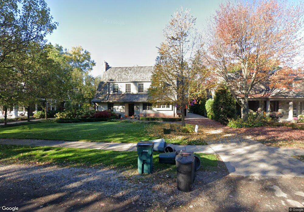
239 Pilgrim Ave Birmingham, MI 48009
Estimated Value: $1,401,000 - $1,772,000
About This Home
This home is located at 239 Pilgrim Ave, Birmingham, MI 48009 and is currently estimated at $1,538,277, approximately $449 per square foot. 239 Pilgrim Ave is a home located in Oakland County with nearby schools including Pierce Elementary School, Derby Middle School, and Ernest W. Seaholm High School.
Ownership History
We collect this data history from publicly available records. To have your information removed, we recommend requesting removal directly through your county’s website.
Purchase Details
Purchase Details
Purchase Details
Home Financials for this Owner
Home Financials are based on the most recent Mortgage that was taken out on this home.Home Values in the Area
Average Home Value in this Area
Purchase History
We collect this data history from publicly available records. To have your information removed, we recommend requesting removal directly through your county’s website.
| Date | Buyer | Sale Price | Title Company |
|---|---|---|---|
| -- | None Available | ||
| -- | None Available | ||
| $812,000 | Philip R Seaver Title Co Inc |
Mortgage History
We collect this data history from publicly available records. To have your information removed, we recommend requesting removal directly through your county’s website.
| Date | Status | Borrower | Loan Amount |
|---|---|---|---|
| Closed | $649,600 |
Tax History
We collect this data history from publicly available records. To have your information removed, we recommend requesting removal directly through your county’s website.
| Year | Tax Paid | Tax Assessment Tax Assessment Total Assessment is a certain percentage of the fair market value that is determined by local assessors to be the total taxable value of land and additions on the property. | Land | Improvement |
|---|---|---|---|---|
| 2025 | $13,588 | $638,490 | $0 | $0 |
| 2024 | $13,296 | $584,290 | $0 | $0 |
| 2023 | $12,741 | $569,480 | $0 | $0 |
| 2022 | $13,660 | $520,780 | $0 | $0 |
| 2021 | $13,781 | $524,470 | $0 | $0 |
| 2020 | $12,278 | $517,920 | $0 | $0 |
| 2019 | $13,895 | $509,520 | $0 | $0 |
| 2018 | $13,701 | $488,290 | $0 | $0 |
| 2017 | $13,677 | $503,110 | $0 | $0 |
| 2016 | $13,702 | $483,840 | $0 | $0 |
| 2015 | -- | $459,830 | $0 | $0 |
| 2014 | -- | $306,350 | $0 | $0 |
| 2011 | -- | $232,930 | $0 | $0 |
Map
- 292 Fairfax St
- 146 Puritan Ave
- 364 Chesterfield Ave
- 270 Pleasant St
- 1834 Fairview St
- 380 Kimberly St
- 1900 Fairview St
- 579 Chesterfield Ave
- 852a Puritan Ave
- 592 Lakeside Dr
- 852 Puritan Ave
- 341 Westwood Dr
- 810 Harmon St
- 840 Lakeside Dr
- 826 Larchlea Dr
- 1094 Suffield Ave
- 999 Pleasant Ave
- 750 Hazelwood St
- 1057 Arlington St
- 1183 Puritan Ave
- 236 Suffield Ave
- 202 Suffield Ave
- 270 Suffield Ave
- 176 Suffield Ave
- 229 Pilgrim Ave
- 265 Pilgrim Ave
- 187 Pilgrim Ave
- 239 Suffield Ave
- 287 Pilgrim Ave
- 215 Suffield Ave
- 159 Pilgrim Ave
- 287 Suffield Ave
- 100 Suffield Ave
- 320 Suffield Ave
- 179 Suffield Ave
- 315 Pilgrim Ave
- 325 Suffield Ave
- 139 Pilgrim Ave
- 333 Pilgrim Ave
- 145 Suffield Ave
Ask me questions while you tour the home.