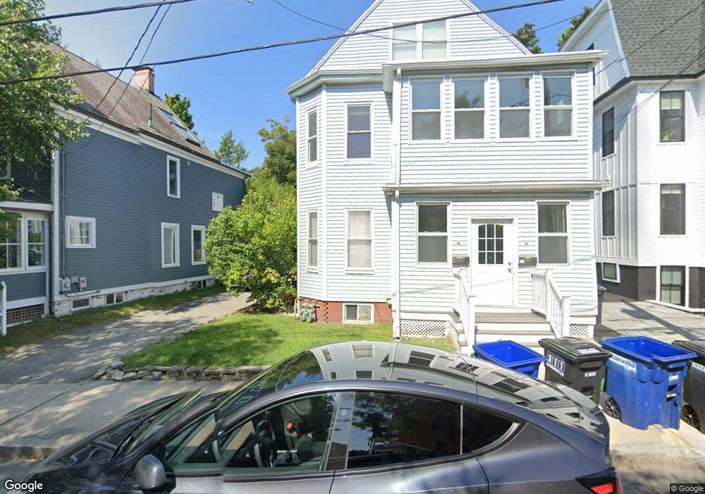
24 Burnside Ave Somerville, MA 02144
Porter Square NeighborhoodEstimated Value: $1,343,000 - $1,889,064
About This Home
24 Burnside Ave. is located in Somerville, Massachusetts, a vibrant community known for its diverse culture, historic sites, and proximity to Boston. This address likely features a residential property, potentially with distinct architectural elements typical of the area, such as classic New England designs or modern updates. The neighborhood may offer a mix of local shops, restaurants, parks, and convenient public transportation options, making it an appealing place to live for those who enjoy urban amenities while still having a sense of community. For specifics about the property itself, such as size, number of bedrooms, or unique features, I would recommend checking real estate listings or local resources.
Ownership History
We collect this data history from publicly available records. To have your information removed, we recommend requesting removal directly through your county’s website.
Purchase Details
Purchase Details
Home Financials for this Owner
Home Financials are based on the most recent Mortgage that was taken out on this home.Home Values in the Area
Average Home Value in this Area
Purchase History
We collect this data history from publicly available records. To have your information removed, we recommend requesting removal directly through your county’s website.
| Date | Buyer | Sale Price | Title Company |
|---|---|---|---|
| -- | -- | ||
| -- | -- | ||
| $820,000 | -- | ||
| $820,000 | -- | ||
| $820,000 | -- |
Mortgage History
We collect this data history from publicly available records. To have your information removed, we recommend requesting removal directly through your county’s website.
| Date | Status | Borrower | Loan Amount |
|---|---|---|---|
| Previous Owner | $533,000 | ||
| Previous Owner | $938,250 |
Property History
We collect this data history from publicly available records. To have your information removed, we recommend requesting removal directly through your county’s website.
| Date | Event | Price | List to Sale | Price per Sq Ft |
|---|---|---|---|---|
| 02/10/2025 02/10/25 | Off Market | $3,495 | -- | -- |
| 01/14/2025 01/14/25 | For Rent | -- | -- | -- |
| 10/08/2024 10/08/24 | Off Market | $3,795 | -- | -- |
| 10/08/2024 10/08/24 | Off Market | $3,495 | -- | -- |
| 09/01/2024 09/01/24 | For Rent | $3,495 | 0.0% | -- |
| 09/01/2024 09/01/24 | For Rent | $3,495 | -7.9% | -- |
| 08/31/2024 08/31/24 | For Rent | $3,795 | -- | -- |
Tax History
We collect this data history from publicly available records. To have your information removed, we recommend requesting removal directly through your county’s website.
| Year | Tax Paid | Tax Assessment Tax Assessment Total Assessment is a certain percentage of the fair market value that is determined by local assessors to be the total taxable value of land and additions on the property. | Land | Improvement |
|---|---|---|---|---|
| 2025 | $16,510 | $1,513,300 | $853,800 | $659,500 |
| 2024 | $15,797 | $1,501,600 | $853,800 | $647,800 |
| 2023 | $15,071 | $1,457,500 | $853,800 | $603,700 |
| 2022 | $14,184 | $1,393,300 | $813,100 | $580,200 |
| 2021 | $13,809 | $1,355,200 | $807,200 | $548,000 |
| 2020 | $12,810 | $1,269,600 | $753,900 | $515,700 |
| 2019 | $12,671 | $1,177,600 | $735,300 | $442,300 |
| 2018 | $11,784 | $1,041,900 | $668,400 | $373,500 |
| 2017 | $11,550 | $989,700 | $630,700 | $359,000 |
| 2016 | $10,216 | $815,300 | $469,300 | $346,000 |
| 2015 | $9,789 | $776,300 | $433,400 | $342,900 |
Map
- 25 Banks St Unit 2
- 36 Burnside Ave Unit 1
- 157 Elm St
- 9 Orchard St
- 10 Beech St Unit 2
- 29 Windsor Rd Unit 29A
- 4 Fairlee St
- 79 Willow Ave
- 7 Beech St Unit 302
- 353 Summer St Unit 310
- 315 Highland Ave Unit 101
- 18 Acadia Park
- 815 Somerville Ave
- 6 Porter Rd Unit 1L
- 5 Porter Cir
- 55 Elm St
- 46 Linden Ave
- 24 Linden Ave
- 371 Highland Ave
- 1 Richdale Ave Unit 7
- 28 Burnside Ave
- 30 Burnside Ave Unit 30
- 24 Burnside Ave
- 24 Burnside Ave
- 24 Burnside Ave Unit 4
- 26 Burnside Ave Unit 2
- 24 Burnside Ave Unit 1
- 26 Burnside Ave
- 24 Burnside Ave Unit 24
- 32 Burnside Ave Unit 1
- 34 Burnside Ave Unit 2
- 34 Burnside Ave Unit 1
- 22 Burnside Ave
- 22 Burnside Ave Unit 4
- 23 Banks St
- 17 Banks St
- 17 Banks St Unit 1
- 19 Banks St Unit 2
- 19 Banks St
- 19 Banks St Unit 19 Banks Street
Ask me questions while you tour the home.